Near Currie in Pender County, North Carolina — The American South (South Atlantic)
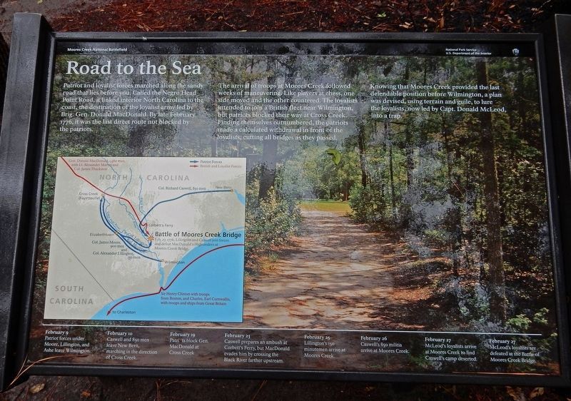
Road to the Sea
— Moores Creek National Battlefield —
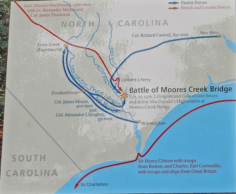
The arrival of troops at Moores Creek followed weeks of maneuvering. Like players at chess, one side moved and the other countered. The loyalists intended to join a British fleet near Wilmington, but patriots blocked their way at Cross Creek. Finding themselves outnumbered, the patriots made a calculated withdrawal in front of the loyalists, cutting all bridges as they passed.
Knowing that Moores Creek provided the last defendable position before Wilmington, a plan was devised, using terrain and guile, to lure the loyalists, now led by Capt. Donald McLeod, into a trap.
[Timeline]
February 9 Patriot forces under Moore, Lillington, and Ashe leave Wilmington
February 10 Caswell and 850 men leave New Bern, marching in the direction of Cross Creek.
February 19 Patriots block Gen. MacDonald at Cross Creek
February 23 Caswell prepares an ambush at Corbett's Ferry, but MacDonald evades him by crossing the Black River farther upstream.
February 25 Lillington's 150 minutemen arrive at Moores Creek.
February 26 Caswell's 850 militia arrive at Moores Creek.
February 27 McLeod's loyalists arrive at Moores Creek to find Caswell's camp deserted.
February 27 McLeod's loyalists are defeated at the Battle of Moores Creek Bridge.
Erected by National Park Service.
Topics. This historical marker is listed in these topic lists: Roads & Vehicles • War, US Revolutionary. A significant historical month for this entry is February 1776.
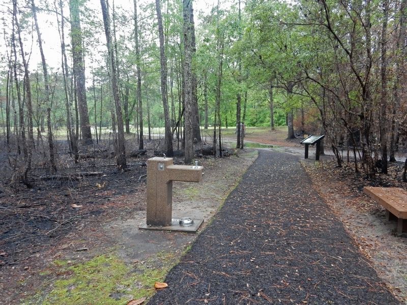
Location. 34° 27.552′ N, 78° 6.679′ W. Marker is near Currie, North Carolina, in Pender County. Marker can be reached from Moores Creek Drive, 0.2 miles west of North Carolina Route 210. Marker is on the Moores Creek National Battlefield History Trail. Touch for map. Marker is in this post office area: Currie NC 28435, United States of America. Touch for directions.
Other nearby markers. At least 8 other markers are within walking distance of this marker. A Very Bad Swamp ... (within shouting distance of this marker); Wisely Chosen Ground (within shouting distance of this marker); Decisive Victory (about 500 feet away, measured in a direct line); Old Wilmington and Fayetteville Stage Road (about 500 feet away); Stunning Defeat (about 500 feet away); Aftermath of Moores Creek (about 600 feet away); Road to Independence (about 600 feet away); Commemorating the Battle (about 600 feet away). Touch for a list and map of all markers in Currie.
Also see . . . Negro Head Road. The road's name reflects a dark and gruesome past. (Wikipedia) (Submitted on March 19, 2023, by Duane and Tracy Marsteller of Murfreesboro, Tennessee.)
Credits. This page was last revised on March 19, 2023. It was originally submitted on March 19, 2023, by Duane and Tracy Marsteller of Murfreesboro, Tennessee. This page has been viewed 96 times since then and 12 times this year. Photos: 1, 2, 3. submitted on March 19, 2023, by Duane and Tracy Marsteller of Murfreesboro, Tennessee.


