Near Currie in Pender County, North Carolina — The American South (South Atlantic)
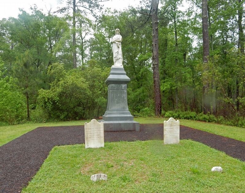
Women's Monument
| — | Moores Creek National Battlefield | — |
Courtesy of Thomas P. Martin, April 24, 2017
1. Women's Monument Marker
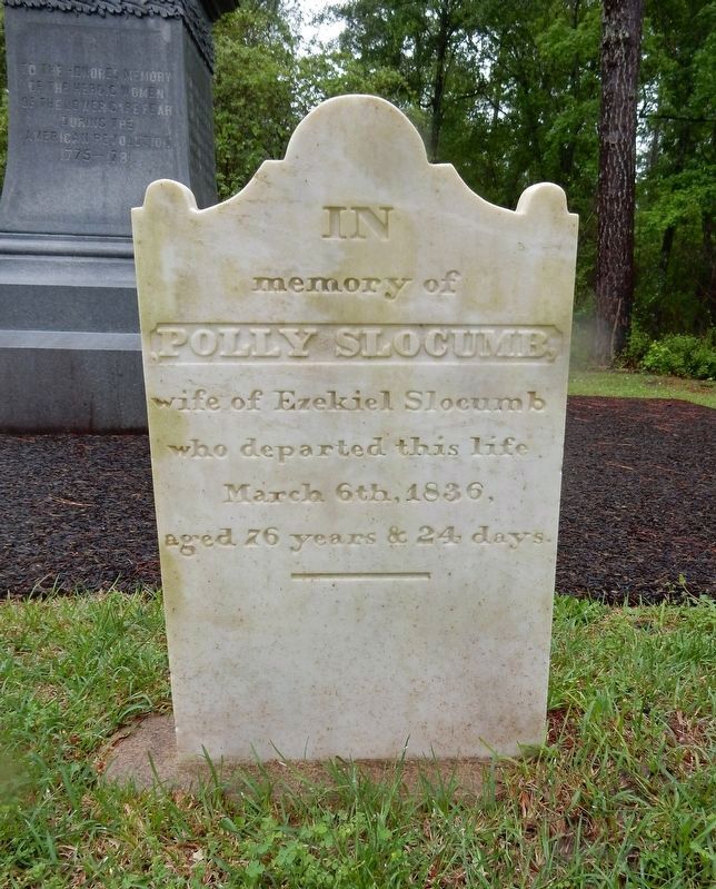
The tombstones of Ezekiel Slocumb (left) and his wife Mary (Polly) Slocumb (right) are at the foot of the monument.
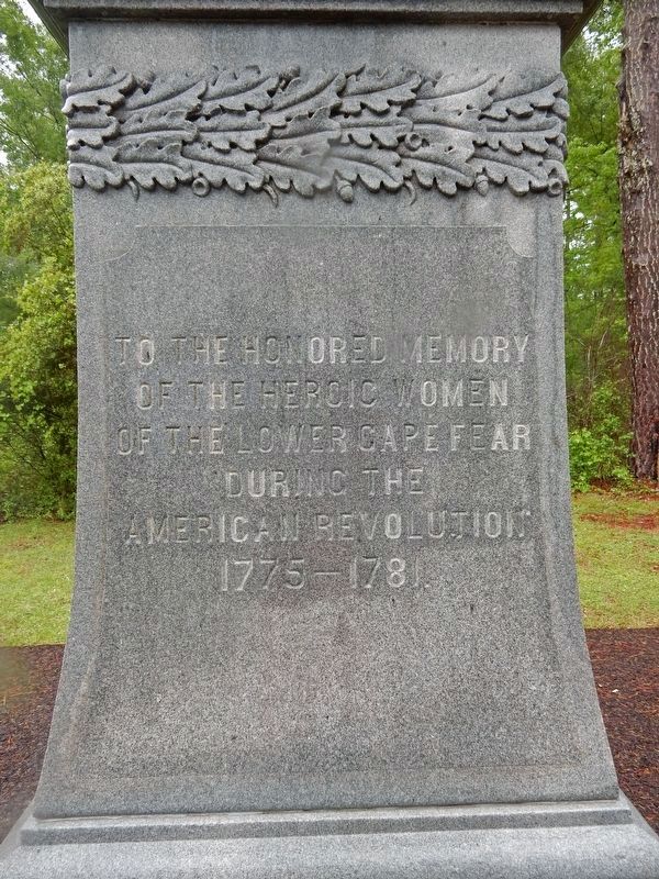
[Northwest side] To the honored memory of the heroic women of the lower Cape Fear during the American Revolution 1775-1781
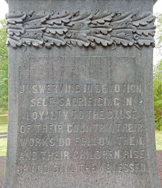
[Northeast side] Unswerving in devotion, self-sacrificing in loyalty to the cause of their country, their works do follow them; and their children rise up and call them blessed.
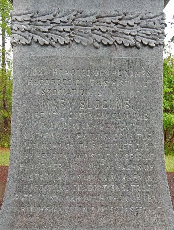
[Southwest side] Most honored of the names recorded by this historic association, is that of Mary Slocumb, wife of Lieutenant Slocumb, riding alone at night 65 miles to succor the wounded on this battlefield. Her heroism and self-sacrifice place her high on the pages of history and should awaken in successive generations, true patriotism and love of country. Virtutes majorum filiae conservant
[Southeast side] This monument was erected by the Moore's Creek Monumental Association in the year 1907.
Erected 1907 by Moore's Creek Monumental Association.
Topics. This monument and memorial is listed in these topic lists: War, US Revolutionary • Women.
Location. 34° 27.417′ N, 78° 6.611′ W. Monument is near Currie, North Carolina, in Pender County. It can be reached from
this page online

Regionally, this memorial monument is in the Coastal Plain. It is also in the American South, specifically in the Upper South, in the Tidewater, and on the Eastern Seaboard. Globally, it is in the North Atlantic Region, North America, the Western Hemisphere, the Western World, and the Anglosphere. Historically, it finds itself in what was once the territory of the Mississippian Culture, one of the original Thirteen Colonies, one of the Confederate States of America, and the Antebellum South.
Other nearby markers. At least 8 other markers are within walking distance of this marker: We Women Have...To Let Our Voices Be Heard (a few steps from this marker); Tarheel Trail (within shouting distance of this marker); Trees for a Navy (within shouting distance of this marker); Blackwater Highways (about 300 feet away, measured in a direct line); Moores Creek National Battlefield (about
Courtesy of Thomas P. Martin, April 24, 2017
2. Women's Monument detail (Northwest side)
Regarding Women's Monument. According to North Carolina Commemorative Landscapes: "In particular, Mary (Polly) Slocumb was singled out for her act of bravery, riding 65 miles in the night to the Battle of Moores Creek after having a dream that her husband, Ezekiel Slocumb, was wounded. However, the story is almost certainly pure legend based on the fact that Mary and Ezekiel were only fifteen and sixteen years old at the time of the battle and Ezekiel did not enlist until 1780."
Also see . . .
1. Moores Creek Women's Monument, Moores Creek National Battlefield. North Carolina Commemorative Landscapes database entry on the monument. (Submitted on March 20, 2023, by Duane and Tracy Marsteller of Murfreesboro, Tennessee.)
2. The legend of Mary Slocumb’s ride is a lesson in fact or fiction. True or not, the legend of Mary Slocumb’s ride is now a part of Moores Creek’s story. In a war fought by men, it’s the story of how
Courtesy of Thomas P. Martin, April 24, 2017
3. Women's Monument detail (Northeast side)
Courtesy of Thomas P. Martin, April 24, 2017
4. Women's Monument detail (Southwest side)
Courtesy of Thomas P. Martin, April 24, 2017
5. Mary (Polly) Slocumb tombstone
Her husband, Ezekiel, is buried next to her at the foot of the Women's Monument.
Credits. This page was last revised on December 19, 2024. It was originally submitted on March 20, 2023, by Duane and Tracy Marsteller of Murfreesboro, Tennessee. This page has been viewed 536 times since then and 92 times this year. Photos: 1, 2, 3, 4, 5. submitted on March 20, 2023, by Duane and Tracy Marsteller of Murfreesboro, Tennessee.
