Cromwell Valley in Parkville in Baltimore County, Maryland — The American Northeast (Mid-Atlantic)
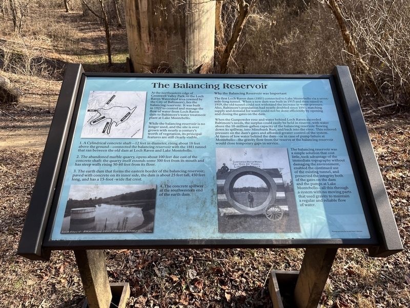
The Balancing Reservoir
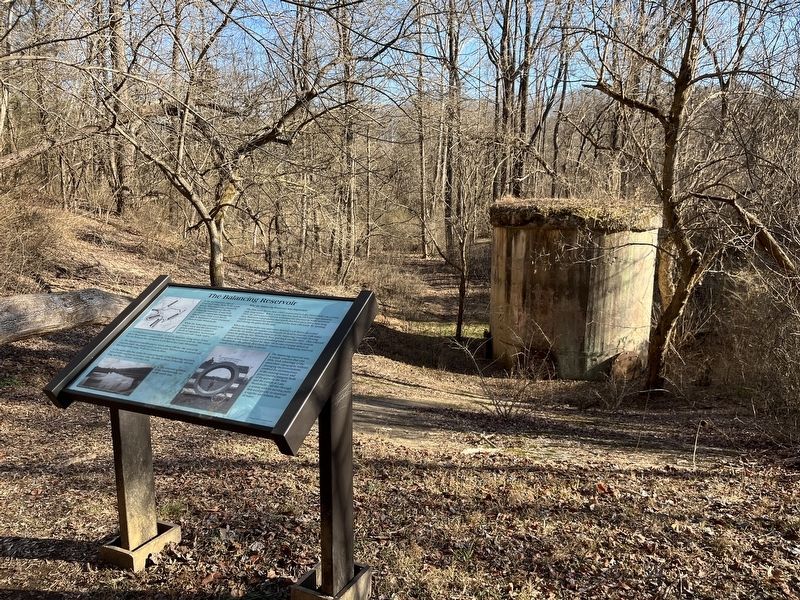
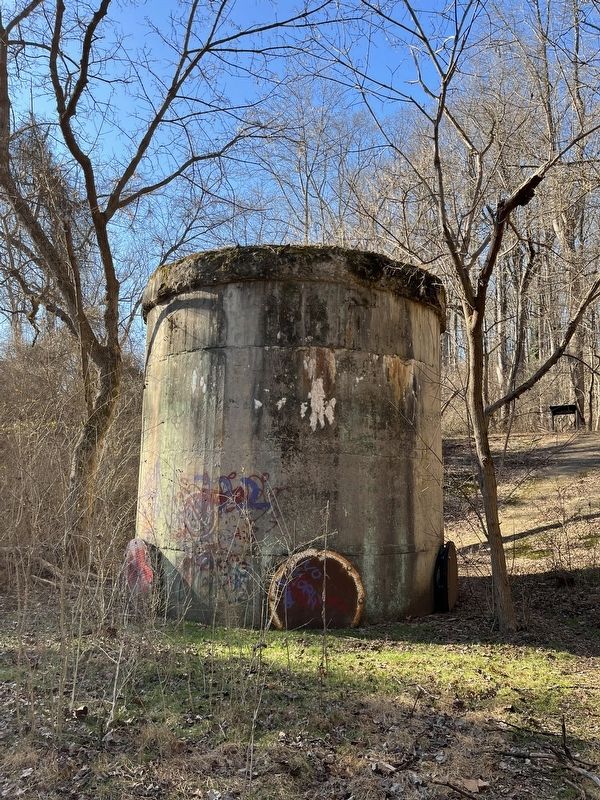
While the balancing reservoir is no longer used, and the site 1s over grown with nearly a century's worth of vegetation, its principal features are still clearly visible.
1. A Cylindrical concrete shaft-12 feet in diameter, rising about 18 feet above the ground--connected the balancing reservoir with the 1881 tunnel that ran between the old dam at Loch Raven and lake Montebello.
2. The abandoned marble quarry, opens about 100 feet due east of the concrete shaft: the quarry itself extends some 300 feet from its mouth and has steep walls rising 50-60 feet from its floor.
3. The earth dam that forms the eastern border of the balancing reservoir; paved with concrete on its inner side, the dam is about 25 feet tall, 450 feet long, and has a 15-foot -wide flat crest.
4. The concrete spillway at the southwestern end of the earth dam.
Why the Balancing Reservoir was Important
The first Loch Raven dam (1881) connected to Lake Montebello via a seven mile long tunnel. When a new dam was built in 1915 and then raised 1919, the old tunnel could not withstand the increase in water pressure. Also, Baltimore's population had nearly doubled since 1881; matching supply and demand for water could not be done efficiently by opening and closing the gates on the dam.
When the Gunpowder rose and water behind Loch Raven exceeded Baltimore's needs, the surplus could easily be held in reserve, with water above the 10-million-gallon capacity of the balancing reservoir flowing down its spillway, into Minebank Run, and back into the river. This relieved pressure on the dam's gates and afforded greater control of the system. At times of low water behind the dam-or in case of pump failure at Montebello-the gravity flow from the reserve at the balancing reservoir at the balancing reservoir would close temporary gaps in service.
The balancing reservoir was a simple solution that cost little, took advantage of the immediate topography without damaging the environment, enabled the continued use of the existing tunnel, and preserved the integrity both of the gates on the dam and the pumps at Lake Montebello- all this through a system with no moving parts that used gravity to maintain regular and reliable flow of water.
Topics. This historical marker is listed in these topic lists: Charity & Public Work • Industry & Commerce • Waterways & Vessels. A significant historical year for this entry is 1922.
Location. 39° 25.237′ N, 76° 32.687′ W. Marker is in Parkville, Maryland, in Baltimore County. It is in Cromwell Valley. Marker can be reached from Satyr Hill Road. Touch for map. Marker is at or near this postal address: 1911 Satyr Hill Rd, Parkville MD 21234, United States of America. Touch for directions.
Other nearby markers. At least 8 other markers are within 3 miles of this marker, measured as the crow flies. Merrick Log House (about 800 feet away, measured in a direct line); Jenifer Lime Kiln (approx. 0.2 miles away); Risteau Lime Kiln (approx. 0.2 miles away); Jenifer Kiln (approx. 0.2 miles away); Risteau Kiln (approx. 0.2 miles away); Shanklin Kiln (approx. 0.2 miles away); Quarters #2 & 3 (approx. 2.2 miles away); A Slave Village (approx. 2.2 miles away). Touch for a list and map of all markers in Parkville.
Credits. This page was last revised on March 25, 2023. It was originally submitted on March 21, 2023, by Adam Margolis of Mission Viejo, California. This page has been viewed 106 times since then and 31 times this year. Photos: 1, 2, 3. submitted on March 21, 2023, by Adam Margolis of Mission Viejo, California. • Bill Pfingsten was the editor who published this page.


