Cromwell Valley in Parkville in Baltimore County, Maryland — The American Northeast (Mid-Atlantic)
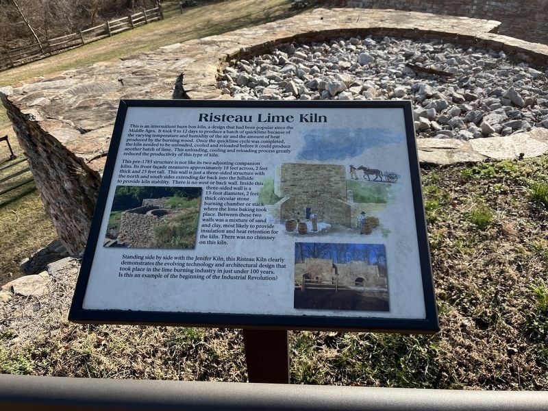
Risteau Lime Kiln
This pre-1785 structure is not like its two adjoining companion kilns. Its front façade measures approximately 18 feet across, 2 feet thick and 25 feet tall. This wall is just a three-sided structure with the north and south sides extending far back into the hillside to provide kiln stability. There is no west or back wall. Inside this three-sided wall is a 13-foot diameter, 2 feet thick circular stone burning chamber or stack where the lime baking took place. Between these two walls was a mixture of sand and clay, most likely to provide insulation and heat retention for the kiln. There was no chimney on this kiln.
Standing side by side with the Jenifer Kiln, this Risteau Kiln clearly demonstrates the evolving technology and architectural design that took place in the lime burning industry in just under 100 years. Is this an example of the beginning of the Industrial Revolution?
Topics. This historical marker is listed in these topic lists: Industry & Commerce • Parks & Recreational Areas • Settlements & Settlers.
Location. 39° 25.091′ N, 76° 32.675′ W. Marker is in Parkville, Maryland, in Baltimore County. It is in Cromwell Valley. Marker can be reached from Cromwell Bridge Road. Touch for map. Marker is at or near this postal address: 2200 Cromwell Bridge Rd, Parkville MD 21234, United States of America. Touch for directions.
Other nearby markers. At least 8 other markers are within 3 miles of this marker, measured as the crow flies. Jenifer Lime Kiln (here, next to this marker); Jenifer Kiln (a few steps from this marker); Risteau Kiln (a few steps from this marker); Shanklin Kiln (within shouting distance of this marker); Merrick Log House (within shouting distance of this marker); The Balancing Reservoir (approx. 0.2 miles away); Knettishall (approx. 2.2 miles away); Thoroughbreds at Hampton (approx. 2.2 miles away). Touch for a list and map of all markers in Parkville.
Credits. This page was last revised on March 25, 2023. It was originally submitted on March 21, 2023, by Adam Margolis of Mission Viejo, California. This page has been viewed 82 times since then and 15 times this year. Photos: 1, 2. submitted on March 21, 2023, by Adam Margolis of Mission Viejo, California. • Bill Pfingsten was the editor who published this page.

