Study Butte-Terlingua in Brewster County, Texas — The American South (West South Central)
Ranching in the Big Bend
Big Bend Snapshot History
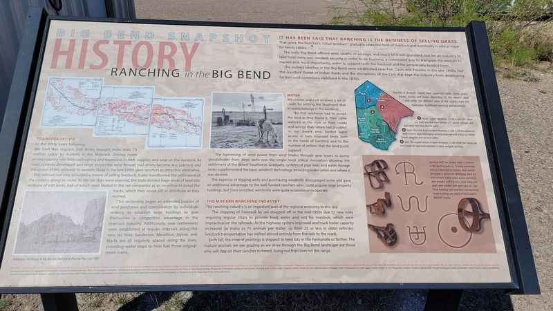
In the thirty years following the Civil War, massive trail drives brought more than 10 million cattle to markets in the Midwest. Driving herds across country was time-consuming and expensive in staff, supplies and wear on the livestock. As road systems developed and large properties were fenced, trail drives became less practical and the arrival of the railroads to western Texas in the late 1880s gave ranchers an attractive alternative.
The railroad not only provided a means of selling livestock, it also transformed the settlement of the country along its route. As the rail lines were planned, the state divided huge areas of land into sections of 640 acres, half of which were traded to the rail companies as an incentive to install the tracks, which they could sell or distribute as they wished.
This sectioning began an extended process of land purchases and consolidation by individuals seeking to establish large holdings to give themselves a competitive advantage in the livestock industry. Additionally, new settlements were established at regular intervals along the new rail lines. Sanderson, Marathon, Alpine, and Marfa are all regularly spaced along the lines, providing water stops to help fuel those original steam trains.
Water
Winchester and Colt received a lot of credit for settling the Southwest that in reality belongs to the windmill.
The first rancheros had to accept the land as they found it. Their cattle watered at the river or from creeks and springs that nature had provided. In our desert area, limited water access in turn imposed limits both to the herds of livestock and to the number of settlers that the land could support.
The harnessing of wind power from wind blades through gear boxes to pump groundwater from deep wells was the single most critical innovation allowing the settlement of the desert Southwest. Gradually, systems of pipe lines and water storage tanks supplemented the basic windmill technology, providing water when and where it was desired.
The expense of digging wells and purchasing windmills discouraged some and gave an additional advantage to the well-funded ranchers who could acquire large property holdings, but once installed, windmills were quite economical to operate.
The Modern Ranching Industry
The ranching industry is an important part of the regional economy to this day.
The shipping of livestock by rail dropped off in the mid-1950s due to new rules requiring regular stops to provide food, water and rest for livestock, which were impractical on the railroads. As the highway system improved and truck trailer capacity increased (as many
as 75 animals per trailer, up from 25 or less in older vehicles), livestock transportation has shifted almost entirely from the rails to the roads.
Each fall, the crop of yearlings is shipped to feed lots in the Panhandle or farther. The mature animals we see grazing as we drive through the Big Bend landscape are those who will stay on their ranches to breed, living out their lives on the range.
It Has Been Said That Ranching Is the Business of Selling Grass. That grass, the Rancher's initial "product", gradually takes the form of livestock and eventually is sold as meat for family tables.
The early Big Bend offered wide swaths of acreage, and much of it rich grassland, but for an industry to take hold more was needed: security in order to do business, a convenient way to transport the animals to market and, most importantly, water to support both the livestock and the people who tended them. The earliest ranches in the Big Bend were established near Fort Davis and Presidio in the late 1840s, but the constant threat of Indian Raids and the disruptions of the Civil War kept the industry from developing further until conditions stabilized in the 1870s.
Captions
Lower Left: Galveston, Harrisburg & San Antonio Railroad at Paisano Pass circa 1883
Lower Right: Map
Ranches in Brewster
County have supported cattle, sheep, goats, horses, burros and mules depending on the owners' need and whim, but different areas of the country have lent themselves to different ranching specializations.
1. North: Higher elevations (3,700-6,000 feet above sea levell provided more rainfall (17 annual average) and grasslands that were ideal for cattle.
2. South: Dry scrub desert at lower elevations (1,500-3,700 feet above sea level) meant a more challenging ranching landscape with a focus on hardier breeds (longhorn and corriente cattle).
3. East: The rougher terrain at lower elevations (1.500-4,000 feet above sea level) made the land more amenable to sheep and goat ranching.
Livestock theft has always been a problem to the ranching industry. To prove ownership and as a deterrent to rustling, each rancher developed a distinctive identifying mark for their animals. Cattle, mules, burros and horses were branded with hot irons, while sheep and goats were marked with paint and ear clips. These branding irons and their corresponding brand markings are typical of those used in Brewster County.
Erected by Brewster County Historical Commission.
Topics. This historical marker is listed in these topic lists: Animals • Industry & Commerce • Railroads & Streetcars • Roads & Vehicles. A significant historical year for this entry is 1883.
Location. 29° 19.667′ N, 103° 32.097′ W. Marker is in Study Butte-Terlingua, Texas, in Brewster County. Marker is at the intersection of State Highway 118 and Farm to Market Road 170, on the right when traveling south on State Highway 118. The marker is located in front of the Big Bend Visitors Information Center. Touch for map. Marker is in this post office area: Terlingua TX 79852, United States of America. Touch for directions.
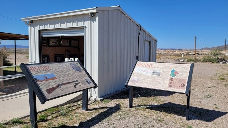
Other nearby markers. At least 8 other markers are within 8 miles of this marker, measured as the crow flies. Big Bend Ranching: South (here, next to this marker); E.E. Townsend (approx. 2.4 miles away); Terlingua (approx. 4.3 miles away); Terlingua Cemetery (approx. 4.7 miles away); Chisos Mine and Terlingua (approx. 4.7 miles away); Federico Villalba (approx. 4.7 miles away); Quicksilver (approx. 5.4 miles away); Luna's Jacal (approx. 7.8 miles away). Touch for a list and map of all markers in Study Butte-Terlingua.
Credits. This page was last revised on March 22, 2023. It was originally submitted on March 22, 2023, by James Hulse of Medina, Texas. This page has been viewed 63 times since then and 6 times this year. Photos: 1, 2, 3. submitted on March 22, 2023, by James Hulse of Medina, Texas.


