Camp Hughes in North Cypress – Langford Municipality, Manitoba — Canada’s Prairie Region (North America)
Camp Hughes Railway Station / Depot / Railhead Area
Gare / dépôt / terminal ferroviaire du Camp Hughes
Inscription.
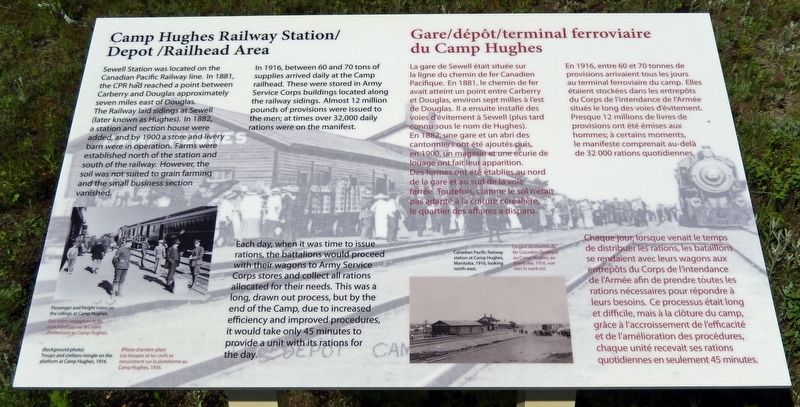
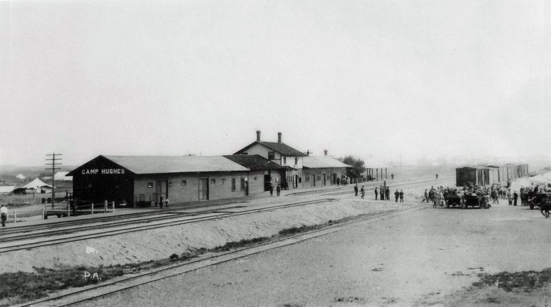
In 1916, between 60 and 70 tons of supplies arrived daily at the Camp railhead. These were stored in Army Service Corps buildings located along the railway sidings. Almost 12 million pounds of provisions were issued to the men; at times over 32,000 daily rations were on the manifest.
Each day, when it was time to issue rations, the battalions would proceed with their wagons to Army Service Corps stores and collect all rations allocated for their needs. This was a long, drawn out process, but by the end of the Camp, due to increased efficiency and improved procedures, it would take only 45 minutes to provide a unit with its rations for the day.
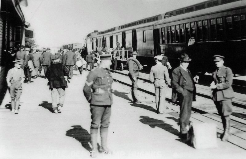
(Background photo) Troops and civilians mingle on the platform at Camp Hughes, 1916.
En 1916, entre 60 et 70 tonnes de provisions arrivaient tous les jours au terminal ferroviaire du camp. Elles étaient stockées dans les entrepôts du Corps de l'intendance de l'Armée situés le long des voies d'évitement. Presque 12 millions de livres de provisions ont été émises aux hommes; à certains moments, le manifeste comprenait au-delà de 32 000 rations quotidiennes.
Chaque jour, lorsque venait le temps de distribuer les rations, les bataillons se rendaient avec leurs wagons aux entrepôts du Corps de l'intendance de l'Armée afin de prendre toutes les rations nécessaires pour répondre à
leurs besoins. Ce processus était long et difficile, mais à la clôture du camp, grâce à l'accroissement de l'efficacité et de l'amélioration des procédures, chaque unité recevait ses rations quotidiennes en seulement 45 minutes.
(Photo d'arrière-plan) Les troupes et les civils se rencontrent sur la plateforme au Camp Hughes, 1916.
Topics. This historical marker is listed in these topic lists: Agriculture • Industry & Commerce • Railroads & Streetcars • War, World I. A significant historical year for this entry is 1916.
Location. 49° 53.104′ N, 99° 33.167′ W. Marker is in Camp Hughes, Manitoba, in North Cypress – Langford Municipality. Marker is on Camp Hughes Road (Road 91 W) one kilometer south of Provincial Road 351, on the left when traveling south. Marker can be accessed from a pull-out on the east side of Camp Hughes Road. Touch for map. Marker is in this post office area: Camp Hughes MB R0K 2A0, Canada. Touch for directions.
Other nearby markers. At least 8 other markers are within walking distance of this marker. Headquarters, Administration and Logistics Area (here, next to this marker); The Parade Ground / La terrain de parade (within shouting distance of this marker); Camp Hughes — Overview / Tour d'horizon du Camp Hughes (within shouting distance of this marker); The Soldier's Recreation / Les moments de loisir des soldats (within shouting distance of this
marker); The Hospital / L'hôpital (approx. 0.6 kilometers away); Camp Life / La vie de camp (approx. 0.6 kilometers away); Training For War / L'entraînement de guerre (approx. 0.6 kilometers away); Camp Hughes National Historic Site of Canada / Le camp Hughes Lieu historique national du Canada (approx. 0.6 kilometers away). Touch for a list and map of all markers in Camp Hughes.
Related markers. Click here for a list of markers that are related to this marker. Camp Hughes National Historic Site
Credits. This page was last revised on March 27, 2023. It was originally submitted on March 23, 2023, by Cosmos Mariner of Cape Canaveral, Florida. This page has been viewed 40 times since then and 3 times this year. Photos: 1. submitted on March 26, 2023, by Cosmos Mariner of Cape Canaveral, Florida. 2, 3, 4. submitted on March 27, 2023, by Cosmos Mariner of Cape Canaveral, Florida.


