Study Butte-Terlingua in Brewster County, Texas — The American South (West South Central)
Big Bend Ranching: South
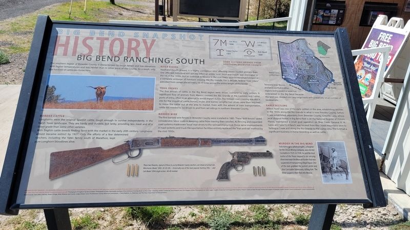
Big Bend Snapshot History
Border Cattle
Longhorns were the original Spanish cattle, tough enough to survive independently in the harsh Texas landscape. They are hardy and durable, but lanky, providing less meat and of a lower grade than some other varieties.
With English cattle breeds finding favor with the market in the early 20th century, Longhorns almost became extinct by 1927. Only the efforts of a few determined ranchers, including the Yates family south of Marathon, kept pure Longhorn bloodlines alive.
River Riders
Hoof-and-mouth disease is a highly contagious virus affecting cloven-hoofed animals. Even one affected individual will quickly infect an entire herd. Hoof-and-mouth was eliminated in the US in the 1930s, but an outbreak in Mexico in the mid-1940s spurred the establishment of a complete embargo of livestock crossing the Rio Grande. For a decade, federal "river riders" patrolled from camps placed every 10-15 miles across the entire length of the border.
Trail Drives
The first arrivals of cattle in the Big Bend region were driven overland by early settlers. A significant flow of animals from Mexico crossed the Rio Grande at the Castolon and Lajitas ports of entry, often in an attempt to avoid import duties. The Stillwell river crossing was also a site for the import of cattle, horses, mules and burros. Lengthy trail drives were then required to move the cattle out of the area to market. Even with the advent of train transportation, cattle still needed to be driven to and from rail sidings in northern Brewster County.
Barbed Wire
The first barbed wire fences in Brewster County were installed in 1885. These "drift fences" saved considerable labor costs in keeping cattle from leaving their ranches. As fencing and expanded road systems made even "local" trail drives to the railroad impractical, these same improvements in road systems and truck transportation facilities entirely replaced the "trail and rail" method by the mid-1950s.
Tensions over fences and land use that in other regions led to violence were not widespread in the Big Bend because the land was divided into very large tracts with a relatively small number of landowners.
Early Settlers
Milton Faver was one of the early settlers in the area, establishing ranches in the 1850s along the Rio Grande in what is now Presidio County, before it was established separately from Brewster County. Gilberto Luna, whose jacal
(dugout home) in Big Bend Park is on the National Register of Historic Places, maintained a small goat operation on Blue Creek. General R. M. Gano and Sons' G-4 Ranch was located from the Chisos mountains west to Terlingua Creek and along the Rio Grande to the Lajitas area. The G-4 had a significant business in horse-breeding as well as cattle.
Murder in the Big Bend
Felix Valenzuela (photo at right), a freighter for the Chisos Mining Company, was elected Constable in 1929. In 1938, he and the local Justice of the Peace stopped a car carrying three men near the Mexican border that was suspected of transporting illegal liquor. One of the men grabbed the justice's pistol and shot Constable Valenzuela, killing him. The three suspects then fled into Mexico.
Captions
Lower Middle: These two firearms, typical of those in use by Brewster County ranchers, are shown at actual size. Winchester Model 1894 .30-30 rifle - historically one of the most popular hunting rifles and Colt Model 1894 single action .44-40 revolver
Upper Right 1: Some Historic Brands From Southern Brewster County
Upper Right 2: Brewster County, Southern Region
Erected by Brewster County Historical Commission.
Topics. This historical marker is listed in these topic lists: Animals
• Industry & Commerce • Law Enforcement • Settlements & Settlers. A significant historical year for this entry is 1927.
Location. 29° 19.666′ N, 103° 32.096′ W. Marker is in Study Butte-Terlingua, Texas, in Brewster County. Marker is at the intersection of State Highway 118 and Farm to Market Road 170, on the right when traveling south on State Highway 118. The marker is located in front of the Big Bend Visitors Information Center. Touch for map. Marker is in this post office area: Terlingua TX 79852, United States of America. Touch for directions.
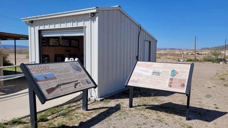
Other nearby markers. At least 8 other markers are within 8 miles of this marker, measured as the crow flies. Ranching in the Big Bend (here, next to this marker); E.E. Townsend (approx. 2.4 miles away); Terlingua (approx. 4.4 miles away); Terlingua Cemetery (approx. 4.7 miles away); Chisos Mine and Terlingua (approx. 4.7 miles away); Federico Villalba (approx. 4.7 miles away); Quicksilver (approx. 5.4 miles away); Luna's Jacal (approx. 7.8 miles away). Touch for a list and map of all markers in Study Butte-Terlingua.
Credits. This page was last revised on March 25, 2023. It was originally submitted on March 24, 2023, by James Hulse of Medina, Texas. This page has been viewed 83 times since then and 11 times this year. Photos: 1, 2, 3. submitted on March 25, 2023, by James Hulse of Medina, Texas.


