Johnstown in Cambria County, Pennsylvania — The American Northeast (Mid-Atlantic)
Market Square
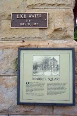
Inscription.
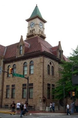
On May 31, 1889, the Market House, which held the police station and municipal offices was completely washed away. It had occupied this northeast corner of Market Square, a plot of land laid out by Joseph Johns in his town plan of 1800.
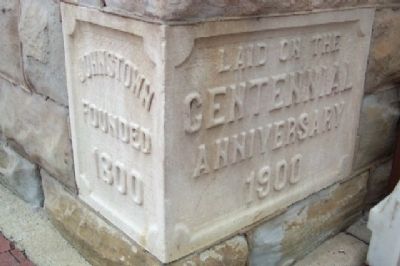
After the flood eight of the valley's small boroughs, including Johnstown, consolidated into the City of Johnstown on December 18, 1889. The city's downtown was rebuilt adhering to Johns' original plan, thus preserving Market Square. On October 5, 1900, Johnstown's centennial year, the cornerstone was placed for this present city hall, built in the Richardsonian Romanesque style.
Topics. This historical marker is listed in these topic lists: Disasters • Settlements & Settlers. A significant historical month for this entry is May 1812.
Location. 40° 19.557′ N, 78° 55.183′ W. Marker is in Johnstown, Pennsylvania, in Cambria County. Marker is at the intersection of Main Street and Market Street (Pennsylvania Route 271), on the left when traveling east on Main Street. Marker is at southwest corner of city hall. Touch for map. Marker is at or near this postal address: 401 Main Street, Johnstown PA 15901, United States of America. Touch for directions.
Other nearby markers. At least 8 other markers are within walking distance of this marker. 1936 Greater Johnstown Flood Victims (here, next to this marker); World War II Memorial (within shouting distance of this marker); Morley's Dog (within shouting distance of this marker); The Grand Army of the Republic Hall (about 300 feet away, measured in a direct line); Central Park (about 400 feet away); Joseph Johns (about 400 feet away); Johnstown Veterans and War Memorial (about 400 feet away); Greater Johnstown Flood Victims (about 500 feet away). Touch for a list and map of all markers in Johnstown.

Photographed By William Fischer, Jr., June 26, 2009
2. Market Square Marker on City Hall
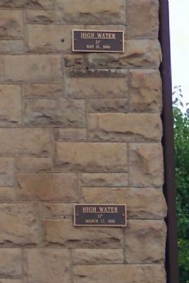
Marker is to left of bend in drainpipe at corner of city hall, to left of the 1936 Flood Victims marker. Immediately above the Market Square marker is the 1977 flood height; further above, level with top of first floor windows is the 1936 flood height; and at base of the second floor windows is the 1889 flood height.
Credits. This page was last revised on December 4, 2019. It was originally submitted on August 23, 2009, by William Fischer, Jr. of Scranton, Pennsylvania. This page has been viewed 1,539 times since then and 44 times this year. Photos: 1, 2, 3, 4. submitted on August 23, 2009, by William Fischer, Jr. of Scranton, Pennsylvania. • Kevin W. was the editor who published this page.


