Santa Clara in Santa Clara County, California — The American West (Pacific Coastal)
Secundino Robles and María Antonia García
Secundino Robles
c. 1811-1890
María Antonia García
c. 1816-1896
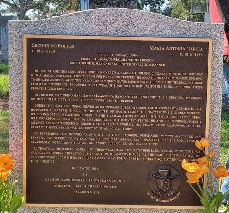
Here lie a Don and Doña. Proud Californios who shaped this region under Spanish, Mexican, and United States governance. In 1824, at age thirteen, Secundino discovered an ancient Ohlone cinnabar mine in present-day New Almaden. For centuries, the Ohlone people pulverized the area's cinnabar into a red pigment to be used as body paint. The New Almaden Quicksilver Mine eventually became the region's most profitable workings, producing more wealth than any other California mine, including those from the Gold Rush era.
In the 1830s, Secundino married Maria Antonia Garcia, his guiding light. Their fruitful marriage of more than fifty years yielded twenty-nine children. During the 1840s, Secundino served as mayordomo (superintendent) of Mission Santa Clara. In 1847, he played a leadership role in the Battle of Santa Clara. The "battle was the only skirmish waged in northern California during the Mexican American War (1846-1848). Although Secundino was not opposed to California becoming part of the United States, he and his neighbors fought against American forces in order to protest the overall mistreatment of Californios and the blatant theft of personal property by invading U.S. troops.
In September 1847, Secundino and his brother, Teodoro, purchased Rancho Rincon de San Francisquito in present-day Palo Alto, renaming it Rancho Santa Rita. It is here the Robles fame graciously hosted many fiestas. fandangos, bullfights, and bearbaitings.
Ultimately, the Robles Family lost their wealth and title to their land, a common outcome for Californios during this litigious transition to American rule. At the time of their deaths, the Robleses were left with insufficient assets to pay for a headstone. This plaque attempts remedy that injustice.
Dedicated 2021 by California Pioneers of Santa Clara County
Mountain Charlie Chapter No. 1850 E Clampus Vitus
"Right wrongs Nobody"
Erected 2021 by Mountain Charlie Chapter 1850 E Clampus Vitus.
Topics and series. This historical marker is listed in these topic lists: Hispanic Americans • Settlements & Settlers. In addition, it is included in the E Clampus Vitus series list. A significant historical month for this entry is September 1847.
Location. 37° 20.498′ N, 121° 57′ W. Marker is in Santa Clara, California, in Santa Clara County. Marker can be reached from Lincoln Street near Bellomy Street, on the right when traveling north. The marker is on the grounds of the Santa Clara Mission Cemetery. Touch for map. Marker is at or near this postal address: 490 Lincoln St, Santa Clara CA 95050, United States of America. Touch for directions.
Other nearby markers. At least 8 other markers are within walking distance of this marker. California Wesleyan College (about 400 feet away, measured in a direct line); Saint Luke (approx. 0.2 miles away); Saint John (approx. 0.2 miles away); Saint Matthew (approx. 0.2 miles away); Saint Mark (approx. 0.2 miles away); The Berryessa Adobe (approx. 0.2 miles away); Harris/Lass House (approx. 0.2 miles away); Kiely House (approx. 0.3 miles away). Touch for a list and map of all markers in Santa Clara.
Credits. This page was last revised on April 3, 2023. It was originally submitted on March 26, 2023, by Frank Gunshow Sanchez of Hollister, California. This page has been viewed 147 times since then and 50 times this year. Photo 1. submitted on March 26, 2023, by Frank Gunshow Sanchez of Hollister, California. • J. Makali Bruton was the editor who published this page.
Editor’s want-list for this marker. A wide view photo of the marker and the surrounding area together in context. • Can you help?
