Study Butte-Terlingua in Brewster County, Texas — The American South (West South Central)
E.E. Townsend
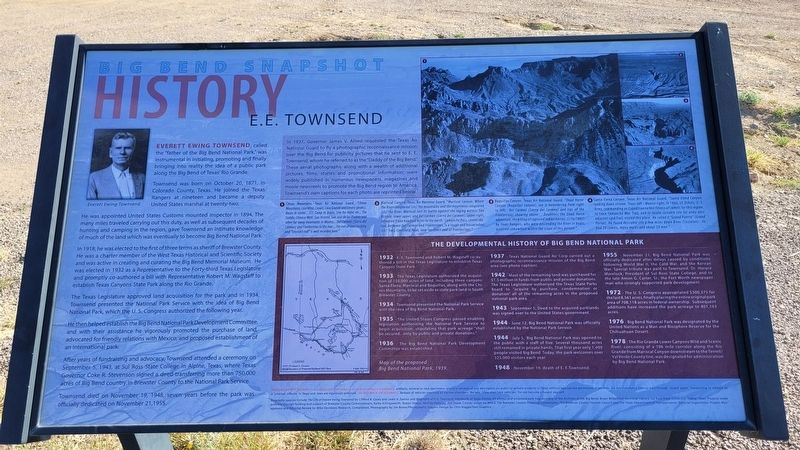
Big Bend Snapshot History
Townsend was born on October 20, 1871, in Colorado County, Texas. He joined the Texas Rangers at nineteen and became a deputy United States marshal at twenty-two.
He was appointed United States Customs mounted inspector in 1894. The many miles traveled carrying out this duty, as well as subsequent decades of hunting and camping in the region, gave Townsend an intimate knowledge of much of the land which was eventually to become Big Bend National Park.
In 1918, he was elected to the first of three terms as sheriff of Brewster County. He was a charter member of the West Texas Historical and Scientific Society. and was active in creating and curating the Big Bend Memorial Museum. He was elected in 1932 as a Representative to the Forty-third Texas Legislature and promptly co-authored a bill with Representative Robert M. Wagstaff to establish Texas Canyons State Park along the Rio Grande.
The Texas Legislature approved land acquisition for the park and in 1934, Townsend presented the National Park Service with the idea of Big Bend National Park, which the U. S. Congress authorized the following year.
He then helped establish the Big Bend National Park Development Committee, and with their assistance he vigorously promoted the purchase of land, advocated for friendly relations with Mexico, and proposed establishment of an international park.
After years of fundraising and advocacy, Townsend attended a ceremony on September 5, 1943, at Sul Ross State College in Alpine, Texas, where Texas Governor Coke R. Stevenson signed a deed transferring more than 750,000 acres of Big Bend country in Brewster County to the National Park Service.
Townsend died on November 19, 1948, seven years before the park was officially dedicated on November 21,1955.
In 1937, Governor James V. Alired requested the Texas Air National Guard to fly a photographic reconnaissance mission over the Big Bend for publicity pictures that he sent to E.E. Townsend, whom he referred to as the "Daddy of the Big Bend." These aerial photographs, along with a wealth of additional pictures, films, stories and promotional information, were widely published in numerous newspapers, magazines and movie newsreels to promote the Big Bend region to America. Townsend's own captions for each photo are reprinted below.
1. Chisos Mountains, Texas Air National Guard. "Chisos Mountains; Lost Mine, Crown, Casa Grande and Emory (peaks). Basin in center....CCC
Camp in Base, Site for Hotel etc., The Saddle, Chinese Wall. San Vincente, San Jose de las Piedras and other far away mountains in Mexico....Del Carmen (Sierra del Carmen) and Fronterrizas to the rear....The evil of overstocking and "Erosion's Toll" is well recorded here."
2. Mariscal Canyon. Texas Air National Guard. "Mariscal Canyon. Where the River conquored (sic) the mountains and the mountains conquored (sic) the River. Mariscal lost its battle against the raging waters. San Vicente, lower upper, and Del Carmen (Sierra del Carmen), upper right, retreated it one hundred miles to the north. Comanche Pass, center sky- line, between Del Carmen and Fronterrizas, is a tough and hazzaradous (sic) Trail. Centinela Peak, near northern end of Fronterrizas."
3. Boquillas Canyon. Texas Air National Guard. "Dead Horse Canyon (Boquillas Canyon), see it meandering from right to left. Del Carmen (Sierra del Carmen) and tips of the Fronterrizas showing above....Doubtless the Dead Horse adventure, the killing of captured Indian horses, (1/16/1882) by Texas Rangers, who were descending the River in boats, occurred somewhere within the scope of this picture."
4. Santa Elena Canyon. Texas Air National Guard. "Santa Elena Canyon, looking down stream. Texas left - Mexico right. In 1860, Lt. Echols, U. S. Army, commanding an Expedition to test fitness of camels for this region, to trace Comanche War Trail, and to locate suitable site for army post adjacent said Trail, visited this place. He called it "Grand Puerta" (Grand Portal). He found desirable site a few miles down River (Castalon). He had 20 camels many mules and about 50 men."
1933 - The Texas Legislature authorized the acquisition of 150,000 acres of land, including three canyons: Santa Elena, Mariscal and Boquillas, along with the Chisos Mountains, to be set aside as state park land in South Brewster County.
1934 - Townsend presented the National Park Service with the idea of Big Bend National Park.
1935 - The United States Congress passed enabling legislation authorizing the National Park Service to begin acquisition, stipulating that park acreage "shall be secured...only by public and private donations."
1936 - The Big Bend National Park Development Committee was established.
1937 - Texas National Guard Air Corp carried out a photographic reconnaissance mission of the Big Bend area (see photo caption).
1942 - Most of the remaining land was purchased for $1.5 million in funds from public and private donations. The Texas Legislature authorized the Texas State Parks Board to "acquire by purchase, condemnation or donation" all of the remaining acres in the proposed national park area.
1943 - September 5, Deed to the acquired parklands was signed over to the United States government.
1944 - June 12, Big Bend National Park was officially established by the National Park Service.
1944 - July 5, Big Bend National Park was opened to the public with a staff of five. Several thousand acres still remained in private hands. That first year only 1,409 people visited Big Bend. Today, the park welcomes over 325,000 visitors each year.
1948 - November 19, death of E. E.Townsend.
1955 - November 21, Big Bend National Park was officially dedicated after delays caused by conditions following World War II, the Cold War, and the Korean War. Special tribute was paid to Townsend, Dr. Horace Morelock, President of Sul Ross State College, and to the late Amon G. Carter, Sr., the Fort Worth newspaper man who strongly supported park development.
1972 - The U. S. Congress appropriated $300,375 for the last 8,561 acres, finally placing the entire original park area of 708,118 acres in federal ownership. Subsequent additions have increased the park acreage to 801,163 acres.
1976 - Big Bend National Park was designated by the United Nations as a Man and Biosphere Reserve for the Chihuahuan Desert.
1978 - The Rio Grande Lower Canyons Wild and Scenic River, consisting of a 196 mile corridor along the Rio Grande from Mariscal Canyon downstream to the Terrell/ Val Verde County line, was designated for administration by Big Bend National Park.
Map of the proposed Big Bend National Park, 1939.
Erected by Brewster County Historical Commission.
Topics. This historical marker is listed in this topic list: Parks & Recreational Areas. A significant historical date for this entry is September 5, 1943.
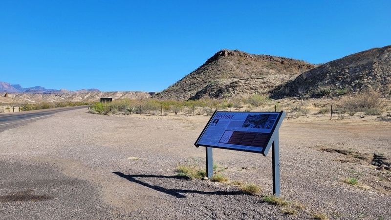
Location. 29° 18.1′ N, 103° 30.514′ W. Marker is in Study Butte-Terlingua, Texas, in Brewster County. Marker is on State Highway 118, 2.9 miles south of Farm to Market Road 170, on the right when traveling south. The marker is located at a small road side pullout northwest the Big Bend National Park Sign. Touch for map. Marker is in this post office area: Terlingua TX 79852, United States of America. Touch for directions.
Other nearby markers. At least 8 other markers are within 7 miles of this marker, measured as the crow flies. Big Bend Ranching: South (approx. 2.4 miles away); Ranching in the Big Bend (approx. 2.4 miles away); Terlingua (approx. 6 miles away); Luna's Jacal (approx. 6.2 miles away); Terlingua Cemetery (approx. 6.4 miles away); Chisos Mine and Terlingua (approx. 6.4 miles away); Federico Villalba (approx. 6.4 miles away); Quicksilver (approx. 6.9 miles away). Touch for a list and map of all markers in Study Butte-Terlingua.
Also see . . . Everett Townsend: The Father of Big Bend National Park. National Park Service
On August 31, 1894, Townsend ventured into the Chisos Mountains, which form the heart of the present-day national park, tracking mules stolen from a Mexican citizen. The panoramic view from the South Rim made a real impression on the young man—decades later he recalled that the sight made him "see God as he had never seen Him before and so overpoweringly impressed him that he made note of its awesomeness…" Inspired by the expansive vista he had seen, Townsend vowed to preserve the region in some fashion.(Submitted on March 27, 2023, by James Hulse of Medina, Texas.)
Credits. This page was last revised on March 27, 2023. It was originally submitted on March 26, 2023, by James Hulse of Medina, Texas. This page has been viewed 102 times since then and 17 times this year. Photos: 1, 2, 3. submitted on March 27, 2023, by James Hulse of Medina, Texas.


