Sierra City in Sierra County, California — The American West (Pacific Coastal)
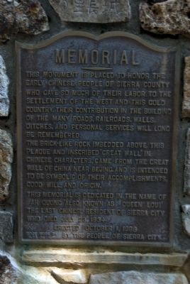
Memorial
The brick-like rock imbedded above this plaque and inscribed 'Great Wall' in Chinese characters, came from the Great Wall of China near Bejing and is intended to be symbolic of their accomplishments, good will, and origin.
This memorial is dedicated in the name of Ah Quong also known as Queen Lou! The last Chinese resident of Sierra City who died July 23, 1934.
Erected October 1, 1988
by the People of Sierra City
Erected 1988 by People of Sierra City.
Topics and series. This historical marker is listed in these topic lists: Asian Americans • Industry & Commerce • Railroads & Streetcars • Settlements & Settlers. In addition, it is included in the Chinese Heritage Sites of the American West series list. A significant historical month for this entry is July 1913.
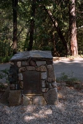
Location. 39° 34.367′ N, 120° 37.3′ W. Marker is in Sierra City, California, in Sierra County. Marker can be reached from Kentucky Mine Road, 0.1 miles west of Highway 49. The marker is located on the grounds of the Kentucky Mine Historic Park and Museum. Touch for map. Marker is in this post office area: Sierra City CA 96125, United States of America. Touch for directions.
Other nearby markers. At least 8 other markers are within 11 miles of this marker, measured as the crow flies. Busch & Heringlake Building (approx. 0.8 miles away); Miner’s Hotel (approx. 0.9 miles away); Here Today – Gone Tomorrow (approx. 2.2 miles away); Site of Howard Ranch and Inn 1865 (approx. 3˝ miles away); Crossing the Summit - Weather or Not (approx. 7.6 miles away); Cornish Ranch House (approx. 9.8 miles away); Downieville Cemetery (approx. 10.8 miles away); Downieville Foundry (approx. 10.9 miles away). Touch for a list and map of all markers in Sierra City.
Also see . . .
1. Kentucky Mine Historic Park and Museum. Repaired broken link; 11/23/2020 LPG. (Submitted on August 24, 2009, by Karen Key of Sacramento, California.)
2. Sierra County History. (Submitted on August 24, 2009, by Karen Key of Sacramento, California.)
Credits. This page was last revised on November 23, 2020. It was originally submitted on August 24, 2009, by Karen Key of Sacramento, California. This page has been viewed 753 times since then and 9 times this year. Photos: 1, 2. submitted on August 24, 2009, by Karen Key of Sacramento, California.

