Bluffton in Beaufort County, South Carolina — The American South (South Atlantic)
Bluffton, S.C.
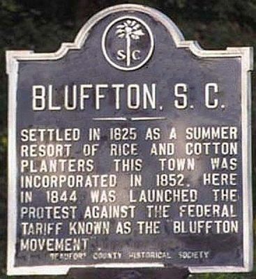
1. Bluffton, S.C. Marker
Settled in 1825, as a summer resort of rice and cotton planters, this town was incorporated in 1852. Here in 1844 was launched the protest against the Federal tariff known as the "Bluffton Movement".
Erected by Beaufort County Historical Society. (Marker Number 7-2.)
Topics and series. This historical marker is listed in these topic lists: Government & Politics • Settlements & Settlers. In addition, it is included in the South Carolina, Beaufort County Historical Society series list. A significant historical year for this entry is 1825.
Location. Marker is missing. It was located near 32° 14.246′ N, 80° 52.448′ W. Marker was in Bluffton, South Carolina, in Beaufort County. It was at the intersection of May River Road (State Highway 46) and Verdier Cove Road, on the right when traveling east on May River Road. Touch for map. Marker was in this post office area: Bluffton SC 29910, United States of America. Touch for directions.

Regionally, this marker was in the Lowcountry and on the Sea Islands. It was also in the American South, specifically in the Deep South, and on the Eastern Seaboard. Globally, it
this page online
Other nearby markers. At least 8 other markers are within walking distance of this location: First Zion Baptist Church (approx. half a mile away); Cyrus Garvin / Cyrus Garvin House (approx. half a mile away); a different marker also named Bluffton (approx. 0.7 miles away); Michael C. Riley Schools (approx. 0.7 miles away); Church of the Cross (approx. ¾ mile away); Bluffton United Methodist Church (approx. ¾ mile away); The Burning of Bluffton (approx. 0.8 miles away); Town of Bluffton, South Carolina (approx. 0.8 miles away). Touch for a list and map of all markers in Bluffton.
More about this marker. Marker was mowed down in a DUI accident, early 2005, and missing. Per conversation with Historical Society, Marker to be replaced upon completion of road improvements, SC-46, perhaps before this years
Photographed by Mike Stroud, 2003
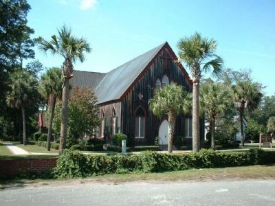
2. Church of the Cross
Bluffton, SC boasts surprisingly few antebellum buildings. Most were destroyed by Union troops stationed at Hilton Head Island during the Civil War. The surviving buildings in Bluffton include the Episcopal Church of the Cross
Regarding Bluffton, S.C.. The town of Bluffton, located in what was the King's grant to Lord Proprietor Colleton, has had quite an interesting and important history.Originally settled by Native American tribes who lived off the plentiful oysters, clams and shrimp in local waterways,
Bluffton was ultimately "discovered" by wealthy Savannah plantation owners in the early nineteenth century. At that time, Bluffton served as an important summer destination, where families of area rice and cotton plantation owners could escape the heat and malaria that afflicted coastal plantations in the summer months.
Located on a scenic bluff overlooking the May River, Bluffton offered plenty of boating, fishing, crabbing and shrimping opportunities. With easy access to Savannah, Beaufort and Charleston, Bluffton became an important distribution center, shipping valuable crops across the Southeast and beyond. Eventually, this active commerce brought year-round residents to Bluffton.In 1844, area planters rebelled against unfair federal import taxes, leading to the historic "Bluffton Movement." Area planters gathered beneath what is now known
Photographed by Mike Stroud, December 27, 2007
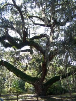
3. “Secession Oak,”
By the early 1840s, though, locals had become increasingly irritated by Federal tariffs on imported merchandise. These duties levied by the government added significant expense to essential goods as well as luxury items coming into the country. From their frustration grew the “Bluffton Movement” in protest to the tariffs. Angry residents met under a massive ancient oak tree in the town which became known as “Secession Oak,” where protests eventually resulted in calls for secession from the Union.
Bluffton, as a high-profile headquarters of the Confederate “rebels”, was attacked by Union forces who bombarded and burned the town in June of 1863. Note: Tree is located on Private Property, but visible along Verdier Cove Rd. approx. .2 miles from SC-46
South Carolina ultimately became the first state to secede from the Union sixteen years later, causing a national uproar.On June 4, 1863, Union gunboats and infantrymen charged up the river to Bluffton to squelch Confederate insurrections.
A fierce battle ensued, but Confederate soldiers were outnumbered and outgunned. When Union forces finally withdrew, dozens of local homes and churches had been shelled, torched or otherwise destroyed.
Over the years, Bluffton has recovered from its losses during the Civil War and grown to become one of the most vibrant metropolitan areas along the South Carolina coast. Many of Bluffton's antebellum homes and churches still stand today, offering a fascinating window into the area's past. With more and more people moving to the Bluffton area each year, the town continues to grow, welcoming new residents from near and far
Also see . . .
1. Bluffton, South Carolina. Wikipedia entry (Submitted on August 31, 2024, by Larry Gertner of New York, New York.)
2. "Bluffton Movement". Wikipedia entry (Submitted on August 11, 2009, by Mike Stroud of Bluffton, South Carolina.)
Photographed by Mike Stroud, April 3, 2004
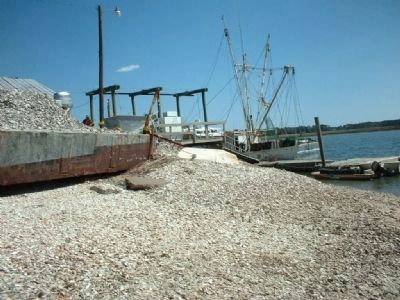
4. Bluffton, S.C., Last working Oyster Factory in South Carolina
Also Available is locally caught Shrimp and Blue Crabs, when all are in season
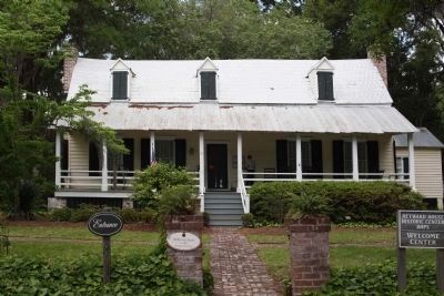
Photographed by Mike Stroud, April 30, 2009
5. Heyward House, ca. 1840 , home of Bluffton Historical Preservation Society
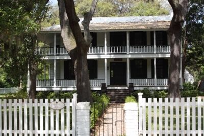
Photographed by Mike Stroud, April 30, 2009
6. Bluffton Historical Preservation Society, " Seven Oaks", ca. 1850
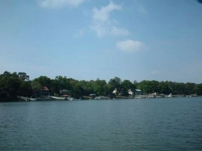
Photographed by Mike Stroud, 2005
7. Bluffton, S.C. Along the May River

Photographed by Mike Stroud, 2007
8. Locally famous Bluffton BBQ sign
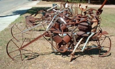
Photographed by Mike Stroud, 2004
9. Bluffton, Local artists at work
Credits. This page was last revised on August 31, 2024. It was originally submitted on August 11, 2009, by Mike Stroud of Bluffton, South Carolina. This page has been viewed 6,633 times since then and 384 times this year. Last updated on March 29, 2023, by Glen Umberger of Bluffton, South Carolina. Photos: 1, 2, 3, 4, 5, 6, 7, 8, 9. submitted on August 11, 2009, by Mike Stroud of Bluffton, South Carolina. • Bernard Fisher was the editor who published this page.
