Sherborn in Middlesex County, Massachusetts — The American Northeast (New England)
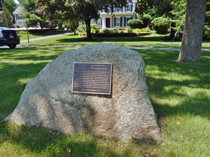
In Honor of Two Magnificent and Historically Significant Trees

Photographed by Cosmos Mariner, July 7, 2019
1. In Honor of Two Magnificent and Historically Significant Trees Marker
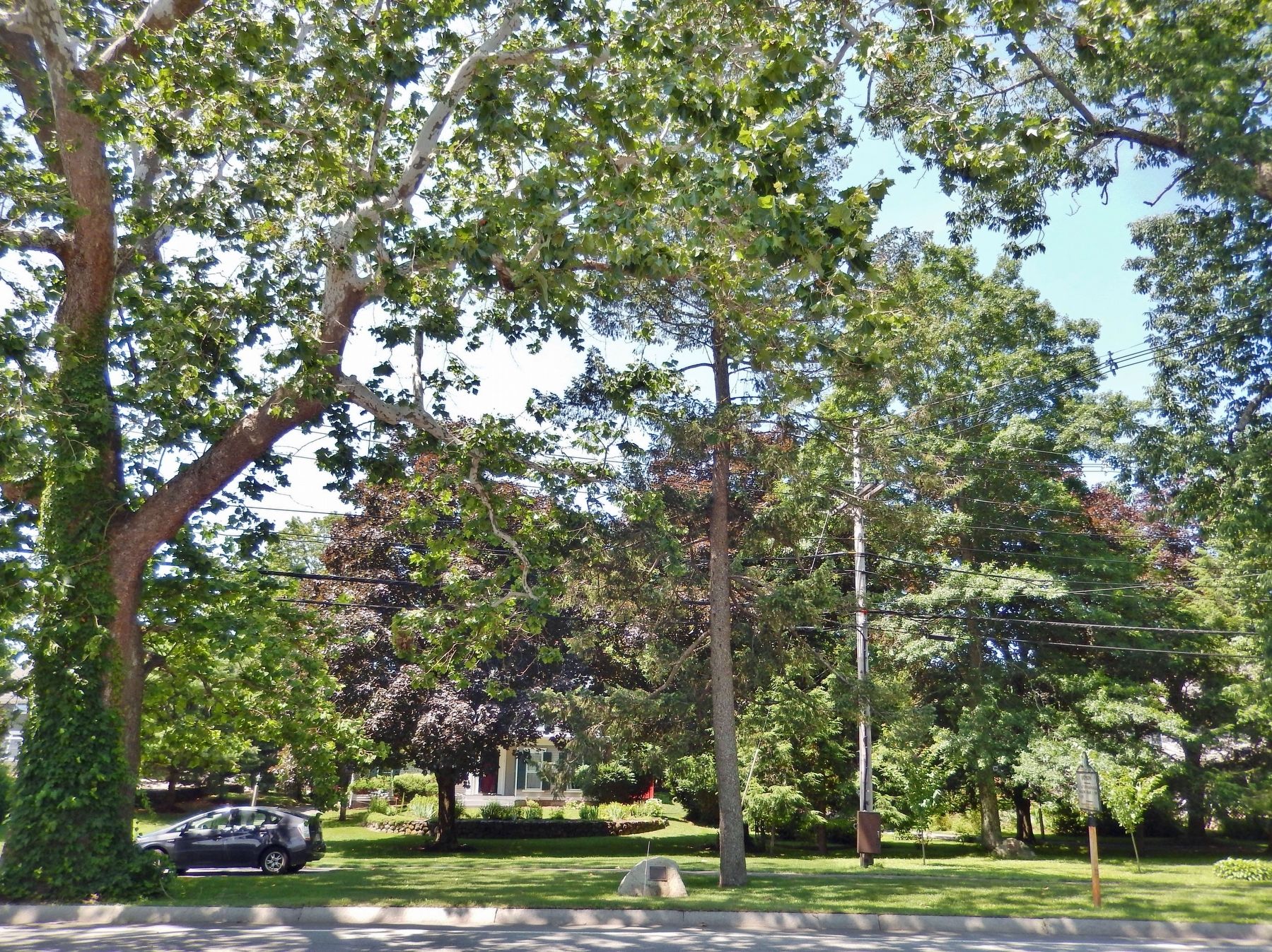
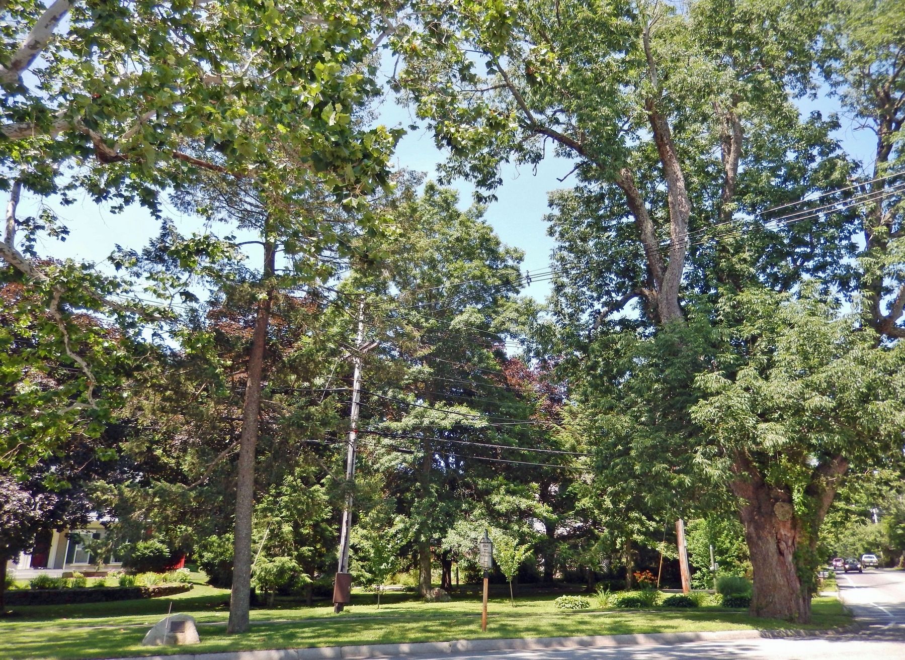
It is believed that four trees, two ash and two sycamore, were set out in 1780 by Joseph Dowse at the end of the Revolutionary War. Several generations later, one ash and one sycamore, were blown down in the hurricane of 1938. Charles Arthur Dowse Jr. and his mother Jesse carefully counted the rings on the destroyed trees and found that the years they recorded were consistent with the trees having been planted around 1780. The remaining trees, one ash and one sycamore, approximately 233 years old, are located at Dowse’s corner, on common land opposite the Farm Stand.
Erected 2013.
Topics and series. This historical marker is listed in these topic lists: Disasters • Horticulture & Forestry • War, US Revolutionary. In addition, it is included in the Historic Trees series list. A significant historical year for this entry is 1780.
Location. 42° 15.332′ N, 71° 22.106′ W. Marker is in Sherborn, Massachusetts, in Middlesex County. It is on North Main Street (Massachusetts Route 27) just south of Coolidge Street, on the right when traveling south. Touch for map. Marker is in this post office
this page online

Regionally, this marker is in Greater Boston. It is also in the American Northeast, in New England, and on the Eastern Seaboard. Globally, it is in the North Atlantic Region, North America, the Western Hemisphere, the Western World, and the Anglosphere. Historically, it finds itself in what was once one of the original Thirteen Colonies.
Other nearby markers. At least 8 other markers are within 5 miles of this marker, measured as the crow flies: Sherborn (here, next to this marker); Odd Fellow's Building (approx. 2.2 miles away); First Congregational Church (approx. 2.3 miles away); Indian Meetinghouse (approx. 2.9 miles away); Future Performing Arts Center (approx. 3.6 miles away); Thomas Eames (approx. 4 miles away); Site of Eames Massacre (approx. 4.1 miles away); Old Burying Ground Cemetery (approx. 4.2 miles away).
Also see . . .
1. Edward's Plain–Dowse's Corner Historic District.
Dowse's Corner, at the north end of the district, is named for Ebenezer Dowse, who settled in Sherborn after fleeing Charlestown before the 1775 Battle of(Submitted on March 29, 2023, by Cosmos Mariner of Cape Canaveral, Florida.)Bunker Hill. Dowse became a significant figure in the local industrial pursuits, establishing an early tannery in the buggy lowlands behind his house. At one time, ten Dowse family dwellings stood near the intersections of Lake, Coolidge and North Main Streets, giving it the name Dowse’s Corner.Photographed by Cosmos Mariner, July 7, 20192. In Honor of Two Magnificent and Historically Significant Trees Marker(looking west from North Main Street)
2. 1938 New England hurricane.
The 1938 New England Hurricane (also referred to as the Great New England Hurricane and the Long Island Express Hurricane) was one of the deadliest and most destructive tropical cyclones to strike Long Island, New York, and New England. The eye of the storm followed the Connecticut River north into Massachusetts, where the winds and flooding killed 99 people. Two-thirds of the boats sank in New Bedford harbor. The Blue Hill Observatory registered sustained winds of 121 mph and a peak gust of 186 mph, which is the strongest hurricane-related surface wind gust ever recorded in the United States. A 50 ft wave, the tallest of the storm, was recorded at Gloucester.(Submitted on March 29, 2023, by Cosmos Mariner of Cape Canaveral, Florida.)
Photographed by Cosmos Mariner, July 7, 2019
3. Historic Sycamore Tree
Photographed by Cosmos Mariner, July 7, 2019
4. Historic Ash Tree
Credits. This page was last revised on March 29, 2023. It was originally submitted on March 29, 2023, by Cosmos Mariner of Cape Canaveral, Florida. This page has been viewed 375 times since then and 41 times this year. Photos: 1, 2, 3, 4. submitted on March 29, 2023, by Cosmos Mariner of Cape Canaveral, Florida.
