The Bight Settlement in Providenciales, Turks and Caicos Islands, British Overseas Territories — North Atlantic Ocean
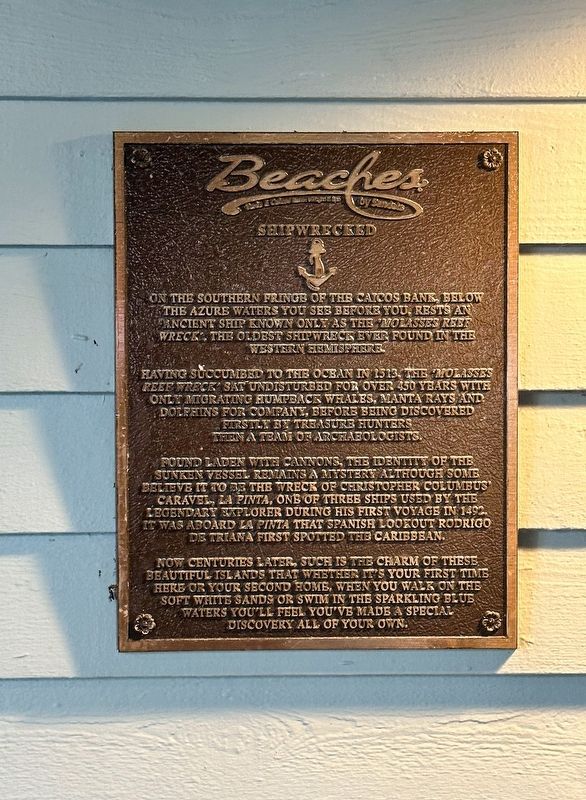
Shipwrecked
Having succumbed to the ocean in 1513, the 'Molasses Reef Wreck' sat undisturbed for over 450 years with only migrating humpback whales, manta rays and dolphins for company, before being discovered firstly by treasure hunters then a team of archeologists.
Found laden with cannons, the identity of the sunken vessel remains a mystery although some believe it to be the wreck of Christopher Columbus' caravel, La Pinta, one of the three ships used by the legendary explorer during his first voyage in 1492. It was aboard La Pinta that Spanish lookout Rodrigo De Triana first spotted the Caribbean.
Now centuries later, such is the charm of these beautiful islands that whether it's your first time here or your second home, when you walk on the soft white sands or swim in the sparkling blue waters you'll feel you've made a special discovery all of your own
Erected by Beaches.
Topics. This historical marker is listed in this topic list: Waterways & Vessels. A significant historical year for this entry is 1513.
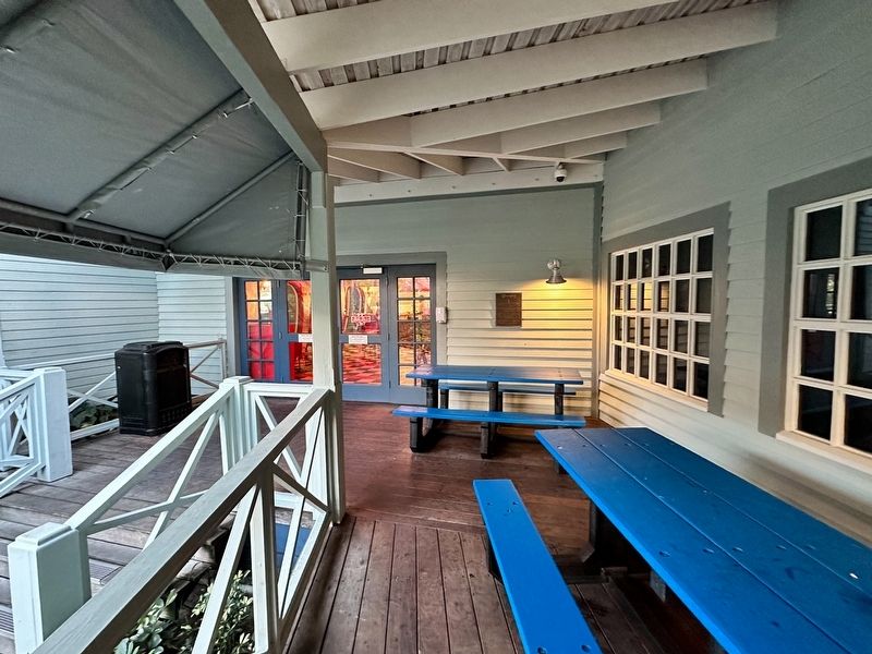
Location. 21° 47.269′ N, 72° 11.724′ W. Marker is in The Bight Settlement, Turks and Caicos Islands, in Providenciales. Marker can be reached from Lower Bight Road. Touch for map. Marker is in this post office area: The Bight Settlement, Turks and Caicos Islands TKCA 1ZZ, British Overseas Territories. Touch for directions.
Other nearby markers. At least 2 other markers are within walking distance of this marker. Welcome to Port Royal (within shouting distance of this marker); Edward Thatch (within shouting distance of this marker).
Also see . . . Molasses Reef Wreck. Excerpt:
A large number of arms, including cannons and small arms, bowls and storage jars, surgical and carpentry tools, as well as wooden pieces of the hull and metal pieces from the rigging, have been recovered from the wreck. Arms on the ship included two bombardettas, fifteen versos (a type of breech-loading swivel gun), haquebuts, haquebuzes (a smaller type of arquebus), grenades, crossbows and quarrels, swords, daggers, breech chambers (powder cartridges) for the bombardetas and versos, shot molds, and sheets of lead to be melted as needed to make shot.(Submitted on April 3, 2023, by J.T. Lambrou of New Boston, Michigan.)
Credits. This page was last revised on April 3, 2023. It was originally submitted on April 3, 2023, by J.T. Lambrou of New Boston, Michigan. This page has been viewed 56 times since then and 8 times this year. Photos: 1, 2. submitted on April 3, 2023, by J.T. Lambrou of New Boston, Michigan. • Andrew Ruppenstein was the editor who published this page.

