Inner Harbor in Baltimore, Maryland — The American Northeast (Mid-Atlantic)
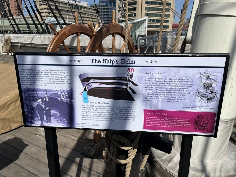
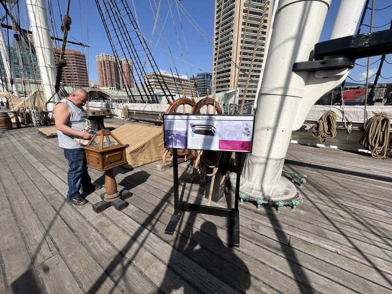
The Ship's Helm
The quarterdeck is the area of the ship around the helm. At sea, the officer-of-the-deck would have managed the sailing of the ship from this area. The quartermasters were senior enlisted sailors who were responsible for keeping the ship on coarse. Quartermasters got their orders from the officer-of-the-deck and made the requisite changes to the ship's course using the helm. Because of the helms presence here, the quarterdeck became the command area of the ship and, overtime,became the most ceremonial area on the ship.
How the Helm Works
"Helm" is the Navy term for the ship's wheel. The helm connects to the rudder via the tiller rope, which wraps around the helm drum several times. From the helm, the tiller rope goes down through two decks to the berth deck where pulleys direct it aft to the tiller room. When the helm is turned, it pulls the tiller rope and cause the rudder to be pulled port or starboard, depending on which way the helm is turned. As you move through the ship, look for the tiller rope as it passes 'tween decks and into the tiller room.
Steering the Ship
At least one quartermaster would be assigned to the helm at all times while at sea. In the open ocean, the quartermaster held the ship on course by taking readings from two compasses housed in binnacles located next to the helm. Ship's courses were plotted on nautical charts and used compass points for directions. By using the binnacles, helmsmen did not need to rely on lookouts or other visual direction cues, and could reliably steer the ship from near the stern. His position aft allowed the helmsmen a good view aloft. When steering by the wind, the helmsman was able to respond to the action of the wind on the sails.
Why Are There Two Helms?
This type of helm is known as a double helm. In heavy seas or foul weather, one sailor would not be able to keep the ship on course by himself. The two attached wheels permitted up to four sailors to steer and doubled the power that could be applied to the helm. In partially bad weather, as many as six or eight men could be assigned to the helm to keep the ship on course as it battled the waves.
[Captions:]
Left: Military Ceremony on the Quarterdeck of USS Constellation, May 31st, 1945. Note the ship's name on the helm.
Top right: A helmsman's view. His position on the helm allowed him to monitor the wind's effect on the sails and adjust the ship's course accordingly.
Erected by Historic Ships in Baltimore.
Topics. This historical marker is listed in this topic list: Waterways & Vessels
Location. 39° 17.125′ N, 76° 36.673′ W. Marker is in Baltimore, Maryland. It is in the Inner Harbor. Marker can be reached from East Pratt Street east of Light Street (Maryland Route 2), on the right when traveling east. Touch for map. Marker is at or near this postal address: 301 E Pratt St, Baltimore MD 21230, United States of America. Touch for directions.
Other nearby markers. At least 8 other markers are within walking distance of this marker. Spar Deck Guns (here, next to this marker); Hammock Rails (a few steps from this marker); The Port of Baltimore (within shouting distance of this marker); USS Constellation (within shouting distance of this marker); The Ship's Head (within shouting distance of this marker); Baltimore’s Maritime Heritage (about 300 feet away, measured in a direct line); Living Classrooms (about 300 feet away); An Active Port for 300 Years (about 400 feet away). Touch for a list and map of all markers in Baltimore.
Additional keywords. The marker is onboard the USS Constellation.
Credits. This page was last revised on April 3, 2023. It was originally submitted on April 3, 2023, by Devry Becker Jones of Washington, District of Columbia. This page has been viewed 57 times since then and 18 times this year. Photos: 1, 2. submitted on April 3, 2023, by Devry Becker Jones of Washington, District of Columbia.

