Fillmore in Ventura County, California — The American West (Pacific Coastal)
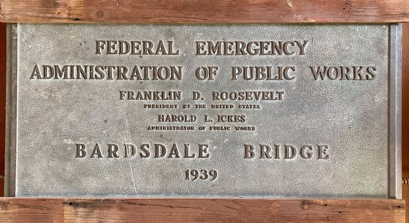
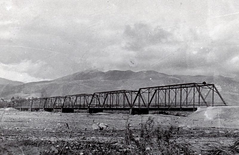
Bardsdale Bridge
1939
Federal Emergency Administration of Public Works.
Franklin D. Roosevelt, President of the United States.
Harold L. Ickes, Administrator of Public Works.
Bardsdale Bridge.
1939
Erected 1939 by Federal Emergency Administration of Public Works.
Topics and series. This historical marker is listed in this topic list: Roads & Vehicles. In addition, it is included in the Works Progress Administration (WPA) projects series list. A significant historical year for this entry is 1928.
Location. 34° 23.957′ N, 118° 54.65′ W. Marker is in Fillmore, California, in Ventura County. Marker can be reached from Main Street, 0.1 miles east of Central Avenue, on the right when traveling east. Located in the Fillmore Historical Museum. Touch for map. Marker is at or near this postal address: 350 Main St, Fillmore CA 93015, United States of America. Touch for directions.
Other nearby markers. At least 8 other markers are within walking distance of this marker. Southern Pacific Depot (within shouting distance of this marker); Rancho Sespe Bunkhouse #2 (within shouting distance of this marker); Fillmore State Bank (about 800 feet away, measured in a direct line); 320 Central Avenue (about 800 feet away); 328 Central Avenue (approx. 0.2 miles away); Fillmore's First Bank & Masonic Hall (approx. 0.2 miles away); 338 Central Avenue (approx. 0.2 miles away); 340 Central Avenue (approx. 0.2 miles away). Touch for a list and map of all markers in Fillmore.
Regarding Bardsdale Bridge. This plaque is now located in the Fillmore Historical Museum. It was originally ˝ mile southwest of the museum, on the Bardsdale Bridge (Hwy 23) over the Santa Clara River.
The original bridge opened on November 23, 1909. In 1914, part of the structure was washed away, and later repaired. The entire bridge structure was destroyed by the St. Francis Dam Disaster flood of 1928. Construction began that year on a replacement bridge using the remaining piers for support.
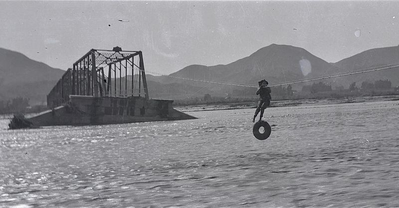
In 1938, flooding washed away the north approach to the bridge. At first a bosons’ chair was slung across the river for access. Within weeks a swinging bridge was constructed for pedestrian traffic. The new approach was completed in 1939 by the Federal Emergency Administration of Public Works.
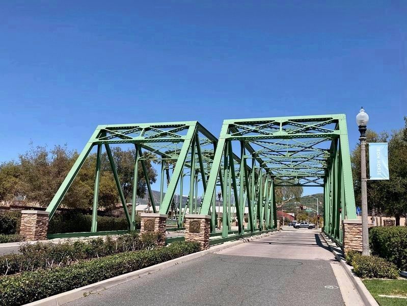
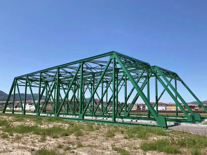
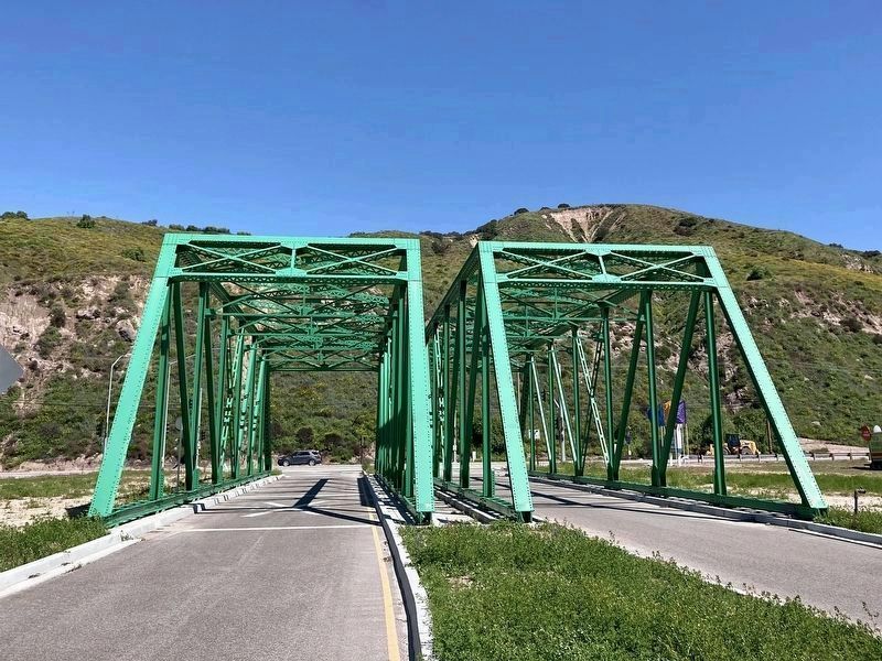
The 1928 structure over the Santa Clara River was too narrow for modern cars and trucks. With the completion of a new bridge in 1994, the old, green bridge superstructure was saved for future use. Today, two sections
are on Trestle Way, and two sections are on Mountain View Drive, just south of Hwy 126. They serve as decorative entrances to a new housing development.
Also see . . . Fillmore Historical Museum. (Submitted on April 4, 2023.)
Credits. This page was last revised on December 14, 2023. It was originally submitted on April 3, 2023, by Craig Baker of Sylmar, California. This page has been viewed 261 times since then and 57 times this year. Photos: 1, 2, 3, 4. submitted on April 3, 2023, by Craig Baker of Sylmar, California. 5, 6. submitted on April 4, 2023, by Craig Baker of Sylmar, California.
