Rochester in Oakland County, Michigan — The American Midwest (Great Lakes)
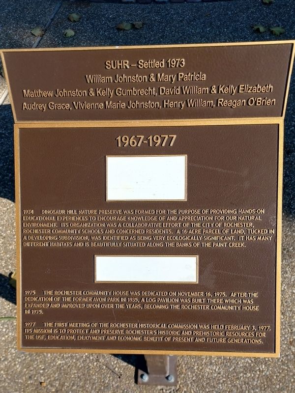
1967-1977
1974 Dinosaur Hill Nature Preserve was formed for the purpose of providing hands-on educational experiences to encourage knowledge of and appreciation for our natural environment. Its organization was a collaborative effort of the City of Rochester, Rochester Community Schools and concerned residents. A 16-acre parcel of land, tucked in a developing subdivision, was identified as being very ecologically significant. It has many different habitats and is beautifully situated along the banks of Paint Creek.
1975 The Rochester Community House was dedicated on November 16, 1975. After the dedication of the former Avon Park in 1935, a log pavilion was built there which was expanded and improved upon over the years, becoming the Rochester Community House in 1975.
1977 The first meeting of the Rochester Historical Commission was held February 3, 1977. Its mission is to protect and preserve Rochester's historic and prehistoric resources for the use, education, enjoyment and economic benefit of present and future generations.
William Johnston & Mary Patricia
Matthew Johnston & Kelly Gumbrecht, David William & Kelly Elizabeth
Audry Grace, Vivienne Marie Johnston, Henry William, Reagan O'Brien
Erected 2017 .
Topics. This historical marker is listed in these topic lists: Charity & Public Work • Parks & Recreational Areas. A significant historical year for this entry is 1974.
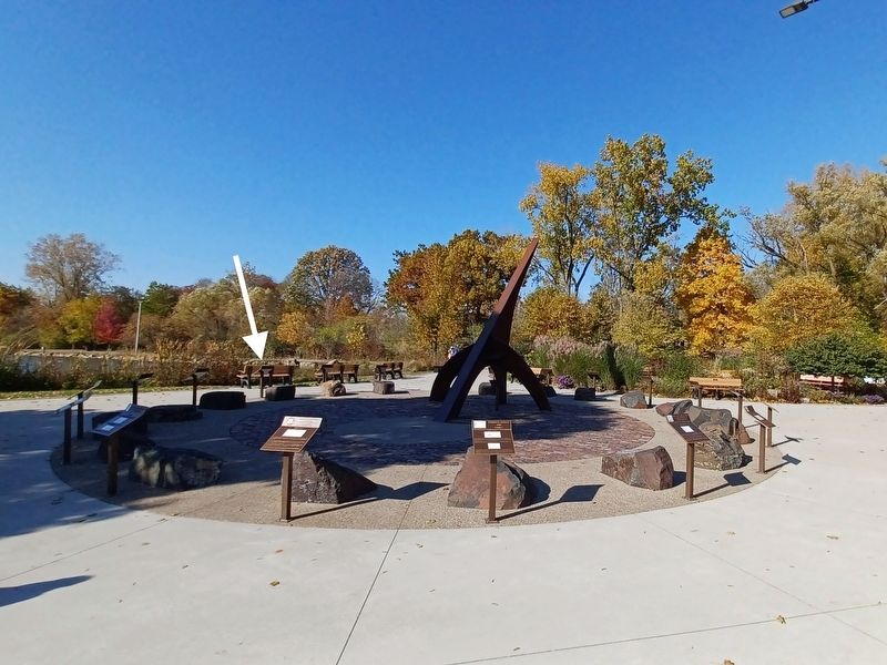
Location. 42° 41.033′ N, 83° 8.216′ W. Marker is in Rochester, Michigan, in Oakland County. Marker can be reached from 6th Street. Marker is in Rochester Municipal Park at the southeast end near Pine Street — between the parking lot and the pond. Touch for map. Marker is at or near this postal address: 400 Sixth Street, Rochester MI 48307, United States of America. Touch for directions.
Other nearby markers. At least 8 other markers are within walking distance of this marker. 1977-1987 (here, next to this marker); 1957-1967 (here, next to this marker); 1987-1997 (here, next to this marker); 1947-1957 (here, next to this marker); 1937-1947 (here, next to this marker); 1997-2007 (here, next to this marker); 2007-2017 (here, next to this marker); 1927-1937 (here, next to this marker). Touch for a list and map of all markers in Rochester.
Credits. This page was last revised on April 6, 2023. It was originally submitted on April 6, 2023, by Joel Seewald of Madison Heights, Michigan. This page has been viewed 43 times since then and 3 times this year. Photos: 1, 2, 3. submitted on April 6, 2023, by Joel Seewald of Madison Heights, Michigan.


