Lincoln in Lewis and Clark County, Montana — The American West (Mountains)
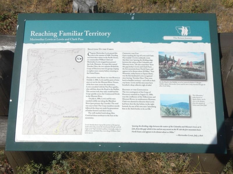
Reaching Familiar Territory
Meriwether Lewis at Lewis and Clark Pass
— The Return Journey —

Photographed By Barry Swackhamer, August 12, 2022
1. Reaching Familiar Territory Marker
Captions: (map on the left) Lewis's hastily drawn map of his portion of the journey marks where they crossed the Continental Divide with the single word "Gap" (circled in yellow). Ironically, today it is called Lewis and Clark Pass, even though William Clark never saw it.; (picture at upper right) On the Road to the Buffalo, an oil on canvas by Robert W. Morgan (2000), depicts Meriwether Lewis and his men as they traveled through the Alice Creek Valley.; (photo at center right) "Fort Mountain," today known as Square Butte, can be seen in the distance from the summit of Lewis and Clark Pass.
Splitting Up the Corps
Captain Meriwether Lewis passed this way in the summer of 1806. Traveling east from their winter on the Pacific Ocean, co-commanders William Clark and Meriwether Lewis stopped near present-day Lolo, Montana. At a spot they named Travelers' Rest, the two captains divided the Corps of Discovery into two groups, hoping to explore more country before returning to the United States.
Following the Road to the Buffalo
On July 3, 1806, Lewis and his party of nine men set out for the Missouri River. Unsure of the best route across the mountains, Lewis consulted with his Nez Perce guides, who told him about the Road to the Buffalo. This ancient trail, they said, would lead the Corps quickly across the Continental Divide to the Missouri River.
On July 6, 1806, Lewis and his men traveled swiftly east along the Blackfoot River (past present-day Lincoln). The road was easy to find. The Corps members merely followed the deep ruts made by generations of Indian hunters and their travois.
The well-marked track along Alice Creek led them northwest to the foot of the mountains.
Crossing the Gap
Upon reaching the top of Lewis and Clark Pass on July 7, Lewis exultantly wrote that they were "passing the dividing ridge between the waters of the Columbia and Missouri rivers." He also noted that "from this gap [today's Lewis and Clark Pass] ... the fort mountain bears North Eaast (sic), and appears to be distant about 20 Miles." Fort Mountain, today known as Square Butte, was the first landmark Lewis recognized since leaving leaving Travelers' Rest. They were back in familiar territory -- and well on their way home. Lewis and his men must have breathed a deep collective sigh of relief.
Reunion at the Confluence
The two contingents of the Corps of Discovery reunited on August 12, 1806, near the confluence of the Yellowstone and Missouri Rivers, in southeastern Montana. Clark was alarmed to discover that Lewis had been shot the day before in the right buttock, by one of his own men "misstaking (sic) him in the thick bushes to be an Elk."
"passing the dividing ridge between the waters of the Columbia and Missouri rivers at 1/4 mile. from this gap which is low and an easy ascent on the W.side of the fort mountain bears North Eaast (sic), and appears to be distant about 20 Miles." -- Meriwether Lewis, July 7, 1806
Erected by Lewis & Clark National Historic Trail.
Topics and series. This historical marker is listed in these topic lists: Exploration • Roads & Vehicles. In addition, it is included in the Lewis & Clark Expedition series list. A significant historical date for this entry is July 7, 1806.
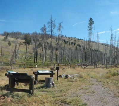
Location. 47° 8.34′ N, 112° 27.384′ W. Marker is in Lincoln, Montana, in Lewis and Clark County. Marker is on Alice Creek Road near State Highway 200. The marker is a far, north-end of Alice Creek Road (gravel/dirt), about 10 miles from the intersection with Montana Highway. Touch for map. Marker is in this post office area: Lincoln MT 59639, United States of America. Touch for directions.
Other nearby markers. At least 8 other markers are within 12 miles of this marker, measured as the crow flies. Road to the Buffalo (here, next to this marker); Crossing Lewis and Clark Pass (here, next to this marker); Lewis and Clark Pass (approx. 1.3 miles away); Coldest Temperature in Contiguous United States (approx. 6.1 miles away); Record Cold Spot (approx. 6.1 miles away); Return to the United States (approx. 8 miles away); Eagle Watch (approx. 8 miles away); A Fine Passageway (approx. 11.7 miles away). Touch for a list and map of all markers in Lincoln.
Credits. This page was last revised on April 8, 2023. It was originally submitted on April 8, 2023, by Barry Swackhamer of Brentwood, California. This page has been viewed 62 times since then and 10 times this year. Photos: 1, 2. submitted on April 8, 2023, by Barry Swackhamer of Brentwood, California.
