Fondulac Township in East Peoria in Tazewell County, Illinois — The American Midwest (Great Lakes)
Bridges
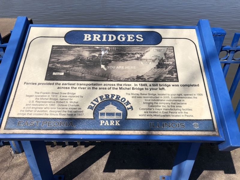
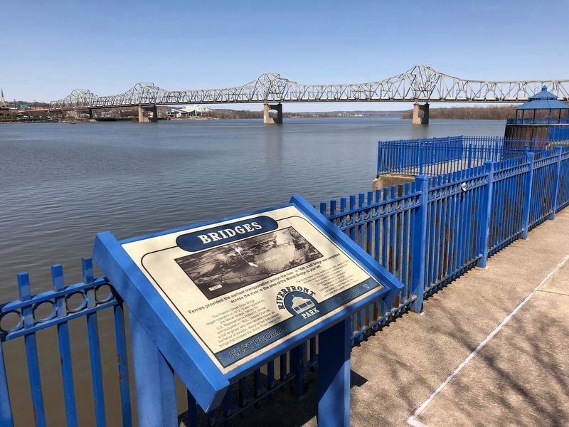
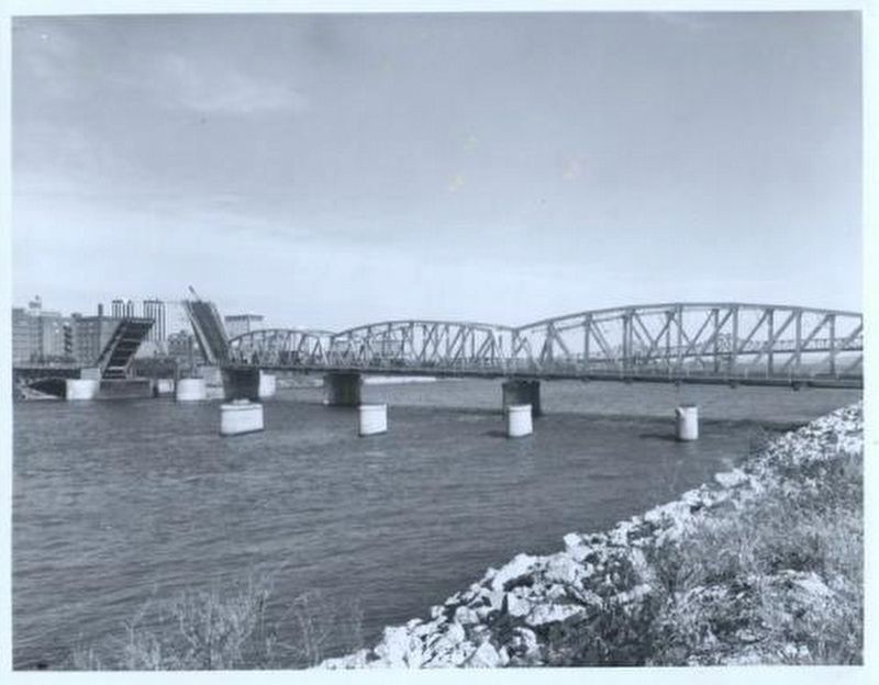
The Franklin Street Draw Bridge began operation in 1912. It was replaced by the Michel Bridge, named for U.S. Representative Robert H. Michel and dedicated in 1992. Octave Chanute, a civil engineer who later became known as the father of aviation, designed the first railroad bridge that crossed the Illinois River here in 1857.
The Murray Baker Bridge, located to your right, opened in 1958 and was reconstructed in 2005. It commemorates the local industrialist instrumental in bringing the company that became Caterpillar Inc. to this area. Caterpillar's major manufacturing facilities are located in East Peoria with the world wide headquarters located in Peoria.
Topics. This historical marker is listed in these topic lists: Bridges & Viaducts • Industry & Commerce. A significant historical year for this entry is 1849.
Location. 40° 41.084′ N, 89° 35.181′ W. Marker is in East Peoria, Illinois, in Tazewell County. It is in Fondulac Township. Marker can be reached from Riverside Drive, on the right when traveling west. Marker is in East Peoria Riverfront Park. Touch for map. Marker is at or near this postal address: 1201 Riverside Dr, East Peoria IL 61611, United States of America. Touch for directions.
Other nearby markers. At least 8 other markers are within walking distance of this marker. CILCO-Wallace Station (a few steps from this marker); Steamboats (a few steps from this marker); Railroads (within shouting distance of this marker); Peoria Skyline (within shouting distance of this marker); East Peoria Veterans Memorial (about 600 feet away, measured in a direct line); Manitowoc Submarines (approx. ¼ mile away); Peoria on The Riverfront / Peoria (approx. 0.4 miles away); Schwab - Powell Building (approx. 0.4 miles away). Touch for a list and map of all markers in East Peoria.
Also see . . . Rickety, Risky Bridges. Once upon a time, crossing a bridge in Peoria was a real gamble. (Phil Luciano, Peoria Magazine, posted Oct. 1, 2022) (Submitted on April 10, 2023, by Duane and Tracy Marsteller of Murfreesboro, Tennessee.)
Credits. This page was last revised on April 10, 2023. It was originally submitted on April 10, 2023, by Duane and Tracy Marsteller of Murfreesboro, Tennessee. This page has been viewed 77 times since then and 15 times this year. Photos: 1, 2, 3. submitted on April 10, 2023, by Duane and Tracy Marsteller of Murfreesboro, Tennessee.


