Clements in San Joaquin County, California — The American West (Pacific Coastal)
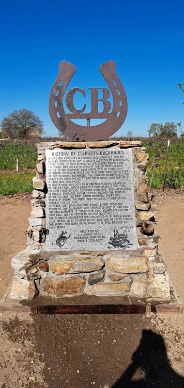
History of Clements Buckaroos
It was 1938 ranchers Lee Bluck, Jack Granlees and Art Burger (manager of the George R. Clements merchandising store) came up with a plan for a pleasure riding club. The three men held a meeting at the Clement's schoolhouse to see if others were interested. Of those that attended 20 people paid $2.50 to become charter members of the Clements Buckaroos. The charter members elected Burger as their president and their 1st event was held: a trail ride and picnic.
In 1940 a date was set for a non-professional round up at Gillies Field which was later purchased in 1945. This was the first official Clements stampede and horse show. from George R. Clements, whose father founded the town of Clements, was the first Grand Marshall. Over 1500 people attended the event that included a greased pig contest for the kids.
With the cost of $14000 and a huge effort from the members, the clubhouse was completed just in time for the 1954 stampede. It consists of 1650 square feet in the main hall with a complete kitchen adjoining.
The Clements Buckaroos was organized as a family horse club meant to be enjoyed by all who like to spend time in the saddle for work or pleasure. It is still enjoyed as such today.
Erected 2023 by Tuleburgh Chapter 69, E Clampus Vitus.
Topics and series. This historical marker is listed in these topic lists: Animals • Entertainment • Parks & Recreational Areas • Sports. In addition, it is included in the E Clampus Vitus series list. A significant historical year for this entry is 1938.
Location. 38° 11.634′ N, 121° 4.707′ W. Marker is in Clements, California, in San Joaquin County. Marker is on California 88 (State Highway 88) just west of Hwy 88 hwy 12 split (State Highway 12), on the left when traveling east. Touch for map. Marker is at or near this postal address: 20400 CA-88, Acampo CA 95220, United States of America. Touch for directions.
Other nearby markers. At least 8 other markers are within 2 miles of this marker, measured as the crow flies. Clements Elementary School (approx. ¼ mile away); Athearn School Bell (approx. 0.3 miles away); David S. Terry (approx. half a mile away); James B. Anderson (approx. 0.8 miles away); Glenview Cemetery (approx. 0.8 miles away); Lone Star Mill (approx. one mile away); Mackville Road Bridge (approx. 1.1 miles away); Dogtown Cemetery (approx. 1.7 miles away). Touch for a list and map of all markers in Clements.
Credits. This page was last revised on April 15, 2023. It was originally submitted on April 11, 2023, by Brock Wiley of Modesto, California. This page has been viewed 169 times since then and 105 times this year. Photo 1. submitted on April 11, 2023, by Brock Wiley of Modesto, California. • J. Makali Bruton was the editor who published this page.
Editor’s want-list for this marker. A clear, close-up photo of the marker. • A wide view photo of the marker and the surrounding area together in context. • Can you help?
