Waterloo in Monroe County, Illinois — The American Midwest (Great Lakes)
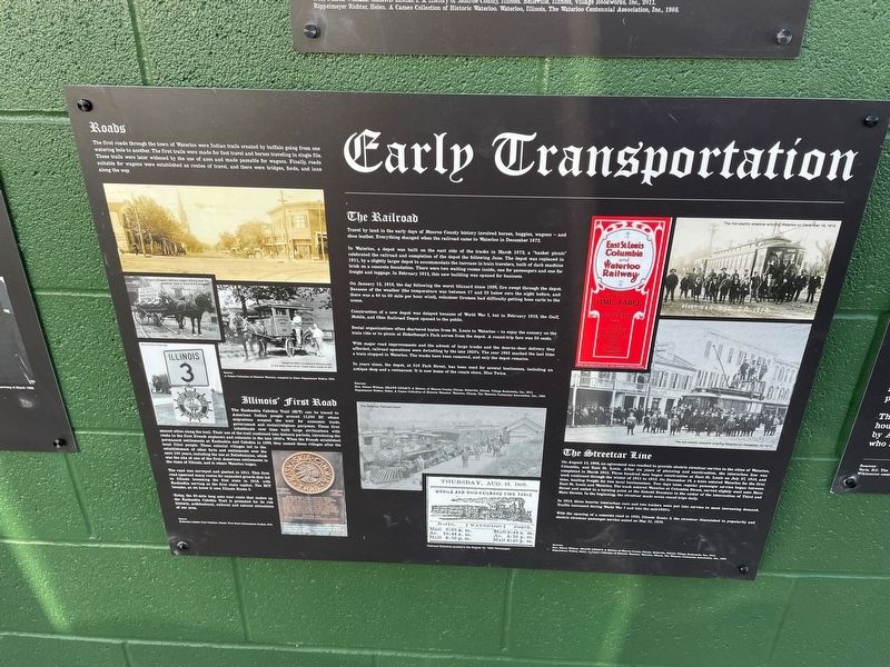
Early Transportation
The first roads through the town of Waterloo were Indian trails created by buffalo going from one hole to another. The first trails were made for foot travel and horses traveling in single file. trails were later widened by the use of axes and made passable for wagons. Finally, roads for wagons were established as routes of travel, and there were bridges, forts, and inns the way.
Illinois' First Road
The Kaskaskia Cahokia Trail (KCT) can be traced to American Indian people around 11,000 BC whose migrations created the trail for economic trade, government and social/religious purposes. These first inhabitants over time built large civilizations with mound cities along the trail. Their use of the trail continued into historic periods, introducing the route to the first French explorers and colonists in the late 1600's. When the French established permanent settlements at Kaskaskia and Cahokia in 1699, they named these villages after the local Illini people. These colonial villages led to the establishment of other forts and settlements over the next 100 years, including the one at Bellefontaine, which was the site of one of the first American settlements in the state of Illinois, and is where Waterloo began.
Illinoi's First Road
The Kaskaskia Trail (KCT)can be traced to American Indians.
The road was surveyed and platted in 1811. This first road spawned many routes for expanded growth that led to Illinois becoming the 21st state in 1818, with Kaskaskia serving as the first state capital. The KCT became, as we know it now, Illinois Route 3.
Today, the 60-mile long auto tour route that makes up the Kaskaskia Cahokia Trail is promoted for its rich historic, architectural, cultural and natural attractions of our area.
The Railroad
Travel by land in the early days of Monroe County history involved horses, buggies, and shoe leather. Everything changed when the railroad came to Waterloo in December 1872.
In Waterloo, a depot was built on the east side of the tracks in March 1873; a "bask celebrated the railroad and completion of the depot the following June. The depot was rep 1911, by a slightly larger depot to accommodate the increase in train travelers, built of dark a brick on a concrete foundation. There were two waiting rooms inside, one for passengers and freight and luggage. In February 1912, this new building was opened for business.
On January 12, 1918, the day following the worst blizzard since 1899, fire swept through the Because of the weather (the temperature was between 17 and 22 below zero the night before there was a 40 to 60 mile per hour wind), volunteer firemen had difficulty getting hose carts to scene.
Construction of a new depot was delayed because of World War I, but in February 1913, the Gulf Mobile, and Ohio Railroad Depot opened to the public.
Social organizations often chartered trains from St. Louis to Waterloo - to enjoy the scenery on the train ride or to plenic at Bickelhaupt's Park across from the depot. A round-trip fare was 50 cents.
With major road improvements and the advent of large trucks and the door-to-door delivery they afforded, railroad operations were dwindling by the late 1950's. The year 1985 marked the last time a train stopped in Waterloo. The tracks have been removed, and only the depot remains.
In years since, the depot, at 518 Park Street, has been used for several businesses, including an antique shop and a restaurant. It is now home of the resale store, Nice Twice
The Streetcar Line
On August 13, 1906, an agreement was reached to provide electric streetcar service to the cities of Waterloo, Columbia, and East St. Louis. After six years of planning and construction, the interurban line was completed in March 1912. Three hundred men began construction at East St. Louis on July 27, 1910, and work continued through the winter of 1911 to 1912. On December 18, a train entered Waterloo for the first time, hauling freight for two local businessmen. Two days later, regular passenger service began between East St. Louis and Waterloo. The track entered Waterloo at Columbia Street, curved slightly west onto Main Street and ended in a turning point at the Ziebold Fountain in the center of the intersection of Third and Main Streets. In the beginning, the streetcar made seven round trips daily.
In 1913, three heavier interurban cars and two trailers were put into service to meet increasing demand. Traffic increased during World War I and into the mid-1920's.
With the opening of a concrete road in 1925, Illinois Route 3, the streetcar diminished in popularity and electric streetcar passenger service ended on May 31, 1932.
Topics. This historical marker is listed in these topic lists: Railroads & Streetcars • Roads & Vehicles.
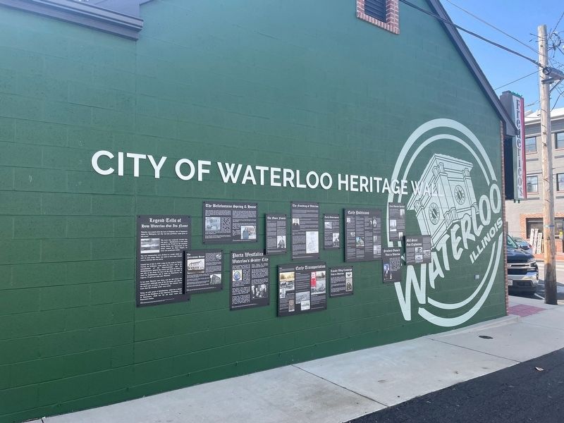
Location. 38° 20.197′ N, 90° 9.02′ W. Marker is in Waterloo, Illinois, in Monroe County. Marker is on North Main Street just south of First Street, on the left when traveling south. Located on the north side of Frederico's Restaurant. Touch for map. Marker is at or near this postal address: 114 N Main St, Waterloo IL 62298, United States of America. Touch for directions.
Other nearby markers. At least 8 other markers are within walking distance of this marker. Patriotic Mural (here, next to this marker); Mill Street Gas Explosions (a few steps from this marker); Early Waterloo Churches (a few steps from this marker); Early Government (a few steps from this marker); The Founding of Waterloo (a few steps from this marker); Porta Westfalica (a few steps from this marker); The Bellefontaine Spring & House (a few steps from this marker); Legend Tells How Waterloo Got Its Name (a few steps from this marker). Touch for a list and map of all markers in Waterloo.
Credits. This page was last revised on April 13, 2023. It was originally submitted on April 11, 2023, by Thomas Smith of Waterloo, Ill. This page has been viewed 80 times since then and 22 times this year. Photos: 1. submitted on April 11, 2023, by Thomas Smith of Waterloo, Ill. 2. submitted on April 4, 2023, by Thomas Smith of Waterloo, Ill. • Devry Becker Jones was the editor who published this page.

