Manteca in San Joaquin County, California — The American West (Pacific Coastal)
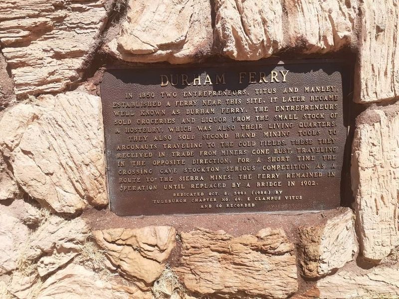
Durham Ferry
In 1859 two entrepreneurs, Titus and Manley, established a ferry near this site. It later became well known as Durham Ferry. The entrepreneurs sold groceries and liquor from the small stock of a hostelry, which was also their living quarters. They also sold second-hand mining tools to argonauts traveling to the gold fields. These they received in trade from miners gone bust, travelling in the opposite direction. For a short time the crossing gave Stockton serious competition as a route to the Sierra Mines. The ferry remained in operation until replaced by a bridge in 1902.
Erected 1988 by Tuleburgh Chapter No. 69, E Clampus Vitus.
Topics and series. This historical marker is listed in these topic lists: Industry & Commerce • Waterways & Vessels. In addition, it is included in the E Clampus Vitus series list. A significant historical year for this entry is 1859.
Location. 37° 40.729′ N, 121° 15.634′ W. Marker is in Manteca, California, in San Joaquin County. Marker is on South Airport Way west of Two Rivers Road, on the right when traveling west. Touch for map. Marker is at or near this postal address: 30261 S Airport Way, Manteca CA 95337, United States of America. Touch for directions.
Other nearby markers. At least 8 other markers are within 9 miles of this marker, measured as the crow flies. Site of San Joaquin City (approx. 0.7 miles away); Estanislao's Stronghold (approx. 4.3 miles away); The Comet – 1846 – First Sail Launch (approx. 7.9 miles away); Banta Inn (approx. 8 miles away); Ripon Memorial Library (approx. 8.4 miles away); New Hope – 1846 (approx. 8.4 miles away); 75MM Howitzer (approx. 8.4 miles away); Historic Ripon Jail (approx. 8.4 miles away).
More about this marker. The marker is on the left after entering the Manteca Sportmans' Club.
Credits. This page was last revised on April 17, 2023. It was originally submitted on April 11, 2023, by Brock Wiley of Modesto, California. This page has been viewed 213 times since then and 81 times this year. Photo 1. submitted on April 11, 2023, by Brock Wiley of Modesto, California. • J. Makali Bruton was the editor who published this page.
