
Groveland Township in Creve Coeur in Tazewell County, Illinois — The American Midwest (Great Lakes)
Fort Crevecœur

Photographed by Duane and Tracy Marsteller, April 8, 2023
1. Fort Crevecœur Marker, Side One
1680
upon this spot stood
Fort Crevecœur
built from the plans of
Robert Cavelier Sieur de La Salle
Here was centered the hope of
Louis XIV
for a broader empire of the French
on American soil
From here in 1680 went forth
La Salle on his heroic march
of fifteen hundred miles
to Fort Frontenac
and in 1602 also from here
to the great task of the
exploration of the
Mississippi River
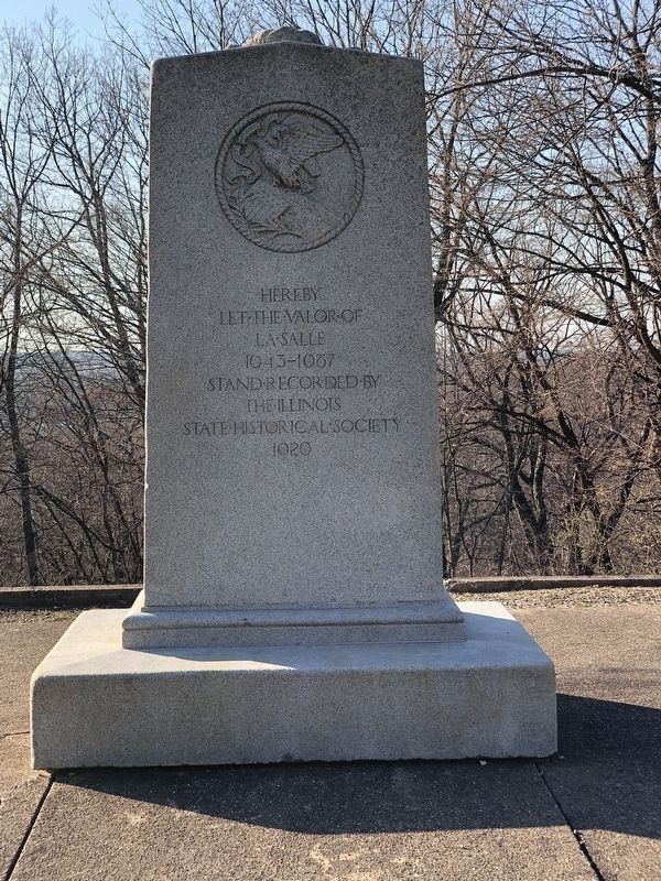
Hereby
let the valor of
La Salle
1643-1687
stand recorded by
the Illinois
State Historical Society
1920
Erected 1920 by Illinois State Historical Society.
Topics. This historical marker is listed in these topic lists: Exploration • Forts and Castles. A significant historical year for this entry is 1680.
Location. 40° 38.88′ N, 89° 36.308′ W. Marker is in Creve Coeur, Illinois, in Tazewell County. It is in Groveland Township. It can be reached from Park Road west of Poplar Street. Monument is an approximately 250-foot downhill walk from the western end of Park Road. It is not wheelchair accessible. Touch for map. Marker is at or near this postal address: 313 Park Rd, Creve Coeur IL 61610, United States of America.
this page online

Regionally, this marker is in the Illinois River Valley and in Greater Peoria. It is also in the American Midwest and in the Corn Belt. Globally, it is in North America, the Western Hemisphere, the Western World, and the Anglosphere. Historically, it finds itself in what was once the territory of the Mississippian Culture and also the Northwest Territory.
Other nearby markers. At least 8 other markers are within 3 miles of this marker, measured as the crow flies: Nance Legins-Costley (approx. 1.8 miles away); Moffatt Cemetery Veterans Memorial (approx. 1.8 miles away); Peoria's Moffatt Cemetery (approx. 1.8 miles away); Railroads (approx. 2.7 miles away); Steamboats (approx. 2.7 miles away); Bridges (approx. 2.7 miles away); CILCO-Wallace Station (approx. 2.7 miles away); Peoria Skyline (approx. 2.7 miles away).
Also see . . . Fort Crevecoeur. Wikipedia entry on the short-lived and ill-fated fortification called "Broken Heart," whose exact location has recently come into dispute. (Submitted on April 12, 2023, by Duane and Tracy Marsteller of Murfreesboro, Tennessee.)
Photographed by Duane and Tracy Marsteller, April 8, 2023
2. Fort Crevecœur Marker, Side Two

Photographed by Duane and Tracy Marsteller, April 8, 2023
3. Fort Crevecœur Marker

History of the Illinois River Valley, John Conger & William Hull via Internet Archive (Public Domain), circa 1932
4. Rendition of Fort Crevecœur
Credits. This page was last revised on April 12, 2023. It was originally submitted on April 12, 2023, by Duane and Tracy Marsteller of Murfreesboro, Tennessee. This page has been viewed 278 times since then and 30 times this year. Photos: 1, 2, 3, 4. submitted on April 12, 2023, by Duane and Tracy Marsteller of Murfreesboro, Tennessee.
