Newport in Perry County, Pennsylvania — The American Northeast (Mid-Atlantic)
Floods!
Newport's Location — a Blessing and a Bane
— Perry County Bicentennial 1820-2020 —
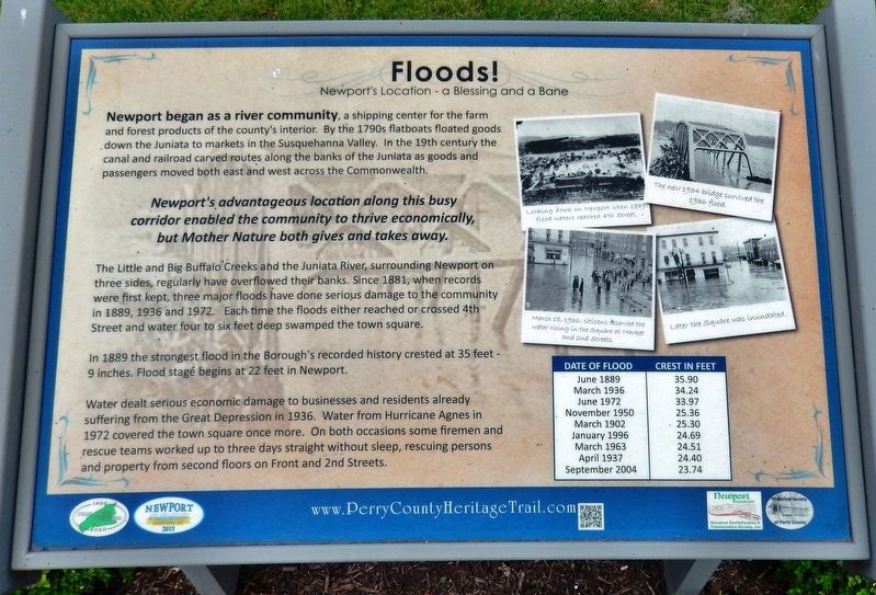
Newport began as a river community, a shipping center for the farm and forest products of the county's interior. By the 1790s flatboats floated goods down the Juniata to markets in the Susquehanna Valley. In the 19th century the canal and railroad carved routes along the banks of the Juniata as goods and passengers moved both east and west across the Commonwealth.
corridor enabled the community to thrive economically,
but Mother Nature both gives and takes away.
The Little and Big Buffalo Creeks and the Juniata River, surrounding Newport on three sides, regularly have overflowed their banks. Since 1881, when records were first kept, three major floods have done serious damage to the community in 1889, 1936 and 1972. Each time the floods either reached or crossed 4th Street and water four to six feet deep swamped the town square.
In 1889 the strongest flood in the Borough's recorded history crested at 35 feet 9 inches. Flood stage begins at 22 feet in Newport.
Water dealt serious economic damage to businesses and residents already suffering from the Great Depression in 1936. Water from Hurricane Agnes in 1972 covered the town square once more. On both occasions some firemen and rescue teams worked up to three days straight without sleep, rescuing persons and property from second floors on Front and 2nd Streets.
Date of Flood / Crest in Feet
June 1889 / 35.90
March 1936 /34.24
June 1972 / 33.97
November 1950 / 25.36
March 1902 / 25.30
January 1996 / 24.69
March 1963 / 24.51
April 1937 / 24.40
September 2004 / 23.74
Erected 2015 by Historical Society of Perry County.
Topics and series. This historical marker is listed in these topic lists: Disasters • Industry & Commerce • Waterways & Vessels. In addition, it is included in the Perry County Heritage Trail in Pennsylvania. series list. A significant historical date for this entry is March 18, 1936.
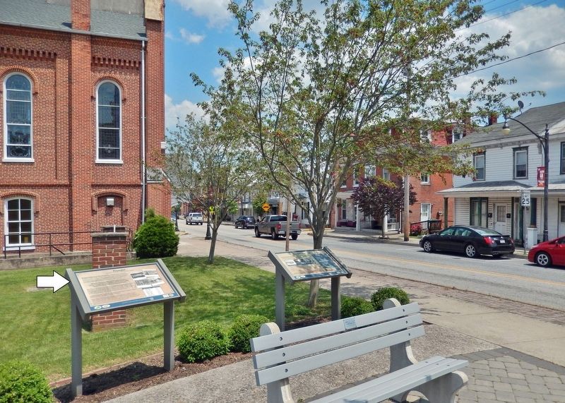
Location. 40° 28.608′ N, 77° 7.956′ W. Marker is in Newport, Pennsylvania, in Perry County. Marker is at the intersection of Market Street (Pennsylvania Route 34) and 4th Street (Pennsylvania Route 849) on Market Street. Marker is located in Newport Heritage Park at the northeast corner of the intersection. Touch for map. Marker is in this post office area: Newport PA 17074, United States of America. Touch for directions.
Other nearby markers. At least 8 other markers are within walking distance of this marker. Newport's Heritage (here, next to this marker); The Industrial and Manufacturing Era (here, next to this marker); Newport Heritage Park (here, next to this marker); St. Paul’s Lutheran Church
(here, next to this marker); The Railroad Era (a few steps from this marker); The Canal Era (a few steps from this marker); Newport Historic District (a few steps from this marker); The Settlement of Newport (a few steps from this marker). Touch for a list and map of all markers in Newport.
Related markers. Click here for a list of markers that are related to this marker. Newport Heritage Park
Also see . . .
1. Our Rich History: The floods of 1883 and 1884 in Newport.
A dreadful flood occurred in 1883 when the Ohio River reached 66.3 feet on Feb. 15, and many residents hoped that it would be only a once-in-a-lifetime event. Unfortunately, those beliefs were mistaken, and a much worse disaster was looming on the horizon. On February 5, 1884, the most disastrous flood in the Ohio Valley up to that point began and lasted for 12 days. Already by Feb. 7, 1,000 buildings in Newport were underwater, including 25 groceries and saloons, 2 rolling mills, a sawmill, and 2 foundries. Not only were many people homeless, but over 1,000 lost work when the manufacturing companies were forced to stop production (“Newport, Kentucky: One Thousand Homes Underwater,” Cincinnati Enquirer, Feb. 7, 1884).(Submitted on April 13, 2023, by Cosmos Mariner of Cape Canaveral, Florida.)
2. Newport Remembers: The Flood of 1972 (professional quality Youtube video).
Residents and students tell the story of Newport during the flooding from Hurricane Agnes. Created by the Newport School District with funding from the Pennsylvania Historical and Museum Commission, 1997.(Submitted on April 13, 2023, by Cosmos Mariner of Cape Canaveral, Florida.)
Credits. This page was last revised on February 25, 2024. It was originally submitted on April 13, 2023, by Cosmos Mariner of Cape Canaveral, Florida. This page has been viewed 141 times since then and 44 times this year. Photos: 1, 2. submitted on April 13, 2023, by Cosmos Mariner of Cape Canaveral, Florida.

