
McLean in Tompkins County, New York — The American Northeast (Mid-Atlantic)
Old Baptist Church - 1828
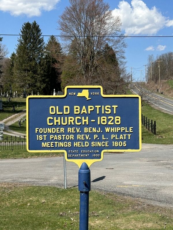
Photographed by Susan A. Dalaba, April 12, 2023
1. Old Baptist Church - 1828 Marker
1st Pastor Rev. P.L. Platt
Meetings held since 1805
Erected 1932 by State Education Department 1932.
Topics. This historical marker is listed in this topic list: Religion & Religious Structures. A significant historical year for this entry is 1805.
Location. 42° 33.363′ N, 76° 17.55′ W. Marker is in McLean, New York, in Tompkins County. It is at the intersection of Church Street and Cemetery Lane, on the left when traveling north on Church Street. Located in front of McLean Community Church. Touch for map. Marker is at or near this postal address: 50 Church Street, Mc Lean NY 13102, United States of America. Touch for directions.

Regionally, this marker is in Upstate New York and in the Southern Tier. It is also in the American Northeast and in the Mid-Atlantic. Globally, it is in North America, the Western Hemisphere, the Western World, and the Anglosphere. Historically, it finds itself in what was once the Haudenosaunee (Iroquois) Confederacy, New Netherland, and one of the original Thirteen Colonies.
Other nearby markers. At least 8 other markers are within 4 miles of this
this page online
Credits. This page was last revised on April 20, 2023. It was originally submitted on April 13, 2023, by Susan A. Dalaba of Cortland, New York. This page has been viewed 218 times since then and 24 times this year. Photo 1. submitted on April 13, 2023, by Susan A. Dalaba of Cortland, New York. • Michael Herrick was the editor who published this page.
