
Plano in Collin County, Texas — The American South (West South Central)
First Methodist Church of Plano
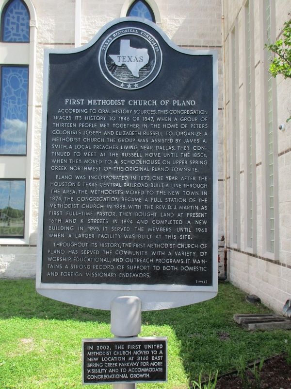
Photographed by Jeff Leichsenring, April 11, 2023
1. First Methodist Church of Plano Marker
Plano was incorporated in 1873, one year after the Houston & Texas Central Railroad built a line through the area. The Methodists moved to the new town in 1874. The congregation became a full station of the Methodist Church in 1888, with the Rev. D.J. Martin as first full-time pastor. They bought land at present 16th and K Streets in 1894 and completed a new building in 1895. It served the members until 1968 when a larger facility was built at this site.
Throughout its history, the First Methodist Church of Plano has served the community with a variety of worship, educational, and outreach programs. It maintains a strong record of support to both domestic
this page online
Additional tablet
In 2002 the First United Methodist Church moved to a new location at 3160 East Spring Creek Parkway for more visibility and congregational growth.
Erected 1992 by Texas Historical Commission. (Marker Number 6152.)
Topics. This historical marker is listed in this topic list: Religion & Religious Structures.
Location. 33° 2.723′ N, 96° 40.202′ W. Marker is in Plano, Texas, in Collin County. It is on East Spring Creek Parkway 0.1 miles north of East Parker Road, on the left when traveling north. Touch for map. Marker is at or near this postal address: 3160 East Spring Creek Parkway, Plano TX 75074, United States of America. Touch for directions.

Regionally, this marker is in the Prairies & Lakes Region and in the Dallas-Fort Worth Metropolitan Area. Globally, it is in North America, a Gulf of Mexico state, the Western Hemisphere, the Western World, and the Anglosphere. Historically, it finds itself in what was once New Spain, the Republic of Texas, one of the Confederate States of America, and the Antebellum South.
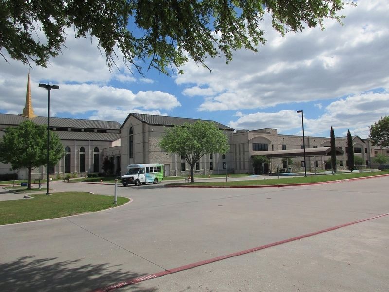
Photographed by Jeff Leichsenring, April 11, 2023
2. First Methodist Church of Plano and Marker
Other nearby markers. At least 8 other markers are within 3 miles of this marker, measured as the crow flies: The Muncey Massacre (approx. half a mile away); a different marker also named The Muncey Massacre (approx. 1.7 miles away); Plano Mutual Cemetery (approx. 1.7 miles away); First Presbyterian Church of Plano (approx. 1.8 miles away); Aldridge House (approx. 2½ miles away); Mathews General Store (approx. 2½ miles away); Saigling House (approx. 2½ miles away); Plano National Bank / I.O.O.F. Lodge Building (approx. 2½ miles away). Touch for a list and map of all markers in Plano.
Credits. This page was last revised on May 4, 2024. It was originally submitted on April 13, 2023, by Jeff Leichsenring of Garland, Texas. This page has been viewed 437 times since then and 46 times this year. Photos: 1, 2. submitted on April 13, 2023, by Jeff Leichsenring of Garland, Texas. • James Hulse was the editor who published this page.
