Broadway - Assiniboine in Winnipeg, Manitoba — Canada’s Prairie Region (North America)
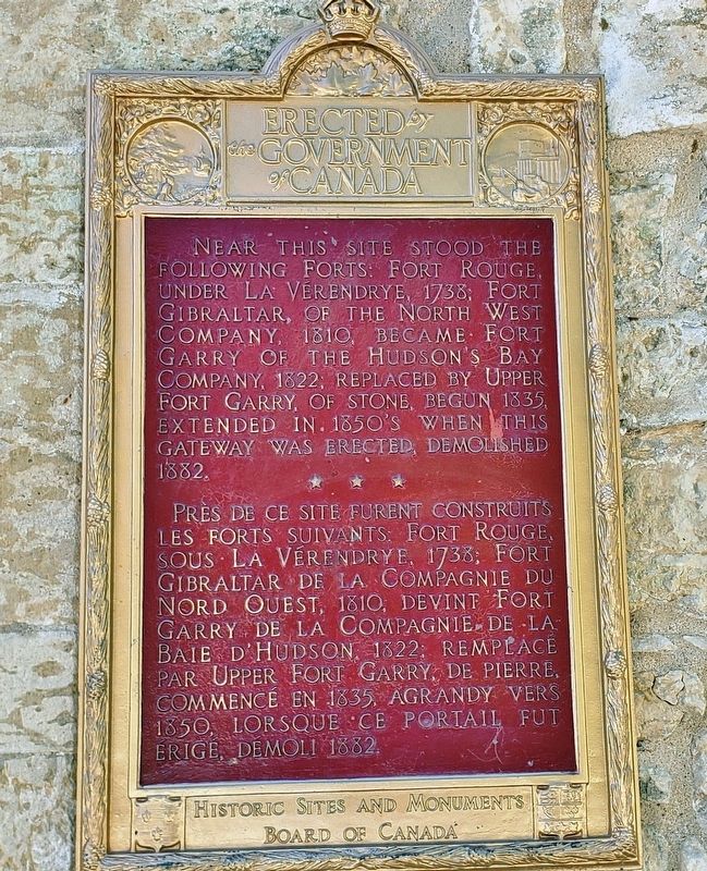
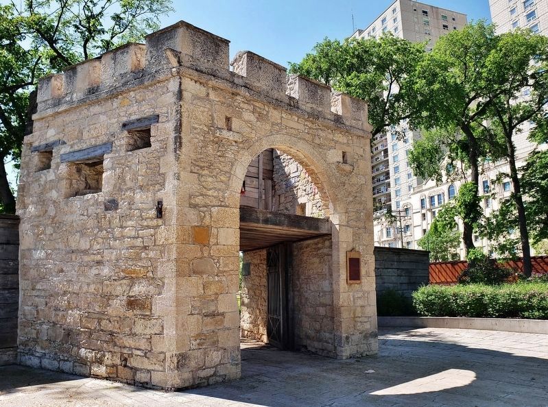
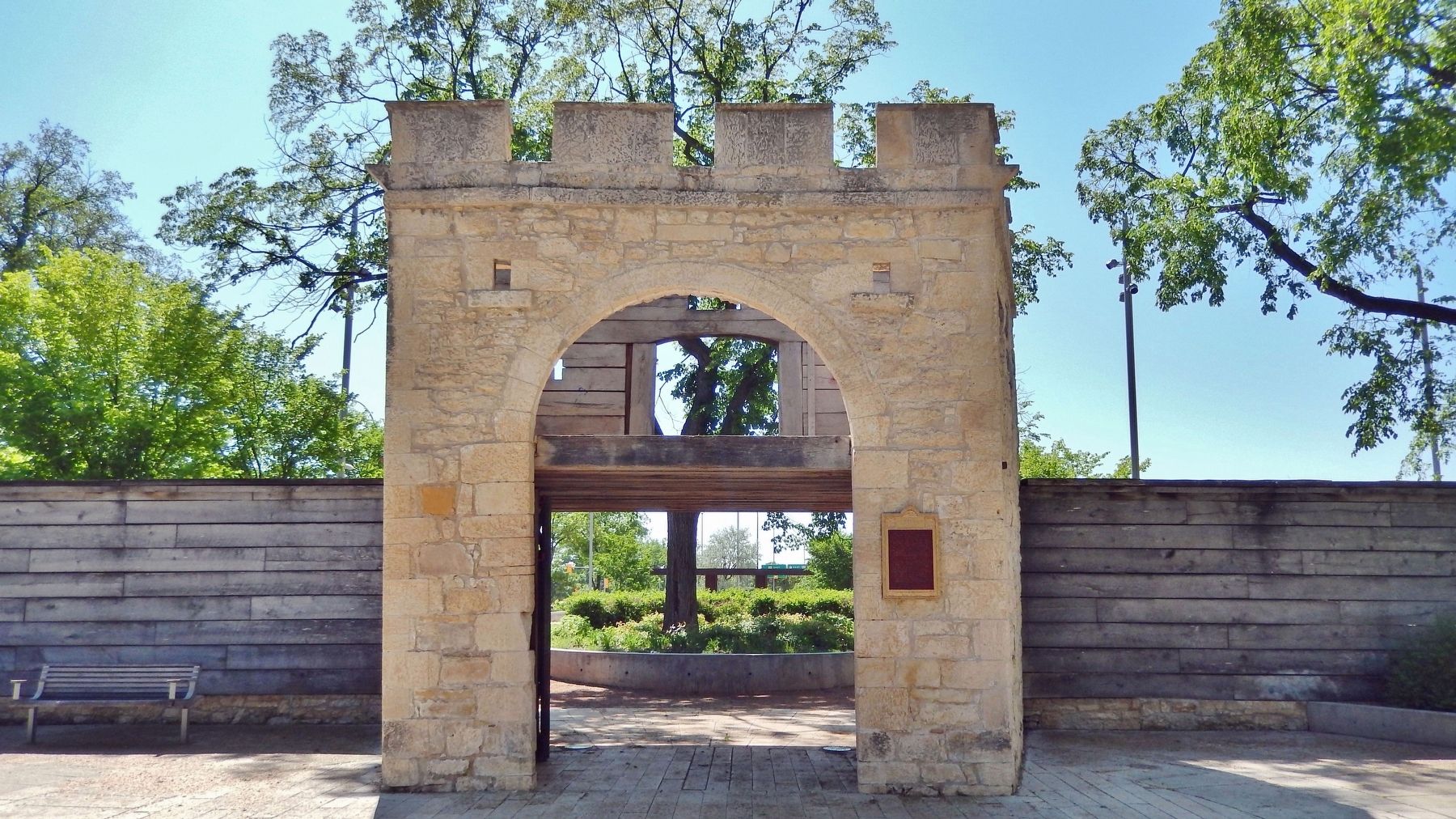
Upper Fort Garry Gateway / Porte d'entrée d'Upper Fort Garry
Erected by Historic Sites and Monuments Board of Canada.
Topics and series. This historical marker is listed in these topic lists: Colonial Era • Forts and Castles. In addition, it is included in the Canada, Historic Sites and Monuments Board series list. A significant historical year for this entry is 1835.
Location. 49° 53.277′ N, 97° 8.124′ W. Marker is in Winnipeg , Manitoba. It is in Broadway - Assiniboine. Marker can be reached from Main Street (Trans-Canada Highway) (Provincial Highway 1) just south of Broadway, on the right when traveling south. Gateway and marker are located along the walkway at the north end of Upper Fort Garry Heritage Provincial Park. Touch for map. Marker is at or near this postal address: 130 Main Street, Winnipeg MB R3C 1A4, Canada. Touch for directions.
Other nearby markers. At least 8 other markers are within walking distance of this marker. Ambroise-Didyme Lépine (a few steps from this marker); Fort Garry — Fort Edmonton Trail (within shouting distance of this marker); The Fort Garry (about 90 meters away, measured in a direct line); The Fort Garry Hotel / L'hôtel Fort Garry (about 90 meters away); Bonnycastle Park (about 240 meters away); Pierre Gaultier de La Vérendrye (approx. 0.2 kilometers away); Dr. Amelia Yeomans / Le Docteur Amelia Yeomans (approx. 0.4 kilometers away); Canadian Northern Railway Freight Lift Bridge, East Yard (approx. half a kilometer away). Touch for a list and map of all markers in Winnipeg.
Regarding Upper Fort Garry Gateway / Porte d'entrée d'Upper Fort Garry. Canadian Register of Historic Places (1991/06/13).
Also see . . .
1. Fort Rouge.
Fort Rouge was a fort located on the Assiniboine River in Manitoba, Canada, on the site of what is now the city of Winnipeg. Its exact location is unknown.(Submitted on April 15, 2023, by Cosmos Mariner of Cape Canaveral, Florida.)
2. Fort Gibraltar.
Fort Gibraltar was founded in 1809 by Alexander Macdonell of Greenfield of the North West Company in present-day Manitoba, Canada. It was located at the confluence of the Red and Assiniboine rivers in or near the area now known as The Forks in the city of Winnipeg.(Submitted on April 15, 2023, by Cosmos Mariner of Cape Canaveral, Florida.)
3. Fort Garry / Upper Fort Garry.
Fort Garry, also known as Upper Fort Garry, was a Hudson's Bay Company trading post at the confluence of the Red and Assiniboine rivers in what is now downtown Winnipeg. Fort Garry was established in 1822, although its first iteration was destroyed in 1826 by severe flooding. The trading post was rebuilt in 1836. The fort was demolished in the 1880s to make way for Winnipeg's Main Street, although the fort's gate remains.(Submitted on April 15, 2023, by Cosmos Mariner of Cape Canaveral, Florida.)
4. Upper Fort Garry Gate.
Upper Fort Garry Gate, also called the Governor's Gate, is a multi-level shell structure, built of limestone and wood in 1853, with a reconstructed wooden section recalling the placement of the original fort walls. Within its walls were the facilities and personnel that supported the Hudson Bay Company’s vast inland fur trade and the work of the territorial government. The stone and wood gate is vernacular in style with hints of Norman and Italian Renaissance influences in its battlements, large archway and detailing. Designed by HBC employee Alexander Hunter Murray, the gate displays the grandiosity and dignity that befitted its occasional ceremonial role and distinguished it from the fort's other entrances and bastions.(Submitted on April 15, 2023, by Cosmos Mariner of Cape Canaveral, Florida.)
Credits. This page was last revised on April 15, 2023. It was originally submitted on April 15, 2023, by Cosmos Mariner of Cape Canaveral, Florida. This page has been viewed 73 times since then and 12 times this year. Photos: 1, 2, 3. submitted on April 15, 2023, by Cosmos Mariner of Cape Canaveral, Florida.


