Niagara Falls in Niagara County, New York — The American Northeast (Mid-Atlantic)
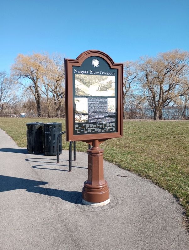
Niagara River Overlook
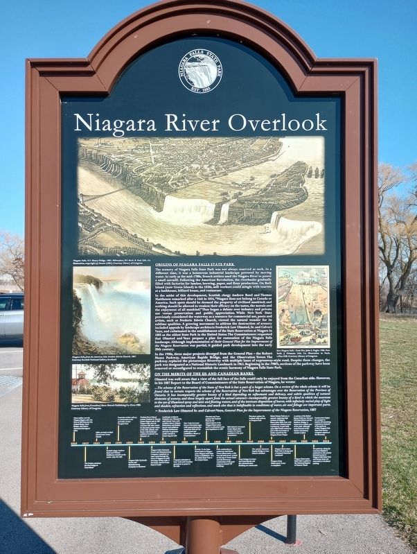
Origins Of Niagara Falls State Park
The scenery of Niagara Falls State Park was not always reserved as such. In a different time, it was a boisterous industrial landscape powered by moving water. As early as the mid-1700s, French settlers used the Niagara River to power a small sawmill. Following the American Revolution, the riverbanks gradually filled with factories for lumber, brewing, paper, and flour production. On Bath Island (now Green Island) in the 1820s, mill workers could mingle with tourists at a bathhouse, billiard house, and restaurant.
In the midst of this development, Scottish clergy Andrew Reed and Thomas Mattheson remarked after a visit in 1834, "Niagara does not belong to Canada or America. Such spots should be deemed the property of civilized mankind; and nothing should be allowed to weaken their efficacy on the tastes, the morals and the enjoyment of all mankind." Thus began a debate over industry and private use versus preservation and public appreciation. While New York State previously considered the waterway as a resource for commercial use, poets and artists, such as Frederic Edwin Church, viewed the natural wonder for its sublime qualities. A growing movement to address the destruction of scenery included appeals by landscape architects Frederick Law Olmsted, Sr. and Calvert Vaux, and culminated in the establishment of the State Reservation at Niagara in 1885 as the oldest State Park in the United States. The Commissioners requested that Olmsted and Vaux prepare a plan for restoration of the Niagara Falls landscape. Although implementation of their General Plan for the Improvement of the Niagara Reservation was partial, it guided park development into the early 20th century.
In the 1950s, three major projects diverged from the General Plan - the Robert Moses Parkway, American Rapids Bridge, and the Observation Tower. The parkway replaced the picturesque Riverway with multiple lanes of expressway-style road. Despite these changes, the park was designated as a National Historic Landmark in 1963. Beginning in the 1980's, sections of the parkway have been removed or reconfigured to reestablish the scenic harmony of Niagara Falls State Park.
On The Merits Of The US And Canadian Banks
Olmsted was well aware that a view of the full face of the Falls could only be enjoyed from the Canadian side. However, in his 1887 Report to the Board of Commissioners of the State Reservation of Niagara, he wrote:On The Merits Of The Us And Canadian Banks ...The scheme of the Reservation of the State of New York is but a part of a larger scheme. On a review of the whole scheme it will be found that in certain respects the scheme of the Reservation of New York has advantages over the Reservation of the Province of Ontario. It has incomparably greater beauty of a kind depending on refinement and delicacy, and subtle qualities of natural elements of scenery, and these largely apart from the actual cataract--incomparably greater beauty of a kind in which the nearness to the eye of illumined spray and mist and fleeting waters, and of the intricate disposition of leaves, with infinitely varied play of light and shadow, refraction and reflections, and much else that is indefinable in conditions of water, air and foliage are important parts.On The Merits Of The Us And Canadian Banks ~Frederick Law Olmsted Sr. and Calvert Vaux, General Plan for the Improvement of the Niagara Reservation, 1887
Topics. This historical marker is listed in this topic list: Waterways & Vessels. A significant historical year for this entry is 1834.
Location. 43° 4.787′ N, 79° 2.884′ W. Marker is in Niagara Falls, New York, in Niagara County. Marker is on Niagara River Scenic Pkwy east of River Way, on the right when traveling east. Touch for map. Marker is in this post office area: Niagara Falls NY 14303, United States of America. Touch for directions.
Other nearby markers. At least 8 other markers are within walking distance of this marker. Old Stone Chimney (about 800 feet away, measured in a direct line); The Niagara River Portage and the Old Stone Chimney (approx. 0.2 miles away); Portage Road (approx. 0.4 miles away); Holy Trinity Roman Catholic Church Complex (approx. half a mile away); Whitney Mansion (approx. half a mile away); Historic Falls Portage (approx. 0.6 miles away); Thomas V. Welch (approx. 0.6 miles away); The Parting of the Waters (approx. 0.6 miles away). Touch for a list and map of all markers in Niagara Falls.
Credits. This page was last revised on April 22, 2023. It was originally submitted on April 19, 2023, by Craig Doda of Napoleon, Ohio. This page has been viewed 45 times since then and 10 times this year. Photos: 1, 2, 3, 4. submitted on April 19, 2023, by Craig Doda of Napoleon, Ohio. • Michael Herrick was the editor who published this page.


