Plymouth Bay Cultural District in Plymouth County, Massachusetts — The American Northeast (New England)
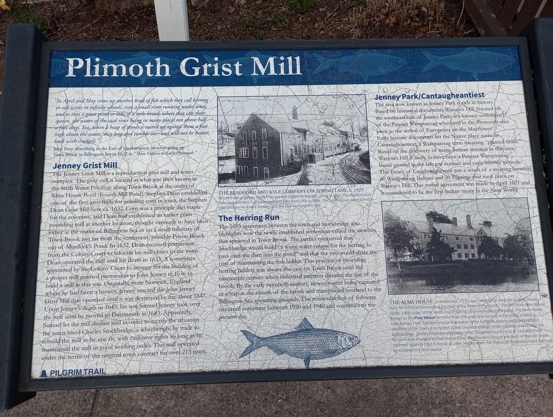
Plimoth Grist Mill
"In April and May come up another kind of fish which they call herring or old wives in infinite schools, into a small river running under town, and so into a great pond or lake of a mile broad, where they cast their spawn, the water of the said river being in many places not above half a foot deep. Yea, when a heap of stones is reared up against them a foot high above the water they leap and tumble over and will not be beaten back with crudgels."
John Pory, describing to the Earl of Southampton, alewives going up Town Brook to Billington Sea in 1622 in "Three Visitors to Early Plymouth."
Jenney Grist Mill
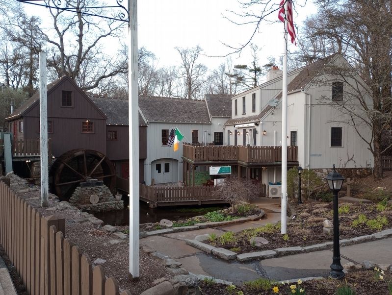
The Jenney Grist Mill is a reproduction grist mill and water complex. The grist mill is located at what was then known as the Sixth Water Privilege along Town Brook at the outlet of Alms House Pond (Fourth Mill Pond). Stephen Dean established one of the first grist mills for grinding corn in town, the Stephen Dean Grist Mill here ca. 1632. Corn was a principle diet staple for the colonists, and Dean had established an earlier grain pounding mill at another location, thought variously to have been either at the outlet of Billington-Sea or on a small tributary of Town Brook not far from the settlement, possibly Prison Brook out of Murdock's Pond. In 1632, Dean received permission from the Colony Court to relocate his mill closer to the town. Dean operated the mill until his death in 1633. A committee appointed by the Colony Court to arrange for the building of a proper mill granted permission to John Jenney in 1636 to build a mill at this site. Originally, from Norwich, England where he had been a brewer, Jenney erected the John Jenney Grist Mill that operated until it was destroyed by fire about 1847. Upon Jenney's death in 1643, his son Samuel Jenney took over the mill until he moved to Dartmouth in 1683.-Apparently, Samuel let the mill decline and in order to rectify the situation the town hired Charles Stockbridge, a wheelwright by trade to rebuild the mill as he saw fit, with exclusive rights so long as he maintained the mill in good working order. This mill operated under the terms of the original town contract for over 213 years.
The Bradford And Kyle Company On Spring Lane, c. 1925 This Mill was originally a tack manufactory begins by Samuel Loring in 1863. The Bradford and Kyle insulated Wire Company operated here from 1905 to 1966. The building was demolished in 1968 and the recreated Jenney Grist Mill now occupies the site.
The Herring Run
The 1683 agreement between the town and Stockbridge also highlights how the newly established settlement valued the alewives. that spawned in Town Brook. The parties concurred that Stockbridge would build "a waste water course for the herring to pass over the dam into the pond and that the two would share the cost of maintaining the fish ladder. This practice of providing herring ladders was always the case on Town Brook until the nineteenth century when industrial interests dictated the use of the brook By the early twentieth century, alewives were being captured in a trap at the mouth of the brook and transported overland to the Billington Sea spawning grounds. The reintroduction of fishways Occurred sometime between 1920 and 1940 and continues to the present day.
Jenney Park/Cantaugheantiest
The area now known as Jenney Park is rich in history. Based on historical documents Watson's Hill (located on the southeast side of Jenney Park) is a known settlement of the Patuxet Wampanoag who lived in the Plymouth area prior to the arrival of Europeans on the Mayflower. Early historic documents list the Native place name as Cantaugheantiest, a Wampanoag term meaning "planted fields. Based on the discovery of many human remains in this area, Watson's Hill is likely to have been a Patuxet Wampanoag burial ground in the late pre-contact and early historic periods. The Treaty of Caughtaughcanta was a result of a meeting between 60 Wampanoag Indians and 30 Pilgrims that took place on Watson's Hill. This verbal agreement was made in April 1621 and is considered to be the first Indian treaty in the New World.
The Alms House In November 1727 it was "Voted that there be an Alms House built for the Entertainment of the Poor of the Town of Plymouth." The first brick Alms House) (1826-1969) stood at the south end of Spring Lane overlooking the pond. The Alms House, known as the Poor House for more than 150 years was located in the midst of what is now Jenney Park. The Alms House was home to the indigent, elderly and handicapped residents of the Town. It consisted of two connected large, brick buildings and at least five outbuildings. Jenney Pond was originally called Slaughterhouse Pond or Corn Mill Pond. Its name was changed to Poor House Pond after the Alms House was built on the site. It was renamed again in 1967 in honor of John Jenney when the Plymouth Redevelopment Authority demolished the Alms House.
Topics. This historical marker is listed in these topic lists: Colonial Era • Industry & Commerce. A significant historical month for this entry is November 1727.
Location. 41° 57.201′ N, 70° 39.914′ W. Marker is in Plymouth, Massachusetts, in Plymouth County. It is in the Plymouth Bay Cultural District. Marker is at the intersection of Summer Street and Spring Lane, on the left when traveling west on Summer Street. Touch for map. Marker is at or near this postal address: 6 Spring Lane, Plymouth MA 02360, United States of America. Touch for directions.
Other nearby markers. At least 8 other markers are within walking distance of this marker. Granite Remnant of the First Canopy Over Plymouth Rock (within shouting distance of this marker); Robert Cushman (about 700 feet away, measured in a direct line); Tercentenary Cannons (about 700 feet away); First Fort (about 700 feet away); The Town House of Plymouth (approx. 0.2 miles away); The Church of Scrooby Leyden and the Mayflower (approx. 0.2 miles away); Burial Hill (approx. 0.2 miles away); Alexander Scammell (approx. 0.2 miles away). Touch for a list and map of all markers in Plymouth.
Also see . . . Plimoth Grist Mill - Plimoth Patuxet Museums. (Submitted on April 23, 2023, by Michael Herrick of Southbury, Connecticut.)
Credits. This page was last revised on April 23, 2023. It was originally submitted on April 19, 2023, by Craig Doda of Napoleon, Ohio. This page has been viewed 87 times since then and 35 times this year. Photos: 1, 2. submitted on April 19, 2023, by Craig Doda of Napoleon, Ohio. • Michael Herrick was the editor who published this page.
Editor’s want-list for this marker. A wide view photo of the marker and its surroundings. • Can you help?

