Stewartsville in Franklin Township in Warren County, New Jersey — The American Northeast (Mid-Atlantic)
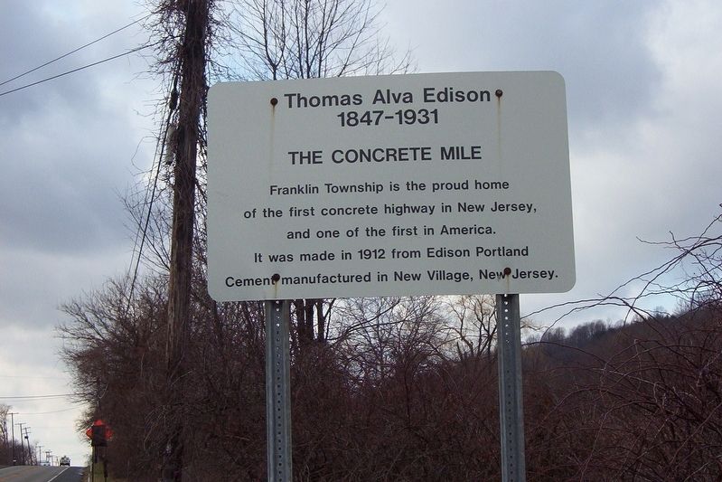
The Concrete Mile
Thomas Alva Edison
— 1847 - 1931 —
Erected by Franklin Township, New Jersey.
Topics. This historical marker is listed in these topic lists: Industry & Commerce • Roads & Vehicles. A significant historical year for this entry is 1912.
Location. This marker has been replaced by another marker nearby. It was located near 40° 42.638′ N, 75° 5.987′ W. Marker was in Franklin Township, New Jersey, in Warren County. It was in Stewartsville. Marker was on New Jersey Route 57, on the right when traveling east. Touch for map. Marker was at or near this postal address: 2666 NJ-57, Stewartsville NJ 08886, United States of America. Touch for directions.
Other nearby markers. At least 8 other markers are within 4 miles of this location, measured as the crow flies. A different marker also named The Concrete Mile (here, next to this marker); Morris Canal Bread Lock No 7 West (approx. 0.4 miles away); Edison Portland Cement Company (approx. half a mile away); Honor Roll (approx. 1.3 miles away); Inclined Plane / Morris Canal Inclined Plane No 9 West (approx. 2.4 miles away); Greenwich Township Veterans Monument (approx. 3.3 miles away); Old Greenwich Cemetery (approx. 3.3 miles away); General William Maxwell (approx. 3.3 miles away).
Related marker. Click here for another marker that is related to this marker. This marker has been replaced multiple times. The linked marker is the most recent available version.
Credits. This page was last revised on April 20, 2023. It was originally submitted on April 20, 2023, by John Ben Urban of Middletown, Delaware. This page has been viewed 121 times since then and 32 times this year. Photo 1. submitted on July 26, 2010, by John Ben Urban of Middletown, Delaware. • Devry Becker Jones was the editor who published this page.
