Godfrey in Madison County, Illinois — The American Midwest (Great Lakes)
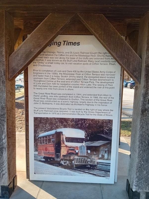
Changing Times
Prior to completion of Lock and Dam #26 by the United States Army Corps of Engineers in the 1930s, the Mississippi River at Clifton Terrace was narrower and faster than it is today. Scotch Jimmy Island, the elongated island located upstream from Clifton Terrace, extended past Clifton Terrace downstream to Youngblood Hollow at the east end of Clifton Terrace Park. The development of Lock and Dam #26 for navigation created Alton Lake. The raising of Pool #26 inundated the lower portion of the island and widened the river at this point to nearly one mile from shore to shore.
The Great River Road was completed in 1944, and extended from Alton to Riehl Landing, one mile upstream from Clifton Terrace. In 1966, the rest of the Great River Road was completed to Grafton. This section of the Great River Road was constructed as a scenic highway, largely due to the inspiration of John D. McAdams. It was dedicated as McAdams Highway in his honor.
The present Vadalabene Bicycle Trail is located on the right-of-way where the Bluff Line Railroad once operated. It was built by the Illinois Department of Transportation in 1976 as a Demonstration Bicycle Trail for the State of Illinois.
Topics. This historical marker is listed in these topic lists: Railroads & Streetcars • Roads & Vehicles. A significant historical year for this entry is 1888.
Location. 38° 55.701′ N, 90° 15.222′ W. Marker is in Godfrey, Illinois, in Madison County. Marker is on Mc Adams Parkway east of Clifton Terrace Road, on the right when traveling east. Marker is located at Clifton Terrace Park. Touch for map. Marker is at or near this postal address: 3216 Mc Adams Pkwy, Godfrey IL 62035, United States of America. Touch for directions.
Other nearby markers. At least 8 other markers are within 4 miles of this marker, measured as the crow flies. La Vista Park (here, next to this marker); Clifton Terrace Park (here, next to this marker); A History of Clifton Terrace (here, next to this marker); Great Rivers Park (approx. 1.7 miles away); Godfrey (approx. 1.7 miles away); North Alton Confederate Cemetery (approx. 3.2 miles away); Confederate Cemetery Monument (approx. 3.2 miles away); Plank Road (approx. 3.3 miles away). Touch for a list and map of all markers in Godfrey.
Credits. This page was last revised on April 20, 2023. It was originally submitted on April 20, 2023, by Jason Voigt of Glen Carbon, Illinois. This page has been viewed 106 times since then and 46 times this year. Photos: 1, 2. submitted on April 20, 2023, by Jason Voigt of Glen Carbon, Illinois.

