Battleford in Battle River No. 438, Saskatchewan — The Prairie Region (North America)
North West Rebellion
⎯⎯⎯
L'insurrection du Nord-Ouest
Battleford
Photographed by Cosmos Mariner, July 14, 2022
1. North West Rebellion Marker

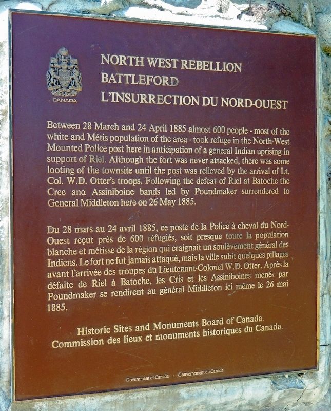
Between 28 March and 24 April 1885 almost 600 people — most of the white and Métis population of the area — took refuge in the North-West Mounted Police post here in anticipation of a general Indian uprising in support of Riel. Although the fort was never attacked, there was some looting of the townsite until the post was relieved by the arrival of Lt. Col. W.D. Otter's troops. Following the defeat of Riel at Batoche the Cree and Assiniboine bands led by Poundmaker surrendered to General Middleton here on 26 May 1885.
Erected by Historic Sites and Monuments Board of Canada/Commission des lieux et monuments historiques
this page online
Topics and series. This historical marker is listed in these topic lists: Forts and Castles • Indigenous Peoples and Communities • Settlements & Settlers. In addition, it is included in the Canada, Historic Sites and Monuments Board series list. A significant historical date for this entry is March 28, 1885.
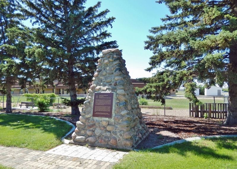
Location. 52° 44.312′ N, 108° 18.537′ W. Marker is in Battleford, Saskatchewan, in Battle River No. 438. It is on 2 Avenue West just south of 25 Street, on the right when traveling south. Marker is located in a small park at the southwest corner of the intersection. It is mounted on an 8-foot-high stone cairn. Touch for map. Marker is in this post office area: Battleford SK S0M 0E0, Canada. Touch for directions.

Regionally, this marker is in Parkland Saskatchewan. It is also in the Prairies. Globally, it is in North America, the Western Hemisphere, the Western World, and the Anglosphere. Historically, it finds itself in what was once a British colony and also Rupert’s Land.
Other nearby markers. At least 8 other markers are within 3 kilometers of this marker, measured as the crow flies: A Tribute to Frederick George Light
Photographed by Cosmos Mariner, July 14, 2022
2. North West Rebellion Marker
Also see . . . North-West Rebellion.
The North-West Rebellion was an armed resistance movement by the Métis under Louis Riel and an associated uprising by First Nations Cree and Assiniboine of the District of Saskatchewan against the Canadian government. Many Métis felt that Canada was not protecting their rights, their land, and their survival as a distinct people. Riel had been invited to lead the movement of protest; he turned it into a military action with a heavily religious tone. That alienated Catholic clergy, whites, most Indigenous tribes, and some Métis, but he had the allegiance of 200 armed Métis, and a smaller number of other Indigenous warriors.(Submitted on April 23, 2023, by Cosmos Mariner of Cape Canaveral, Florida.)
Credits. This page was last revised on October 24, 2025. It was originally submitted on April 23, 2023, by Cosmos Mariner of Cape Canaveral, Florida. This page has been viewed 309 times since then and 30 times this year. Photos: 1, 2. submitted on April 23, 2023, by Cosmos Mariner of Cape Canaveral, Florida.
