Harlingen in Cameron County, Texas — The American South (West South Central)
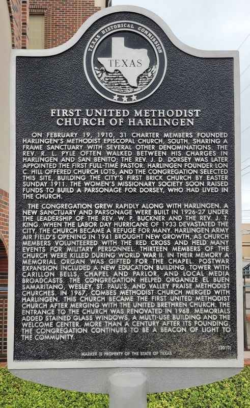
First United Methodist Church of Harlingen
Photographed by James Hulse, April 18, 2023
1. First United Methodist Church of Harlingen Marker
The congregation grew rapidly along with Harlingen. A new sanctuary and parsonage were built in 1926-27 under the leadership of the Rev. W.P. Buckner and the Rev. J.T. King. When the Labor Day Hurricane of 1933 devastated the city, the church became a refuge for many. Harlingen Army Air Field's opening in 1941 brought new growth, as church members volunteered with the Red Cross and held many events for military personnel. Thirteen members of the church were killed during World War II. In their memory a memorial organ was gifted for the chapel. Postwar expansion included a new education building, tower with Carillon Bells, chapel and parlor, and local media broadcasts. The congregation helped organize El Buen Samaritano, Wesley, St. Paul's, and Valley Praise Methodist Churches. In 1967, Combes Methodist Church merged with Harlingen. This church became the First United Methodist Church after merging with the United Brethren Church. The entrance to the church was renovated in 1968. Memorials added stained glass windows, a multi-use building and the welcome center. More than a century after its founding, the congregation continues to be a beacon of light to the community
Erected 2010 by Texas Historical Commission. (Marker Number 16445.)
Topics.
this page online
Location. 26° 11.448′ N, 97° 41.547′ W. Marker is in Harlingen, Texas, in Cameron County. It is at the intersection of East Harrison Avenue and South 4th Street, on the left when traveling east on East Harrison Avenue. The marker is located on the east side of the church. Touch for map. Marker is at or near this postal address: 321 East Harrison Avenue, Harlingen TX 78550, United States of America. Touch for directions.

Regionally, this marker is in South Texas. It is also in the American Borderlands, in the South, and on the Gulf Coast. Globally, it is in North America, a Gulf of Mexico state, the Western Hemisphere, the Western World, and the Anglosphere. Historically, it finds itself in what was once New Spain, the Republic of Texas, and one of the Confederate States of America.
Other nearby markers. At least 8 other markers are within walking distance of this marker: Original Sam Houston School (approx. 0.2 miles away); City of Harlingen (approx. 0.2 miles away); Lozano Plaza (approx.
Photographed by James Hulse, April 18, 2023
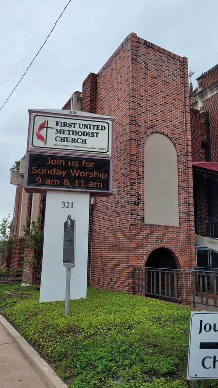
2. First United Methodist Church of Harlingen and Marker
Also see . . . Harlingen, TX. Texas State Historical Association (TSHA) (Submitted on April 25, 2023, by James Hulse of Medina, Texas.)
Photographed by James Hulse, April 18, 2023
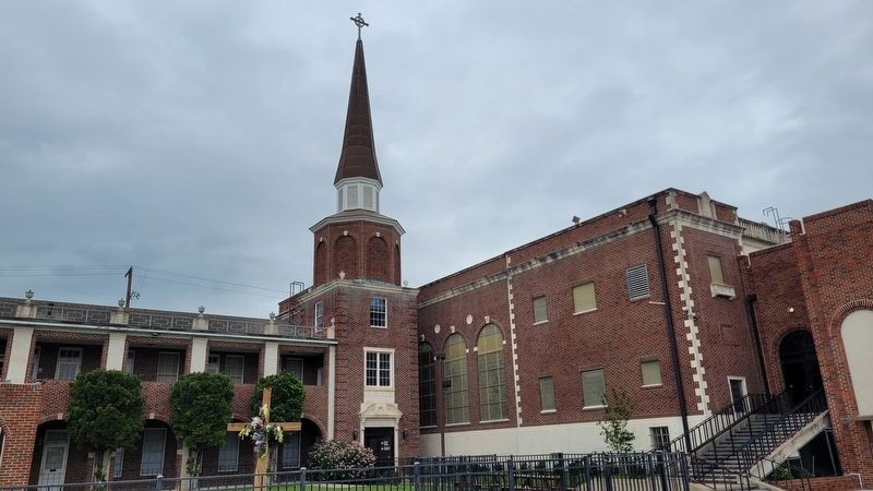
3. The First United Methodist Church of Harlingen
Credits. This page was last revised on April 25, 2023. It was originally submitted on April 25, 2023, by James Hulse of Medina, Texas. This page has been viewed 531 times since then and 80 times this year. Photos: 1, 2, 3. submitted on April 25, 2023, by James Hulse of Medina, Texas.
