Flat Iron in Westmoreland County, Virginia — The American South (Mid-Atlantic)
Popes Creek Episcopal Church
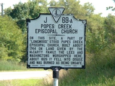
Photographed by J. J. Prats, August 30, 2009
1. Popes Creek Episcopal Church Marker
Erected 1959 by Virginia State Library. (Marker Number J-69-a.)
Topics and series. This historical marker is listed in this topic list: Religion & Religious Structures. In addition, it is included in the Virginia Department of Historic Resources (DHR) series list. A significant historical year for this entry is 1744.
Location. 38° 9.144′ N, 76° 55.367′ W. Marker is in Flat Iron, Virginia, in Westmoreland County. It is at the intersection of Kings Highway (Virginia Route 3) and Longwood Road (County Route 624), on the right when traveling east on Kings Highway. Touch for map. Marker is in this post office area: Montross VA 22520, United States of America. Touch for directions.

Regionally,
this page online
Other nearby markers. At least 8 other markers are within 3 miles of this marker, measured as the crow flies: George Washington’s Birthplace (approx. 2 miles away); Free to Fight (approx. 2.1 miles away); “O! say can you see…” (approx. 2.1 miles away); War in the Chesapeake (approx. 2.1 miles away); Explore a trail network (approx. 2.1 miles away); The First People Here (approx. 2.2 miles away); Remembering Washington
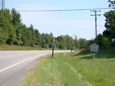
Photographed by J. J. Prats, August 30, 2009
2. Popes Creek Episcopal Church Marker
Other markers no longer nearby. George Washington Birthplace Site (was approx. 2.1 miles away but has been permanently removed); The Historic Area (was approx. 2.2 miles away but has been permanently removed).
Also see . . . History of Pope’s Creek (Virginia). Wikipedia entry. Discusses the Popes and their neighbors to the west, the Washingtons. “After moving from Maryland, Nathaniel Pope, in 1651, patented 1,050 acres in Old Northumberland between two large creeks; one would bear his name. At Mattox Creek he built dwellings, warehouses, and docks for the merchant trade with England including the port of Bristol. He shipped beaver, tobacco with caske, and raw materials; and he imported English manufactured goods. He settled the argument between John Washington and shipping partner Edward Prescott by paying off the senior officer in Beaver skins at eight shillings per pound. In 1655 he was made Lieutenant-Colonel in the militia.” (Submitted on September 3, 2009.)
Credits. This page was last revised on June 16, 2016. It was originally submitted on September 3, 2009, by J. J. Prats of Powell, Ohio. This page has been viewed 2,548 times since then and 109 times this year. Photos: 1, 2. submitted on September 3, 2009, by J. J. Prats of Powell, Ohio.
