Near Henderson in Rusk County, Texas — The American South (West South Central)
Blossom Hill United Methodist Church
Photographed by Jeff Leichsenring, April 23, 2023
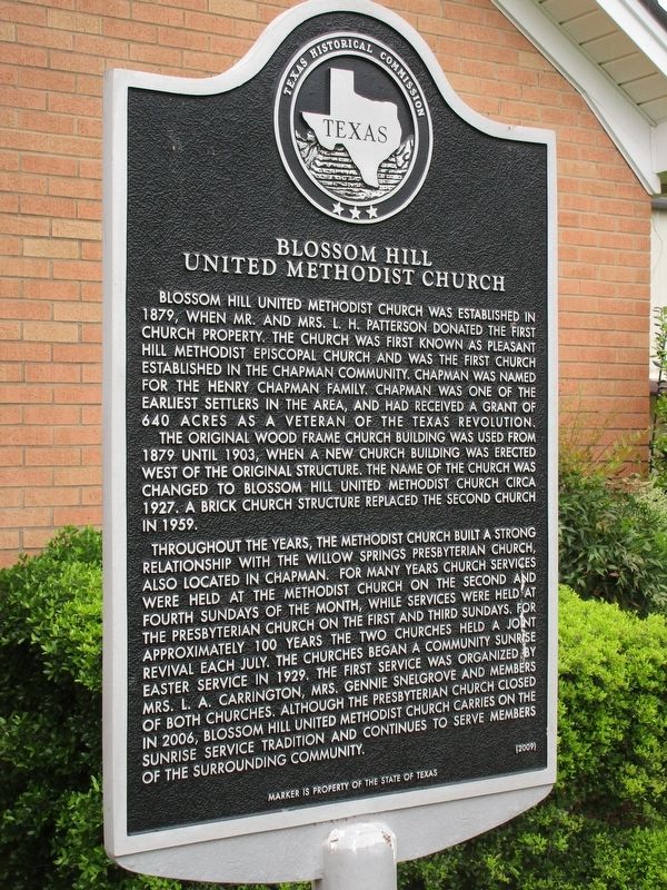
1. Blossom Hill United Methodist Church Marker
Throughout the years, the Methodist Church built a strong relationship with the Willow Springs Presbyterian Church, also located in Chapman. For many years church services were held at the Methodist Church on the second and fourth Sundays of the month, while services were held at the Presbyterian Church on the first and third Sundays. For approximately 100 years the two churches held a joint revival each July. The churches began a community sunrise Easter
this page online
Erected 2009 by Texas Historical Commission. (Marker Number 16031.)
Topics. This historical marker is listed in this topic list: Religion & Religious Structures.
Location. 32° 9.051′ N, 94° 38.013′ W. Marker is near Henderson, Texas, in Rusk County. It is at the intersection of Business U.S. 79 and County Route 341, on the right when traveling west on U.S. 79Business . Touch for map. Marker is at or near this postal address: 9675 US Hwy 79 E, Henderson TX 75652, United States of America. Touch for directions.

Regionally, this marker is in the American South, specifically in the Deep South, and in the Piney Woods. Globally, it is in North America, a Gulf of Mexico state, the Western Hemisphere, the Western World, and the Anglosphere. Historically, it finds
Photographed by Jeff Leichsenring, April 23, 2023
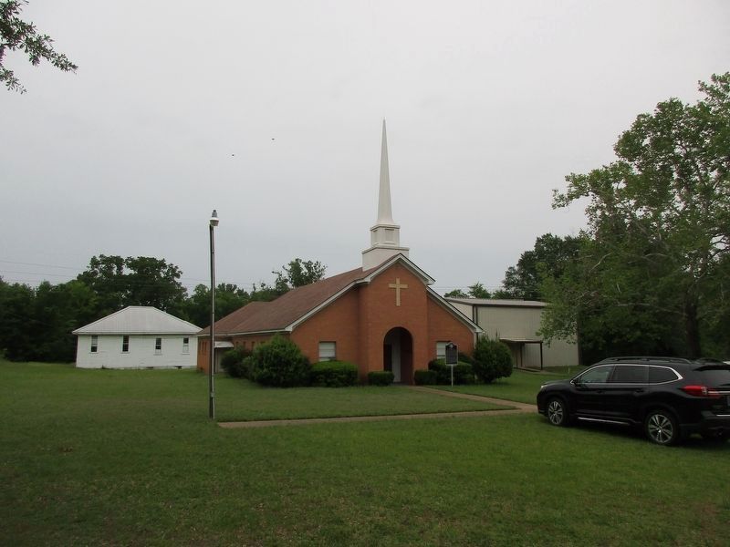
2. Blossom Hill United Methodist Church and Marker
Other nearby markers. At least 8 other markers are within 4 miles of this marker, measured as the crow flies: Bridges Cemetery (approx. 0.9 miles away); John Strong / Mary Ann (Whatley) Strong (approx. 2½ miles away); Strong Cemetery (approx. 2½ miles away); Trammel's Trace (approx. 3 miles away); Liberty Missionary Baptist Church (approx. 3.1 miles away); Buckner Cemetery (approx. 3.3 miles away); Church Hill United Methodist Church (approx. 3½ miles away); Pine Grove Cumberland Presbyterian Church (approx. 3.6 miles away). Touch for a list and map of all markers in Henderson.
Credits. This page was last revised on April 30, 2023. It was originally submitted on April 28, 2023, by Jeff Leichsenring of Garland, Texas. This page has been viewed 436 times since then and 49 times this year. Photos: 1, 2. submitted on April 28, 2023, by Jeff Leichsenring of Garland, Texas. • James Hulse was the editor who published this page.
