Near Tillery in Halifax County, North Carolina — The American South (South Atlantic)
Caledonia
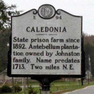
Photographed by Bernard Fisher, October 27, 2012
1. Caledonia Marker
Erected 1987 by Division of Archives and History. (Marker Number E-94.)
Topics and series. This historical marker is listed in this topic list: Notable Places. In addition, it is included in the North Carolina Division of Archives and History series list. A significant historical year for this entry is 1892.
Location. Marker has been reported missing. It was located near 36° 16.318′ N, 77° 29.132′ W. Marker was near Tillery, North Carolina, in Halifax County. It was at the intersection of North Carolina Route 561 and Caledonia Drive (County Highway 1141), on the right when traveling north on North Carolina Route 561. Touch for map. Marker was at or near this postal address: 8065 NC-561, Halifax NC 27839, United States of America. Touch for directions.

Regionally, this marker was in the Coastal Plain. It was also in the American South and specifically in the Upper South. Globally, it was in North America, the Western Hemisphere, the Western World, and the Anglosphere. Historically, it found itself
this page online
Other nearby markers. At least 8 other markers are within 7 miles of this location, measured as the crow flies: Tillery Resettlement (approx. 1.3 miles away); Conoconnara Chapel (approx. 3.7 miles away); The Sally Billy House (approx. 6.9 miles away); Escape! (approx. 6.9 miles away); Willie Jones (approx. 6.9 miles away); Hutchins G. Burton (approx. 6.9 miles away); Washington’s Southern Tour (approx. 6.9 miles away); Independence (approx. 6.9 miles away).
Another marker is no longer nearby. Willie Jones (was approx. 6.9 miles away but has been replaced with another marker now near it).
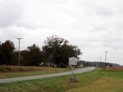
Photographed by Bernard Fisher, October 27, 2012
2. NC 561 & Caledonia Dr
Credits. This page was last revised on April 29, 2023. It was originally submitted on October 29, 2012, by Bernard Fisher of Richmond, Virginia. This page has been viewed 744 times since then and 45 times this year. Last updated on April 29, 2023, by Michael Buckner of Durham, North Carolina. Photos: 1, 2. submitted on October 29, 2012, by Bernard Fisher of Richmond, Virginia.
