La Crosse in La Crosse County, Wisconsin — The American Midwest (Great Lakes)
Quarrying the Bluffs of La Crosse
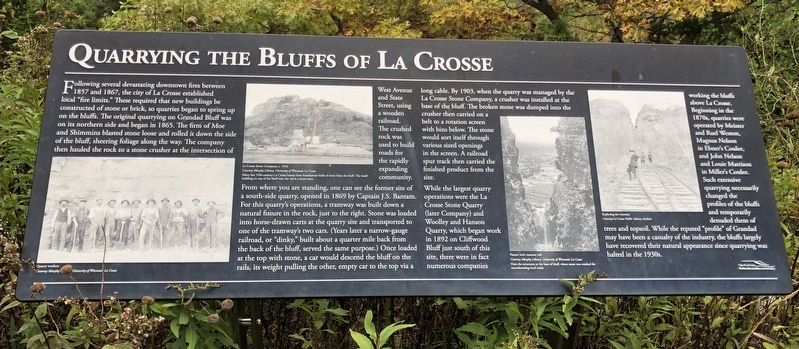
Following several devastating downtown fires between 1857 and 1867, the city of La Crosse established local "fire Limits." These required that new buildings be constructed of stone or brick, so quarries began to spring up on the bluffs. The original quarrying on Grandad Bluff was on its northern side and began in 1865. The firm of Moe and Shimmins blasted stone loose and rolled it down the side of the bluff, sheering foliage along the way. The company then hauled the rock to a stone crusher at the intersection of West Avenue and State Street, using a wooden railroad. The crushed rock was used to build roads for the rapidly expanding community.
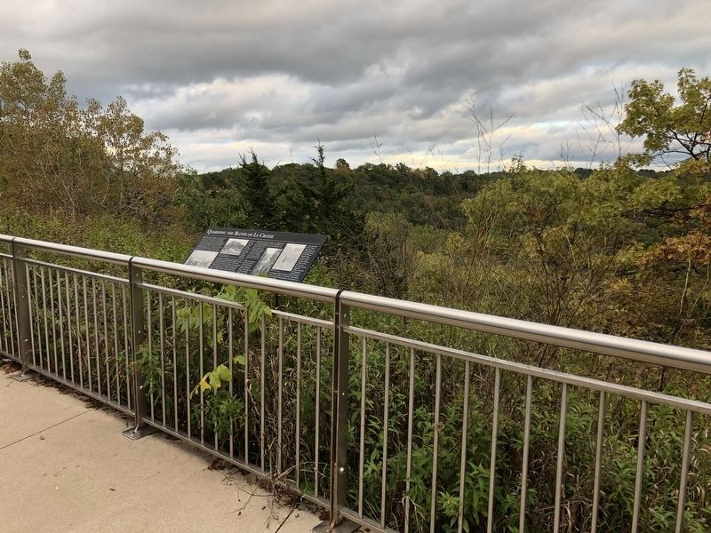
From where you are standing, one can see the former site of a south-side quarry, opened in 1869 by Captain J.S. Bantam. For this quarry's operations, a tramway was built down a natural fissure in the rock, just to the right. Stone was loaded into horse-drawn carts at the quarry site and transported to one of the tramway's two cars. (Years later a narrow-gauge railroad, or "dinky," built about a quarter mile back from the back of the bluff, served the same purpose.) Once loaded at the top with stone, a car would descend the bluff on the rails, its weight pulling the other, empty car to the top via a long cable. By 1903, when the quarry was managed by the La Crosse Stone Company, a crusher was installed at the base of the bluff. The broken stone was dumped into the crusher then carried on a belt to a rotation screen with bins below. The stone would sort itself through various sized openings in the screen, A railroad spur track then carried the finished product from the site.
While the largest quarry operations were the La Crosse Stone Quarry (later Company) and Woolley and Hanson Quarry, which began work in 1892 on Cliffwood Bluff just south of this site, there were in fact numerous companies working the bluffs above La Crosse. Beginning in the 1870s, quarries were operated by Meister and Ruel Weston, Magnus Nelson in Ebner's Coulee, and John Nelson and Louie Mattison in Miller's Coulee. Such extensive quarrying necessarily changed the profiles of the bluffs and temporarily denuded them of trees and topsoil. While the reputed "profile" of Grandad may have been a casualty of the industry, the bluffs largely have recovered their natural appearance since quarrying was halted in the 1930s.
Captions
Quarry workers
Courtesy Murphy Library, University of Wisconsin La Crosse
La Crosse Stone Company, c 1916
Courtesy Murphy Library, University of Wisconsin La Crosse
Many late 19th-century La Crosse homes have foundations built of stone from the bluff. The small building on top of the bluff near the rail is a horse barn.
Fissure with tramway rail
Courtesy Murphy Library University of Wisconsin La Crosse
Note the structures at the base of bluff, where stone was crushed for macadamizing local roads.
Exploring the tramway
Courtesy La Crosse Public Library Archives
Erected by City of La Crosse, Parks, Recreation and Forestry.
Topics. This historical marker is listed in these topic lists: Environment • Industry & Commerce • Settlements & Settlers. A significant historical year for this entry is 1857.
Location. 43° 48.729′ N, 91° 12.678′ W. Marker is in La Crosse, Wisconsin, in La Crosse County. Marker is on Bliss Road. Located 1 mile west of the entrance to Grandad Bluff Park. Touch for map. Marker is at or near this postal address: 071 Bliss Road, La Crosse WI 54601, United States of America. Touch for directions.
Other nearby markers. At least 8 other markers are within walking distance of this marker. La Crosse: "A Choice Town" (here, next to this marker); The Driftless Area of Wisconsin (here, next to this marker); History of Flagpole (within shouting distance of this marker); Grandad Bluff: The Making of a Park (within shouting distance of this marker); First Complete Service of Christian Divine Worship (about 500 feet away, measured in a direct line); Our Lady of Sorrows Chapel (approx. 0.7 miles away); Myrick Park Treewalk (approx. 0.9 miles away); Myrick Park Mounds (approx. one mile away). Touch for a list and map of all markers in La Crosse.
Credits. This page was last revised on May 3, 2023. It was originally submitted on October 30, 2019, by Ruth VanSteenwyk of Aberdeen, South Dakota. This page has been viewed 663 times since then and 100 times this year. Last updated on May 3, 2023, by Connor Olson of Kewaskum, Wisconsin. Photos: 1, 2. submitted on October 30, 2019, by Ruth VanSteenwyk of Aberdeen, South Dakota. • J. Makali Bruton was the editor who published this page.

