Roanoke Rapids in Halifax County, North Carolina — The American South (South Atlantic)
Raleigh and Gaston Railroad
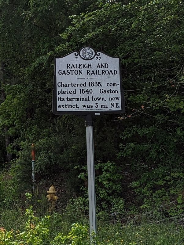
Photographed by Michael Buckner, May 3, 2023
1. Raleigh and Gaston Railroad Marker
Erected 1939 by North Carolina Office of Archives and History. (Marker Number E-22.)
Topics. This historical marker is listed in these topic lists: Industry & Commerce • Railroads & Streetcars. A significant historical year for this entry is 1835.
Location. 36° 27.446′ N, 77° 48.537′ W. Marker is in Roanoke Rapids, North Carolina, in Halifax County. It is at the intersection of Julian R Allsbrook Highway (U.S. 158) and Roper Springs Road, on the right when traveling east on Julian R Allsbrook Highway. Touch for map. Marker is at or near this postal address: 51 Roper Springs Rd, Roanoke Rapids NC 27870, United States of America. Touch for directions.

Regionally, this marker is in the Coastal Plain. It is also in the American South and specifically in the Upper South. Globally, it is in North America, the Western Hemisphere, the Western World, and the Anglosphere. Historically, it finds itself in what was once the territory of the Mississippian Culture, one of the original Thirteen Colonies, one of the Confederate States
this page online
Other nearby markers. At least 8 other markers are within 8 miles of this marker, measured as the crow flies: Plummer Bernard Young (approx. 5.3 miles away); Ella Baker (approx. 5.4 miles away); Willis Alston, Jr. (approx. 5.9 miles away); Brunswick County, Virginia (approx. 6.1 miles away in Virginia); Person's Ordinary (approx. 6.2 miles away); Littleton College (approx. 6.2 miles away); Allen Jones (approx. 7.3 miles away); Mason's Chapel (approx. 7½ miles away in Virginia).
Credits. This page was last revised on May 5, 2023. It was originally submitted on May 4, 2023, by Michael Buckner of Durham, North Carolina. This page has been viewed 275 times since then and 32 times this year. Photo 1. submitted on May 4, 2023, by Michael Buckner of Durham, North Carolina. • Bernard Fisher was the editor who published this page.
