
Halifax in Halifax County, North Carolina — The American South (South Atlantic)
The Sally Billy House
Photographed by Bernard Fisher, October 27, 2012
1. The Sally Billy House Marker
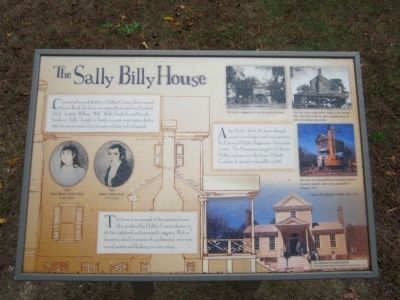
After Smith’s death, the house changed owners several times until it was given to the Historical Halifax Restoration Association in 1972. The Association moved it to Historic Halifax and gave it to the State of North Carolina. It opened to the public in 1976.
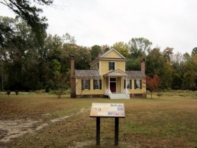
The house is an example of the tripartite houses often produced by Halifax County planters in the late eighteenth and nineteenth centuries. Rich in decorative detail, it consists of a pedimented, two-story central section and flanking one-story wings.
Erected by The Historical Halifax Restoration Association, Inc.
Topics. This historical marker is listed in this topic list: Notable Buildings. A significant historical year for this entry is 1808.
Location. 36° 19.81′ N, 77° 35.117′ W. Marker is in Halifax, North Carolina, in Halifax County. It is on Fishing
this page online

Regionally, this marker is in North Carolina’s Coastal Plain. It is also in the American South and specifically in the Upper South. Globally, it is in North America, the Western Hemisphere, the Western World, and the Anglosphere. Historically, it finds itself in what was once the territory of the Mississippian Culture, one of the original Thirteen Colonies, one of the Confederate States of America, and the Antebellum South.
Other nearby markers. At least 8 other markers are within walking distance of this marker: Burgess Law Office (about 600 feet away, measured in a direct line); The Free Church of Halifax (about 700 feet away); Escape! (about 700 feet away); The Market Green (about 700 feet away); Montfort Archaeological Museum (about 700 feet away); Halifax Runaway Ads (about 700 feet away); The Old Town of Halifax (approx. 0.2 miles away); Halifax Courthouse (approx. 0.2 miles away). Touch for a list and map
Photographed by Bernard Fisher, October 27, 2012
2. The Sally Billy House
More about this marker. On the left are portraits of “Sally” Sarah Walton Norfleet Smith 1782-1870 and “Billy” William Ruffin Smith 1779-1845.
On the right are photos with the captions:
"The house as it appeared in the mid-twentieth century."
"Over time, owners made several changes to the structure. This 1969 view of the rear shows an added porch, as well as substantial deterioration."
"The house was disassembled and eventually moved to its present location, where it was reassembled in January 1976."
"Below: The dedication, Halifax Day 1976."
Credits. This page was last revised on May 5, 2023. It was originally submitted on October 30, 2012, by Bernard Fisher of Richmond, Virginia. This page has been viewed 1,975 times since then and 96 times this year. Last updated on May 5, 2023, by Michael Buckner of Durham, North Carolina. Photos: 1, 2. submitted on October 30, 2012, by Bernard Fisher of Richmond, Virginia.
