Elizabethtown in Bladen County, North Carolina — The American South (South Atlantic)
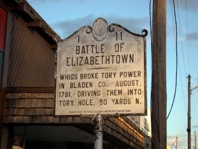
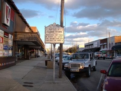
Battle of Elizabethtown
Erected 1939 by Department of Conservation and Development. (Marker Number I-11.)
Topics and series. This historical marker is listed in this topic list: War, US Revolutionary. In addition, it is included in the Daughters of the American Revolution, and the North Carolina Division of Archives and History series lists. A significant historical year for this entry is 1781.
Location. 34° 37.762′ N, 78° 36.414′ W. Marker is in Elizabethtown, North Carolina, in Bladen County. Marker is on West Broad Street (State Highway 87) west of Poplar Street (U.S. 701), on the right when traveling west. Touch for map. Marker is at or near this postal address: 134 W Broad St, Elizabethtown NC 28337, United States of America. Touch for directions.
Other nearby markers. At least 8 other markers are within 13 miles of this marker, measured as the crow flies. John Owen (approx. 3.9 miles away); Future Farmers of America (approx. 5.6 miles away); White Lake CCC Camp (approx. 6.9 miles away); Old Brown Marsh Presbyterian Church (approx. 7.3 miles away); a different marker also named Old Brown Marsh Presbyterian Church (approx. 9.4 miles away); Whistler’s Mother (approx. 9.6 miles away); Mount Horeb Presbyterian Church and Cemetery (approx. 11.9 miles away); Thomas Robeson (approx. 12.2 miles away). Touch for a list and map of all markers in Elizabethtown.
Photographed By J. J. Prats, February 10, 2010
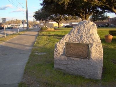
3. DAR Battle of Elizabethtown Monument
Monument is on the grounds of the courthouse at the corner of Main and Poplar Streets. It reads "1781–1928. Erected by The Battle of Elizabethtown Chapter of the Daughters of the American Revolution and the County of Bladen to mar the site where the Battle of Elizabethtown was fought at the Tory Hole on September 29th, 1781.
Photographed By J. J. Prats, February 10, 2010
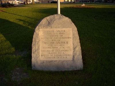
4. Sallie Salter Monument
This monument is on the grounds of the courthouse, facing Poplar street. It reads, "Sallie Salter, 1742–1800, heroine of the Battle of Elizabethtown, wife of William Salter, II, 1732–1802, Assemblyman 1774–75. Erected by descendants, Bladen Co. & Battle of Elizabethtown Chapter of D.A.R."
Credits. This page was last revised on May 8, 2023. It was originally submitted on February 14, 2010, by J. J. Prats of Powell, Ohio. This page has been viewed 2,796 times since then and 38 times this year. Last updated on May 7, 2023, by Michael Buckner of Durham, North Carolina. Photos: 1, 2, 3, 4. submitted on February 14, 2010, by J. J. Prats of Powell, Ohio. 5. submitted on April 13, 2023, by Allie Stevens of Bladenboro, North Carolina.
