Near Stantonsburg in Wilson County, North Carolina — The American South (South Atlantic)
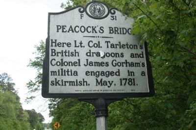
Peacock's Bridge
Photographed by Mike Stroud, April 18, 2013
1. Peacock's Bridge Marker
Erected 2003 by North Carolina Office of Archives and History. (Marker Number F-31.)
Topics and series. This historical marker is listed in this topic list: War, US Revolutionary. In addition, it is included in the North Carolina Division of Archives and History series list. A significant historical month for this entry is May 1781.
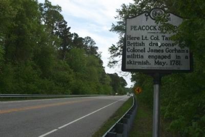
Location. 35° 35.123′ N, 77° 48.688′ W. Marker is near Stantonsburg, North Carolina, in Wilson County. It is on State Highway 58 south of Peacock Bridge Road, on the right when traveling south. Touch for map. Marker is at or near this postal address: 5900 NC-58, Stantonsburg NC 27883, United States of America. Touch for directions.

Regionally, this marker is in the Piedmont. It is also in the American South and specifically in the Upper South. Globally, it is in North America, the Western Hemisphere, the Western World, and the Anglosphere. Historically, it finds itself in what was once the territory of the Mississippian Culture, one of the original Thirteen Colonies, one
this page online
Other nearby markers. At least 8 other markers are within 11 miles of this marker, measured as the crow flies: Nuclear Mishap (approx. 4.7 miles away); James Glasgow (approx. 7.1 miles away); Nooherooka (approx. 8.9 miles away); Toisnot Church (approx. 10.4 miles away); Charles H. Darden (approx. 10.7 miles away); Charles B. Aycock (approx. 10.7 miles away); Frank S. Hargrave, M.D. (approx. 10.7 miles away); Plank Road (approx. 10.7 miles away).
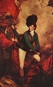
Regarding Peacock's Bridge. Samuel Peacock built a toll bridge prior to 1751 in present-day Stantonsburg in Wilson County. Peacock’s Bridge provided a way of passage across Contentnea Creek. On May 6, 1781, it was the site of a skirmish between Lt. Col. Banastre Tarleton’s British dragoons and Col. James Gorham’s militia.
After crossing the Neuse River, Col. Tarleton’s men met about 400 militiamen waiting for them at the
bridge. Tarleton’s forces dispersed the militia, but not without taking some losses, and headed on toward
Tarboro.
Gen. Jethro Sumner filed a report to Gen. Nathanael Greene, indicating, “The
Photographed by Mike Stroud, April 18, 2013
2. Peacock's Bridge Marker on North Carolina Route 58, here looking south
under Col. Gorum by a party of Tarleton’s horse and fifty Tories. The people are moving before them; most of the public stores here, I flatter myself, will be moved off, and out of the way.” (North Carolina Office of Archives & History — Department of Cultural Resources)
Photographed by Mike Stroud, April 18, 2013
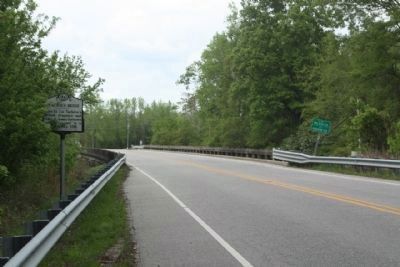
3. Peacock's Bridge Marker, looking north at Contentnea Creek, county line
Photographed by Sir Joshua Reynolds, `
4. Lt. Col.Banastre Tarleton
Credits. This page was last revised on January 31, 2025. It was originally submitted on May 3, 2013, by Mike Stroud of Bluffton, South Carolina. This page has been viewed 2,409 times since then and 105 times this year. Last updated on May 7, 2023, by Michael Buckner of Durham, North Carolina. Photos: 1, 2, 3, 4. submitted on May 3, 2013, by Mike Stroud of Bluffton, South Carolina. • Bernard Fisher was the editor who published this page.
