Manson in Warren County, North Carolina — The American South (South Atlantic)
James Turner
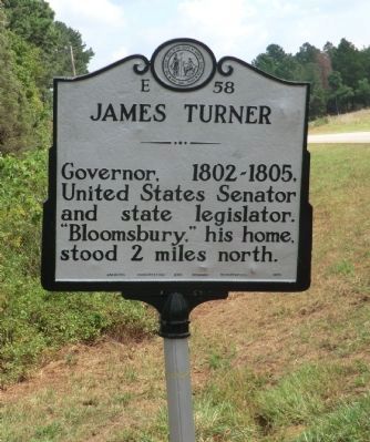
Photographed by Don Morfe, September 16, 2013
1. James Turner Marker
Erected 1955 by Archives, Conservation and Highway Departments. (Marker Number E-58.)
Topics and series. This historical marker is listed in this topic list: Government & Politics. In addition, it is included in the North Carolina Division of Archives and History series list.
Location. 36° 25.333′ N, 78° 16.556′ W. Marker is in Manson, North Carolina, in Warren County. It is at the intersection of U.S. 1 (U.S. 1) and Bloomsbury Road, on the right when traveling south on U.S. 1. Touch for map. Marker is at or near this postal address: 1312 US-1, Manson NC 27553, United States of America. Touch for directions.

Regionally, this marker is in North Carolina’s Coastal Plain. It is also in the American South and specifically in the Upper South. Globally, it is in North America, the Western Hemisphere, the Western World, and the Anglosphere. Historically, it finds itself in what was once the territory of the Mississippian Culture, one of the original
this page online
Other nearby markers. At least 8 other markers are within 7 miles of this marker, measured as the crow flies: Weldon Edwards (approx. 2.6 miles away); Admiral Kirk Donald (approx. 4.7 miles away); Trading Path (approx. 4.9 miles away); Richard Henderson (approx. 5.1 miles away); John Watson House (approx. 6.6 miles away); Dr. L. Julian Haywood (approx. 6.6 miles away); "Bridle Creek" (approx. 6.7 miles away); PCB Protests (approx. 6.7 miles away).
Another marker is no longer nearby. William Hawkins (was approx. 4.1 miles away but has been confirmed missing).
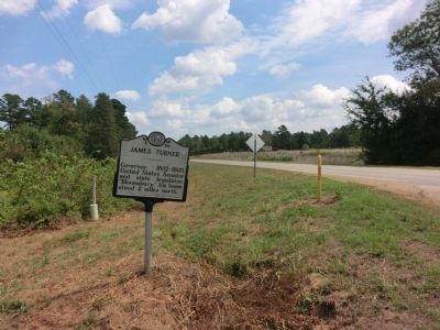
Photographed by Don Morfe, September 16, 2013
2. James Turner Marker
Credits. This page was last revised on May 9, 2023. It was originally submitted on November 4, 2013, by Don Morfe of Baltimore, Maryland. This page has been viewed 560 times since then and 33 times this year. Last updated on May 8, 2023, by Michael Buckner of Durham, North Carolina. Photos: 1, 2. submitted on November 4, 2013, by Don Morfe of Baltimore, Maryland. • J. Makali Bruton was the editor who published this page.
