
Near Dunkirk in Hardin County, Ohio — The American Midwest (Great Lakes)
Hull's Trail, 1812
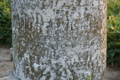
Photographed by Dale K. Benington, September 5, 2009
1. Hull's Trail 1812 Marker
Erected By
Fort McArthur Chapter, D.A.R.
1912
Erected 1912 by Fort McArthur Chapter, D.A.R.
Topics and series. This historical marker is listed in these topic lists: Landmarks • Military • War of 1812. In addition, it is included in the Daughters of the American Revolution (DAR) series list. A significant historical year for this entry is 1812.
Location. 40° 46.827′ N, 83° 39.12′ W. Marker is near Dunkirk, Ohio, in Hardin County. It is on County Route 135 0.2 miles south of West Geneva Street (Ohio Route 81), on the left when traveling north. Touch for map. Marker is in this post office area: Dunkirk OH 45836, United States of America. Touch for directions.

Regionally, this marker is in Ohio’s Till Plains. It is also in the American Midwest and in the Corn Belt. Globally, it is in North America, the Western Hemisphere, the Western World, and the Anglosphere. Historically, it finds itself in what was once the Haudenosaunee (Iroquois) Confederacy, the territory of the Mississippian Culture, and the Northwest Territory.
Other nearby markers. At least 8 other markers are
this page online
Other markers no longer nearby. Fort Necessity (was approx. 2.7 miles away but has been confirmed missing); Fort Necessity / William Hull Memorial Park (was approx. 2.8 miles away but has been permanently removed).
Related markers. Click here for a list of markers that are related to this marker. To better understand the relationship, study each marker in the order shown.
Also see . . . Hull's Trace (North Huron River Corduroy Segment). Wikipedia entry (Submitted on September 26, 2024, by Larry Gertner of New York, New York.)
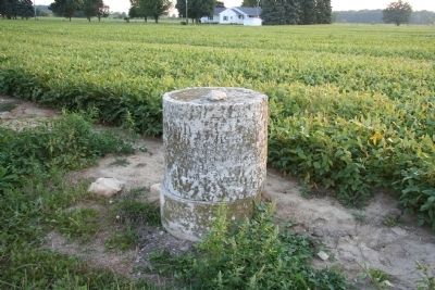
Photographed by Dale K. Benington, September 5, 2009
2. Hull's Trail 1812 Marker
View of historical marker in foreground with farmer's field in the background.
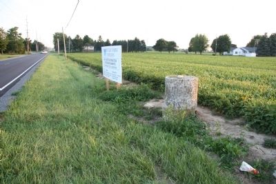
Photographed by Dale K. Benington, September 5, 2009
3. Hull's Trail 1812 Marker
View of historical marker as seen along the west side of County Road 135, looking south.
Credits. This page was last revised on September 26, 2024. It was originally submitted on September 7, 2009, by Dale K. Benington of Toledo, Ohio. This page has been viewed 1,636 times since then and 63 times this year. Photos: 1, 2, 3. submitted on September 7, 2009, by Dale K. Benington of Toledo, Ohio. • Kevin W. was the editor who published this page.
