Near Baynesville in Westmoreland County, Virginia — The American South (Mid-Atlantic)
Westmoreland State Park
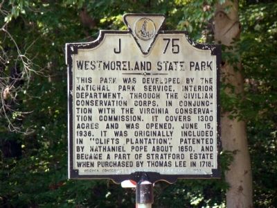
Photographed by J. J. Prats, August 30, 2009
1. Westmoreland State Park Marker
This park was developed by the National Park Service, Interior Department, through the Civilian Conservation Corps, in conjunction with the Virginia Conservation Commission. It covers 1300 acres and was opened, June 15, 1936. It was originally included in “Clifts Plantation,” patented by Nathaniel Pope about 1650, and became part of the Stratford estate when purchased by Thomas Lee in 1718.
Erected 1939 by Virginia Conservation Commission. (Marker Number J-75.)
Topics and series. This historical marker is listed in this topic list: Settlements & Settlers. In addition, it is included in the Civilian Conservation Corps (CCC), and the Virginia Department of Historic Resources (DHR) series lists. A significant historical date for this entry is June 15, 1906.
Location. 38° 8.812′ N, 76° 52.638′ W. Marker is near Baynesville, Virginia, in Westmoreland County. It is at the intersection of Kings Highway (Virginia Route 3) and State Park Road ( Route 347), on the left when traveling east on Kings Highway. Touch for map. Marker is in this post office area: Montross VA 22520, United States of America. Touch for directions.

Regionally,
this page online
Other nearby markers. At least 8 other markers are within 2 miles of this marker, measured as the crow flies: Stratford and Chantilly (approx. 0.6 miles away); A Testament to Craftsmanship (approx. 1.2 miles away); Dividends for the Future (approx. 1.2 miles away); Burrell Eskridge and His Son Vernon Eskridge (approx. 1.6 miles away); Stratford Hall (approx. 1.6 miles away); To Keep in Perpetual Remembrance the Name of Thomas Lee (approx. 1.6 miles away); Tempting Target (approx. 1.8 miles away); War in the Chesapeake (approx. 1.8 miles away).
Also see . . .
1. Westmoreland. Virginia State Parks website entry:
“The
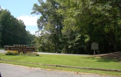
Photographed by J. J. Prats, August 30, 2009
2. Marker at Entrance to Westmoreland State Park
2. Clifts Plantation (44WM33). Digital Archeology Record website entry:
“Permanent English settlement of Westmoreland County began in the late 1640s. Many of the earliest settlers in the region were immigrants from Maryland, among them Nathanial Pope, who first patented the land on which The Clifts was located in 1651. Pope, who lived up river from the Clifts tract at the confluence of Mattox (Appomattox) Creek and the Potomac, was among the county’s wealthiest residents at his death in 1660 when he left The Clifts tract to his son Thomas.” (Submitted on September 9, 2009.)
Credits. This page was last revised on September 23, 2022. It was originally submitted on September 9, 2009, by J. J. Prats of Powell, Ohio. This page has been viewed 1,569 times since then and 62 times this year. Photos: 1, 2. submitted on September 9, 2009, by J. J. Prats of Powell, Ohio.
Editor’s want-list for this marker. Photos of the park • Can you help?
