Valley Grove in Ohio County, West Virginia — The American South (Appalachia)
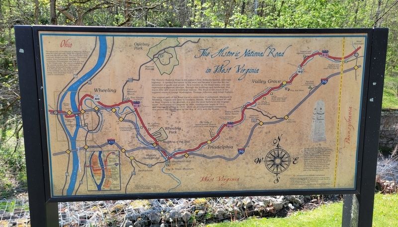
The Historic National Road in West Virginia
The Historic National Road is the nation's first, federally funded, interstate highway. It opened the nation to the west and became a corridor for the movement of goods and people. As a traveler on the Road today, you can experience a physical timeline, through the buildings and landscape, that traces over 200 years of American history. The Road is the result of the inspired vision of George Washington, Thomas Jefferson, and Albert Gallatin.
The original path of the Road traced a route from Cumberland, Maryland to Wheeling, Virginia and later to Vandalia, Illinois. While the section of road in West Virginia is the shortest, it is also the most faithful to the original route. Authorized by Congress in 1806, construction began in 1811 and reached Wheeling in 1818. Quite an accomplishment considering this period was interrupted by the War of 1812 with the British.
The actual cost of construction to Wheeling averaged about $13,000 per mile, while the original estimate was only $6,000 per mile. The construction of the road was divided into two sections. The eastern section, from Cumberland, Maryland to Uniontown, Pennsylvania was built at a cost of $9,745 per mile. The cost of completing the western section, from Uniontown to Wheeling, increased sharply to about $16,000 per mile. One of the factors in the increase was the absence of cheap, local stone that could be used in construction.
As you drive the Road, look for the restored, historic Mile Markers. They were the wayfinders used by early travelers. Each marker shows the distance to Wheeling, then a part of Virginia and the original western terminus of the road, and Cumberland, Maryland, the start of the National Road. The distance to the nearest local town is also displayed. All the markers are located on the north side of the National Road.
(Captions):
About the map -
The background of this map is taken from a letter written in 1818 by one of the workers building the National Road.
● Interpretive Kiosk Locations
Additional interpretive kiosks are located at these sites:
- in front of the Toy & Train Museum on Kruger Street
- at the Madonna of the Trail monument
- in front of the Hampton Inn
- at the east entrance to the Wheeling Suspension Bridge
Topics. This historical marker is listed in these topic lists: Industry & Commerce • Landmarks • Roads & Vehicles. A significant historical year for this entry is 1806.
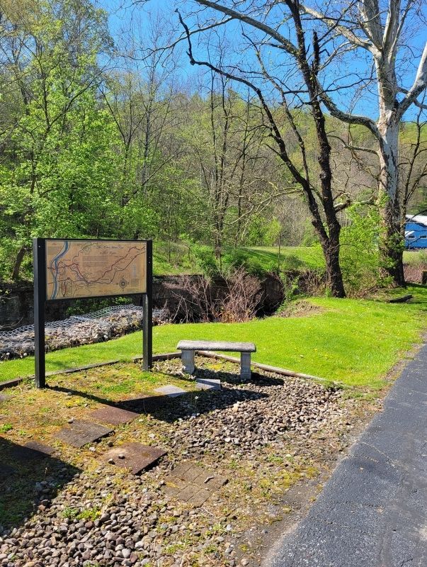
Location. 40° 5.211′ N, 80° 34.247′ W. Marker is in Valley Grove, West Virginia, in Ohio County. Marker is on National Road (U.S. 40) west of McGraws Run Road (County Route 35), on the left when traveling west. Marker is located on the southwest side of the Valley Grove Community Center. Touch for map. Marker is at or near this postal address: 8566 National Road, Valley Grove WV 26060, United States of America. Touch for directions.
Other nearby markers. At least 8 other markers are within 4 miles of this marker, measured as the crow flies. Ray’s Arithmetic (approx. 1.6 miles away); Roney’s Point (approx. 1.7 miles away); Ohio County / State of Pennsylvania (approx. 3 miles away); Revolutionary War Soldiers (approx. 3.4 miles away in Pennsylvania); Veterans Memorial (approx. 3.4 miles away in Pennsylvania); General Lafayette (approx. 3.4 miles away in Pennsylvania); Lafayette's Tour (approx. 3˝ miles away in Pennsylvania); a different marker also named Revolutionary War Soldiers (approx. 3.6 miles away in Pennsylvania). Touch for a list and map of all markers in Valley Grove.
Regarding The Historic National Road in West Virginia. Marker includes a map of the historic districts and notable sites surrounding Wheeling.
Credits. This page was last revised on May 22, 2023. It was originally submitted on May 13, 2023, by Bradley Owen of Morgantown, West Virginia. This page has been viewed 72 times since then and 30 times this year. Photos: 1, 2. submitted on May 14, 2023, by Bradley Owen of Morgantown, West Virginia. • Bill Pfingsten was the editor who published this page.

