Papillion in Sarpy County, Nebraska — The American Midwest (Upper Plains)
The Original Union Pacific Mainline Through Papillion
Photographed by Trenton Albers, May 23, 2023
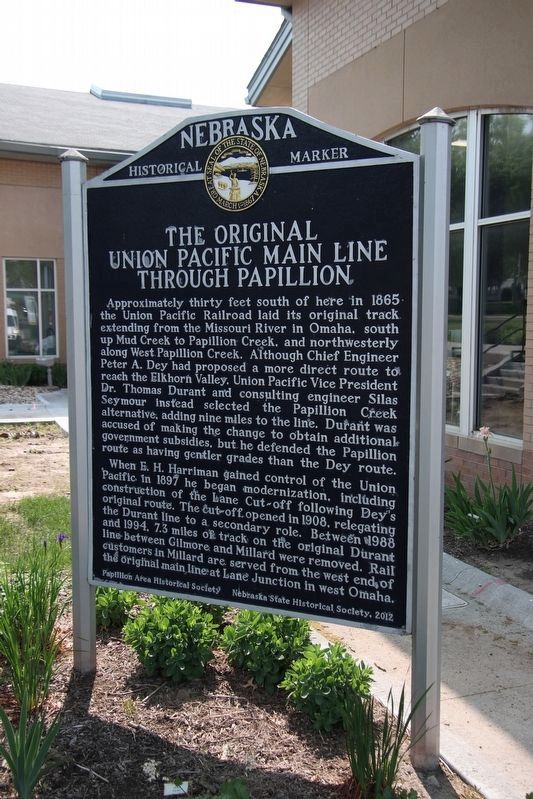
1. The Original Union Pacific Mainline Through Papillion Marker
Approximately thirty feet south of here in 1865 the Union Pacific Railroad laid its original track extending from the Missouri River in Omaha, south up Mud Creek to Papillion Creek, and northwesterly along West Papillion Creek. Although Chief Engineer Peter A. Dey had proposed a more direct route to reach the Elkhorn Valley, Union Pacific Vice President Dr. Thomas Durant and consulting engineer Silas Seymour instead selected the Papillion Creek alternative, adding nine miles to the line. Durant was accused of making the change to obtain additional government subsidies, but he defended the Papillion route as having gentler grades than the Dey route.
When E. H. Harriman gained control of the Union Pacific in 1897 he began modernization, including construction of the Lane Cut-off following Dey's original route. The cut-off opened in 1908, relegating the Durant line to a secondary role. Between 1988 and 1994, 7.3 miles of track on the original Durant line between Gilmore and Millard were removed. Rail customers in Millard are served from the west end of the original main line at Lane Junction in west Omaha.
Erected 2012 by City of Papillion, Papillion Area Historical Society and Nebraska State Historical Society. (Marker Number 182.)
Topics and series. This historical marker is listed in these topic lists: Exploration • Railroads & Streetcars • Settlements & Settlers. In addition, it is included in the Nebraska State Historical Society series list.
Location. 41° 9.477′ N, 96° 2.57′ W. Marker is in Papillion, Nebraska, in Sarpy County. It is on North Washington Street north of East 2nd Street, on the right when traveling north. Touch for map. Marker is in this post office area: Papillion NE 68046, United States of America. Touch for directions.

Regionally,
this page online
Other nearby markers. At least 8 other markers are within walking distance of this marker: Papillion's History as a Main Railroad Hub (here, next to this marker); Original Train Depot & Interurban Railway (within shouting distance of this marker); The Sautter House (within shouting distance of this marker); Papillion's First Jail & The Sander's Store (within shouting distance of this marker); Thriving Papillion Businesses (within shouting distance of this marker); The First Mayor & Third Courthouse (within shouting distance of this marker); The History of Portal School (about 300 feet away, measured in a direct line); Papillion City Hall (about 300 feet away). Touch for a list and map of all markers in Papillion.
Also see . . . The Original Union Pacific Mainline Through Papillion Marker at Nebraska State Historical Society.
Photographed by Trenton Albers, May 23, 2023
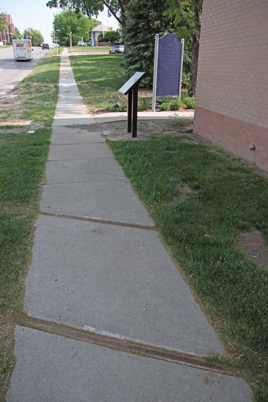
2. The Original Union Pacific Mainline Through Papillion Marker
Railroad tracks are embedded in the sidewalk at the location where the Union Pacific Mainline passed through Papillion near the marker.
Credits. This page was last revised on June 28, 2023. It was originally submitted on March 25, 2023, by David Black of Papillion, Nebraska. This page has been viewed 1,896 times since then and 172 times this year. Last updated on May 14, 2023, by Jeff Leichsenring of Garland, Texas. Photos: 1, 2. submitted on June 26, 2023, by Trenton Albers of Papillion, Nebraska. • J. Makali Bruton was the editor who published this page.
