Lerty in Westmoreland County, Virginia — The American South (Mid-Atlantic)
Stratford and Chantilly
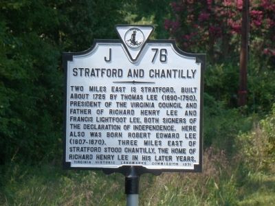
Photographed by J. J. Prats, August 30, 2009
1. Stratford and Chantilly Marker
Two miles east is Stratford, built about 1725 by Thomas Lee (1690–1750), president of the Virginia Council and father of Richard Henry Lee and Francis Lightfoot Lee, both signers of the Declaration of Independence. Here also was born Robert Edward Lee (1807–1870). Three miles east of Stratford stood Chantilly, the home of Richard Henry Lee in his later years.
Erected 1971 by Virginia Historic Landmarks Commission. (Marker Number J-76.)
Topics and series. This historical marker is listed in these topic lists: Colonial Era • Settlements & Settlers • War, US Revolutionary. In addition, it is included in the Signers of the Declaration of Independence, and the Virginia Department of Historic Resources (DHR) series lists. A significant historical year for this entry is 1725.
Location. 38° 8.533′ N, 76° 52.038′ W. Marker is in Lerty, Virginia, in Westmoreland County. It is at the intersection of Kings Highway (Virginia Route 3) and Stratford Hall Road (U.S. 214), on the right when traveling east on Kings Highway. Touch for map. Marker is in this post office area: Montross VA 22520, United States of America. Touch for directions.

Regionally,
this page online
Other nearby markers. At least 8 other markers are within 2 miles of this marker, measured as the crow flies: Westmoreland State Park (approx. 0.6 miles away); Burrell Eskridge and His Son Vernon Eskridge (approx. 1.1 miles away); Stratford Hall (approx. 1.1 miles away); To Keep in Perpetual Remembrance the Name of Thomas Lee (approx. 1.1 miles away); A Testament to Craftsmanship (approx. 1.4 miles away); Dividends for the Future (approx. 1.4 miles away); Oval Site (approx. 1.6 miles away); a different marker also named Stratford Hall (approx. 1.6 miles away).
Also see . . . Stratford Hall Historic Preserve.
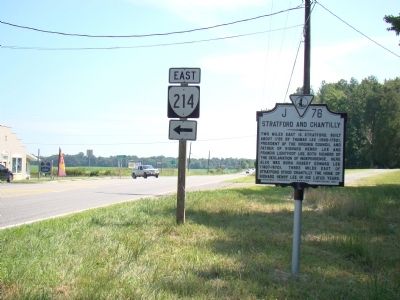
Photographed by J. J. Prats, August 30, 2009
2. Stratford and Chantilly Marker
Credits. This page was last revised on August 23, 2024. It was originally submitted on September 10, 2009, by J. J. Prats of Powell, Ohio. This page has been viewed 1,759 times since then and 78 times this year. Photos: 1, 2. submitted on September 10, 2009, by J. J. Prats of Powell, Ohio.
Editor’s want-list for this marker. Photos of Stratford • Can you help?
