Seabrook in Rockingham County, New Hampshire — The American Northeast (New England)
Bound Rock
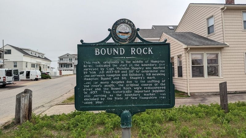
This rock, originally in the middle of Hampton River, indicated the start of the boundary line surveyed by Capt. Nicholas Shapley and marked by him AD 1657-HB and SH to determine the line between Hampton and Salisbury. HB meaning. Hampton Bound and SH Shapley's mark. Lost for many decades due to the shifting of the river's mouth. the original course of the river and the Bound Rock were rediscovered in 1937. This historically important boulder, still serving as the boundary marker. was enclosed by the State of New Hampshire that same year.
Erected 1978 by NH Division of Historical Resources. (Marker Number 0120.)
Topics and series. This historical marker is listed in this topic list: Colonial Era. In addition, it is included in the New Hampshire Historical Highway Markers series list.
Location. 42° 53.465′ N, 70° 48.822′ W. Marker is in Seabrook, New Hampshire, in Rockingham County. Marker is on Woodstock Street west of Ocean Drive, on the left when traveling west. Touch for map. Marker is at or near this postal address: 72 Woodstock Street, Seabrook NH 03874, United States of America. Touch for directions.
Other nearby markers. At least 8 other markers are within 4 miles of this marker, measured as the crow flies. Shapley Line (approx. 2.9 miles away); Site of the Brown Library (approx. 3 miles away); A Little Band Of Pioneers (approx. 3.1 miles away); Salisbury (approx. 3.1 miles away in Massachusetts); Old Landing Road (approx. 3.1 miles away); Thorvald's Rock (approx. 3.1 miles away); Rev. Ira S. Jones (approx. 3.1 miles away); The Proprietary School (approx. 3.1 miles away). Touch for a list and map of all markers in Seabrook.
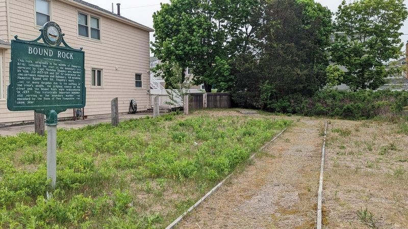
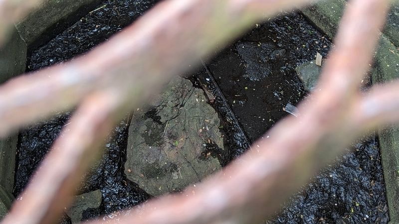
More about this marker. A pathway from the marker leads to a cement structure a few feet away. The rock can be seen through metal grates that cover the cement structure.
Regarding Bound Rock. This boulder marks the start of a boundary line between Hampton & Salisbury created in 1657.
Credits. This page was last revised on May 19, 2023. It was originally submitted on May 16, 2023, by Kelly Marsh of Moultonboro, New Hampshire. This page has been viewed 208 times since then and 91 times this year. Photos: 1, 2, 3. submitted on May 16, 2023, by Kelly Marsh of Moultonboro, New Hampshire. • Michael Herrick was the editor who published this page.


