Waterbury in New Haven County, Connecticut — The American Northeast (New England)
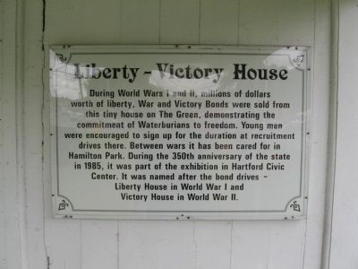
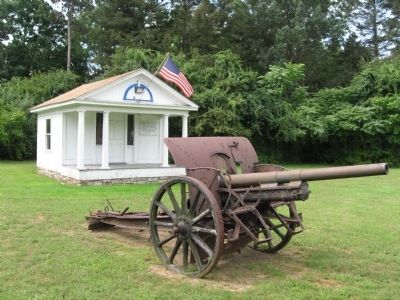
Liberty – Victory House
Topics. This historical marker is listed in these topic lists: War, World I • War, World II. A significant historical year for this entry is 1985.
Location. 41° 32.785′ N, 73° 1.084′ W. Marker is in Waterbury, Connecticut, in New Haven County. Marker is at the intersection of Silver Street Expressway (Connecticut Route 69) and East Main Street, on the right when traveling east on Silver Street Expressway. Located in Hamilton Park. Touch for map. Marker is in this post office area: Waterbury CT 06705, United States of America. Touch for directions.
Other nearby markers. At least 8 other markers are within 2 miles of this marker, measured as the crow flies. Hamilton Park (about 800 feet away, measured in a direct line); John Fitzgerald Kennedy (approx. 1.4 miles away); UNICO National (approx. 1.4 miles away); Fortified House Of Ensign Stanley (approx. 1.4 miles away); POW / MIA Soldiers from Waterbury (approx. 1.4 miles away); Cristoforo Colombo (approx. 1.4 miles away); Waterbury Veteran’s Monument (approx. 1˝ miles away); Enoch Hibbard House (approx. 1˝ miles away). Touch for a list and map of all markers in Waterbury.
Credits. This page was last revised on June 16, 2016. It was originally submitted on September 11, 2009, by Michael Herrick of Southbury, Connecticut. This page has been viewed 1,102 times since then and 37 times this year. Photos: 1, 2. submitted on September 11, 2009, by Michael Herrick of Southbury, Connecticut. • Syd Whittle was the editor who published this page.

