
Provost South in Utah County, Utah — The American Mountains (Southwest)
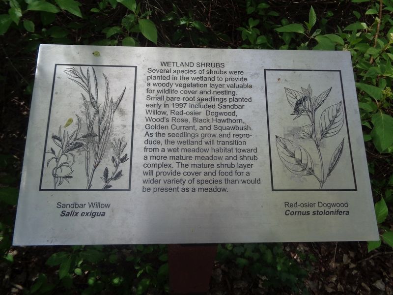
Wetland Shrubs
Photographed by Jason Voigt, May 9, 2023
1. Wetland Shrubs Marker
Topics. This historical marker is listed in this topic list: Horticulture & Forestry. A significant historical year for this entry is 1997.
Location. 40° 12.773′ N, 111° 37.892′ W. Marker is in Provo, Utah, in Utah County. It is in Provost South. It can be reached from East 1440 South east of South 1470 East. Marker is located at Bicentennial Park. Touch for map. Marker is at or near this postal address: 1400 E 1440 S, Provo UT 84606, United States of America. Touch for directions.

Regionally, this marker is in Utah’s Wasatch Front. It is also in the American Mountain West and on the Colorado
this page online
Other nearby markers. At least 8 other markers are within 2 miles of this marker, measured as the crow flies: Fremont Cottonwood (here, next to this marker); Why Was This Wetland Made? (a few steps from this marker); The Nuttall Spring (within shouting distance of this marker); Fish in Utah Lake and the Provo River Saved Utah’s Early Settlers from Starvation (within shouting distance of this marker); A Provo Accident Hastened the Death of President Heber C. Kimball (about 500 feet away, measured in a direct line); Pioneer Burial Grounds (approx. one mile away); History of Scott Memorial (approx. 1.1 miles away); Provo’s Name Has an Interesting History (approx. 1.3 miles away). Touch for a list and map of all markers in Provo.

Photographed by Jason Voigt, May 9, 2023
2. Wetland Shrubs Marker
Marker is located at Bicentennial Park on a nature trail.
Credits. This page was last revised on May 18, 2023. It was originally submitted on May 18, 2023, by Jason Voigt of Glen Carbon, Illinois. This page has been viewed 231 times since then and 17 times this year. Photos: 1, 2. submitted on May 18, 2023, by Jason Voigt of Glen Carbon, Illinois.
